File:Hlinsko, CZ171001-096.jpg

Size of this preview: 800 × 459 pixels. Other resolutions: 320 × 183 pixels | 640 × 367 pixels | 1,024 × 587 pixels | 1,280 × 734 pixels | 2,560 × 1,468 pixels | 4,764 × 2,731 pixels.
Original file (4,764 × 2,731 pixels, file size: 3.66 MB, MIME type: image/jpeg)
Captions
Captions
Add a one-line explanation of what this file represents
Summary
edit
| Description |
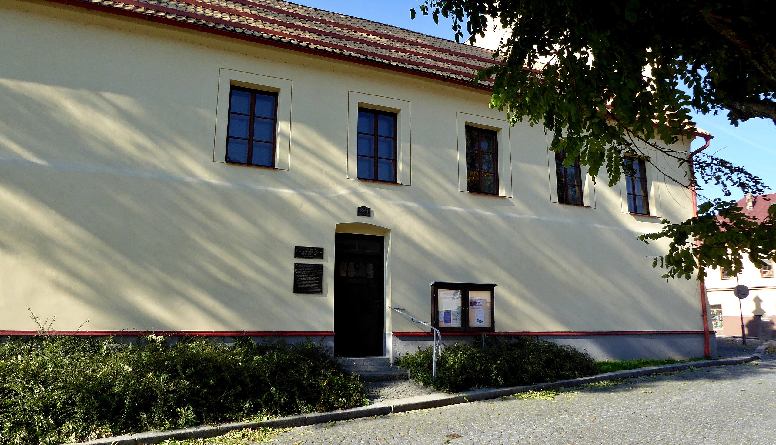
English: "Hlinecká" fortress, the present form, the oldest preserved building on the territory of town Hlinsko. Originally a Gothic fortress at the trade route connecting Bohemia and Moravia. Later, it became the seat of "hlineckého" property. From 1413 is the first written mention of the fortress, in connection with "rychmburským" manor. During the reign of King Ferdinand I. in 1547 the building became a royal customs house. She was rebuilt in the Renaissance style at the end of the 16th century. In 1904 it was changed in connection with the building of the "U tvrze" house. In the years 1972-1973 the building was rebuilt into a prayer house of the Evangelical Church of the Czech Brethren. On the building from 2011 a commemorative plaque on the history of the building. Town Hlinsko, street "U tvrze". Photo-location: Czechia, Pardubice Region, Hlinsko, "Kameničská" Highlands".
Čeština: Hlinecká tvrz, současná podoba, nejstarší dochovaná stavba na území města Hlinsko. Původně gotická tvrz u obchodní cesty spojující Čechy a Moravu. Později se stala sídlem hlineckého statku. Z roku 1413 je první písemná zmínka o tvrzi, v souvislosti s rychmburským panstvím. V době vlády krále Ferdinanda I. se v roce 1547 stala budova královskou celnicí. Koncem 16. století renesančně přestavěna. V roce 1904 v souvislosti se stavbou domu U tvrze (Ježdíkův dům) byla budova stavebně upravena. V letech 1972–1973 objekt přebudován na motlitebnu Českobratrské církve evangelické. Na budově od roku 2011 pamětní deska o historii objektu. Město Hlinsko, ulice U tvrze. Foto-lokace: Česko, Pardubický kraj, Hlinsko, Kameničská vrchovina. |
| Date | |
| Source | Own work |
| Author | Josef Kreuz (PEPan) |
| Camera location | | View this and other nearby images on: OpenStreetMap |
|---|
Externí odkazy
edit
- Turistická mapa – Hlinecká tvrz (bod 1)
- Hlinsko – historické památky archive copy at the Wayback Machine
- Českobratrská církev evangelická
- Farní sbor ČCE Hlinsko
Licensing
edit
I, the copyright holder of this work, hereby publish it under the following license:
This file is licensed under the Creative Commons Attribution-Share Alike 4.0 International license.
- You are free:
- to share – to copy, distribute and transmit the work
- to remix – to adapt the work
- Under the following conditions:
- attribution – You must give appropriate credit, provide a link to the license, and indicate if changes were made. You may do so in any reasonable manner, but not in any way that suggests the licensor endorses you or your use.
- share alike – If you remix, transform, or build upon the material, you must distribute your contributions under the same or compatible license as the original.
File history
Click on a date/time to view the file as it appeared at that time.
| Date/Time | Thumbnail | Dimensions | User | Comment | |
|---|---|---|---|---|---|
| current | 11:57, 12 October 2017 | | 4,764 × 2,731 (3.66 MB) | PEPan (talk | contribs) | User created page with UploadWizard |
You cannot overwrite this file.
File usage on Commons
There are no pages that use this file.
File usage on other wikis
The following other wikis use this file:
- Usage on cs.wikipedia.org