File:Hlinsko-Betlém, CZ171117-010.jpg

Size of this preview: 800 × 447 pixels. Other resolutions: 320 × 179 pixels | 640 × 358 pixels | 1,024 × 572 pixels | 1,280 × 715 pixels | 2,560 × 1,431 pixels | 4,754 × 2,657 pixels.
Original file (4,754 × 2,657 pixels, file size: 5.63 MB, MIME type: image/jpeg)
Captions
Captions
Add a one-line explanation of what this file represents
Summary edit
| Description |
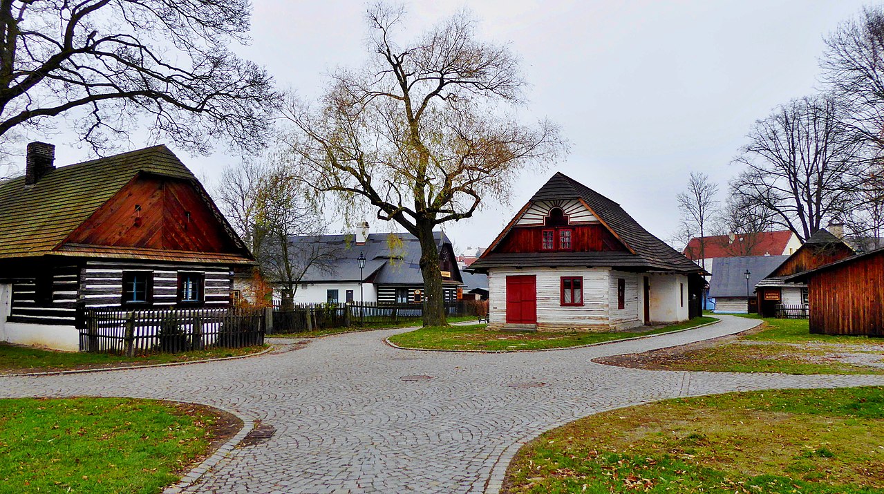
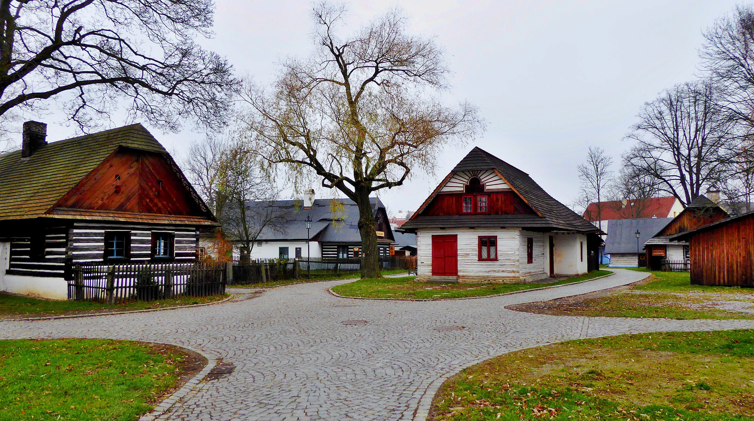
English: Betlém Monument Reserve is a collection of immovable cultural monuments of folk architecture in part of urban whole in central of town Hlinsko. Cultural monuments are managed by the National Monument Institute of Czech Republic, are a part of a museum in the nature entitled "Set of folk architecture Vysočina" based in town Hlinsko. Rural dwellings are used for cultural purposes and services. The monument reserve is open to the public all year round. In monument reservation there is also a tourist information center of town Hlinsko. The hiking trails of the Czech Tourists Club go through in the town Hlinsko also the monument reservation of folk architecture. Visitors are on the place informed by a museum expert guide. Photo-location: Czechia, Pardubice Region, town Hlinsko, Betlém Monument Reservation, in the photo the folk architecture (azimuth 340°), part of the museum the Set of folk buildings Vysočina.
Čeština: Památková rezervace Betlém je soubor nemovitých kulturních památek lidové architektury v části urbanistického celku v centru města Hlinsko. Kulturní památky jsou ve správě Národního památkového ústavu, součást muzea v přírodě s názvem "Soubor lidových staveb Vysočina" se sídlem v Hlinsku. Venkovská obydlí jsou využívána pro kulturní účely a služby. Památková rezervace je přístupná veřejnosti po celý rok. V areálu se nachází také turistické informační centrum města Hlinsko. Turistické trasy Klubu českých turistů procházejí ve městě Hlinsko také památkovou rezervací lidové architektury. Návštěvníci jsou na místě informováni odborným průvodcem muzea. Foto-lokace: Česko, Pardubický kraj, Hlinsko, památková rezervace Betlém, na fotce lidová architektura (azimut 340°), součást muzea Soubor lidových staveb Vysočina. |
| Date | |
| Source | Own work |
| Author | Josef Kreuz (PEPan) |
| Camera location | | View this and other nearby images on: OpenStreetMap |
|---|
Faktografie edit
Na snímku vlevo roubená chalupa se šindelovou střechou z poloviny 18. století, nejstarší dochovaný objekt v památkové rezervaci Betlém. Uvnitř v síni tzv. černá kuchyně, světnice se svatým koutem a dobovým nábytkem, vyhřívací a chlebovou pecí, také s tkalcovským stavem, obývaný ještě v 80. letech 20. století. Uprostřed domek, kopie kupeckého krámu, dnes využívaný Základní uměleckou školou v Hlinsku pro výuku výtvarného umění. Krajinná oblast Železných hor, Kameničská vrchovina.
Externí odkazy edit
- Soubor lidových staveb Vysočina, památková rezervace Betlém – Hlinsko
- Turistické informační centrum Hlinsko archive copy at the Wayback Machine
- Turistická mapa, letecký pohled - kompozice: urbanistický celek s místním jménem (oikonymum) Betlém
Licensing edit
I, the copyright holder of this work, hereby publish it under the following license:
This file is licensed under the Creative Commons Attribution-Share Alike 4.0 International license.
- You are free:
- to share – to copy, distribute and transmit the work
- to remix – to adapt the work
- Under the following conditions:
- attribution – You must give appropriate credit, provide a link to the license, and indicate if changes were made. You may do so in any reasonable manner, but not in any way that suggests the licensor endorses you or your use.
- share alike – If you remix, transform, or build upon the material, you must distribute your contributions under the same or compatible license as the original.
File history
Click on a date/time to view the file as it appeared at that time.
| Date/Time | Thumbnail | Dimensions | User | Comment | |
|---|---|---|---|---|---|
| current | 13:48, 24 November 2017 | | 4,754 × 2,657 (5.63 MB) | PEPan (talk | contribs) | User created page with UploadWizard |
You cannot overwrite this file.
File usage on Commons
There are no pages that use this file.
File usage on other wikis
The following other wikis use this file:
- Usage on cs.wikipedia.org