File:Hochstein (Neuhochstein).jpg
Original file (1,978 × 1,200 pixels, file size: 1.86 MB, MIME type: image/jpeg)
Captions
Captions
Summary edit
| Description |
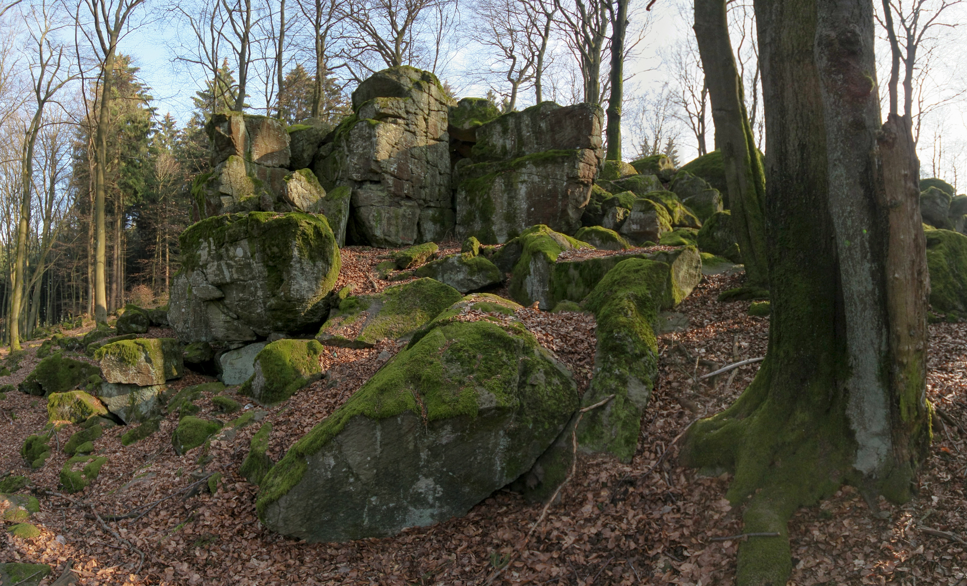
Deutsch: Die Basaltformationen des Naturdenkmals Hochstein nahe Höhn-Neuhochstein - mit 525 m ü. NN. die höchste Erhebung des Westerburger Landes
English: Basalt formations of the natural monument Hochstein near Höhn-Neuhochstein - with 525 m the highest elevation of the Westerburger Land
|
||
| Date | |||
| Source | Own work | ||
| Author | Martin Kraft | ||
| Permission (Reusing this file) |
Reusing this image.jpg) License: CC BY-SA 3.0 via Wikimedia Commons This image was published by Martin Kraft under the free license CC BY-SA 3.0, which also allows the usage outside of Wikipedia under the following conditions:
Please send me a specimen copy or the URL of the website where the image is used. The Online Attribution Generator offers a good tool to generate an attribution sufficient for your use case. Feel free to contact me via eMail photo@martinkraft.com or visit my website photo.martinkraft.com for any questions or in case you need...
Only the terms and conditions mentioned above authorize the free use of this image. Any infringement causes a copyright violation, that may result in a penalty fee of five times the fee suggested by the MFM, inter alia. |

.jpg&action=edit§ion=1)
.jpg)
.jpg)
| Camera location | | View this and other nearby images on: OpenStreetMap |
|---|
.jpg¶ms=050.625162_N_0007.949997_E_globe:Earth_type:camera__&language=en)
Licensing edit
.jpg&action=edit§ion=2)
- You are free:
- to share – to copy, distribute and transmit the work
- to remix – to adapt the work
- Under the following conditions:
- attribution – You must give appropriate credit, provide a link to the license, and indicate if changes were made. You may do so in any reasonable manner, but not in any way that suggests the licensor endorses you or your use.
- share alike – If you remix, transform, or build upon the material, you must distribute your contributions under the same or compatible license as the original.
File history
Click on a date/time to view the file as it appeared at that time.
| Date/Time | Thumbnail | Dimensions | User | Comment | |
|---|---|---|---|---|---|
| current | 22:16, 6 April 2012 | | 1,978 × 1,200 (1.86 MB) | Martin Kraft (talk | contribs) |
You cannot overwrite this file.
File usage on Commons
The following page uses this file:
File usage on other wikis
The following other wikis use this file:
- Usage on de.wikipedia.org
- Usage on en.wikipedia.org
- Usage on ms.wikipedia.org
- Usage on uk.wikipedia.org
.jpg&oldid=763276795)