File:Hofer Geschichtswege 20230904 HOF07996 RAW-Export, Stadtplan.png
Size of this preview: 650 × 600 pixels. Other resolutions: 260 × 240 pixels | 520 × 480 pixels | 710 × 655 pixels.
Original file (710 × 655 pixels, file size: 834 KB, MIME type: image/png)
Captions
Captions
Add a one-line explanation of what this file represents
Summary edit
| Description |
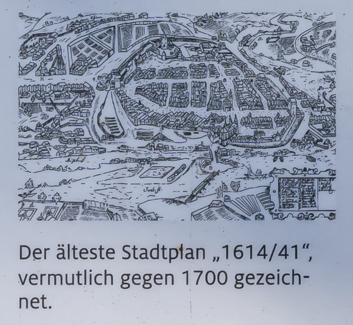
Deutsch: Fotografie der Tafel im Lorenzpark. Sie beschäftigen sich mit der Anlage selbst und der Historie Hofs. Hier sieht man einen Stadtplan von Hof aus dem 17. Jahrhundert.
English: Photography of the board in Lorenzpark. They deal with the plant itself and the history of Hof. Here you can see a map of Hof from the 17th century. |
| Date | |
| Source |
|
| Author |
|
| Camera location | | View this and other nearby images on: OpenStreetMap |
|---|
Licensing edit
|
This work is in the public domain in its country of origin and other countries and areas where the copyright term is the author's life plus 100 years or fewer. | |
| This file has been identified as being free of known restrictions under copyright law, including all related and neighboring rights. | |
File history
Click on a date/time to view the file as it appeared at that time.
| Date/Time | Thumbnail | Dimensions | User | Comment | |
|---|---|---|---|---|---|
| current | 18:16, 4 September 2023 | | 710 × 655 (834 KB) | PantheraLeo1359531 (talk | contribs) | c:User:Rillke/bigChunkedUpload.js: =={{int:filedesc}}== {{Information |description={{de|1=Fotografie der Tafel im Lorenzpark. Sie beschäftigen sich mit der Anlage selbst und der Historie Hofs. Hier sieht man einen Stadtplan von Hof aus dem 17. Jahrhundert.}} {{en|1=Photography of the board in Lorenzpark. They deal with the plant itself and the history of Hof. Here you can see a map of Hof from the 17th century.}} |date=2023-09-04 |source=* Tafeln: Hofer Geschichtswege im Lorenzpark * Date... |
You cannot overwrite this file.
File usage on Commons
There are no pages that use this file.