File:Hohlerch-Info.jpg
![File:Hohlerch-Info.jpg](https://upload.wikimedia.org/wikipedia/commons/thumb/e/e1/Hohlerch-Info.jpg/800px-Hohlerch-Info.jpg?20211113141316)
Size of this preview: 800 × 584 pixels. Other resolutions: 320 × 234 pixels | 640 × 467 pixels | 1,024 × 748 pixels | 1,220 × 891 pixels.
Original file (1,220 × 891 pixels, file size: 477 KB, MIME type: image/jpeg)
File information
Structured data
Captions
Captions
Add a one-line explanation of what this file represents
Walliser Alpen [VS] 1.939 m ü. M.
Summary
edit Switzerland
Valais - Walliser Alpen 1.939 m ü. M.
DescriptionHohlerch-Info.jpg |
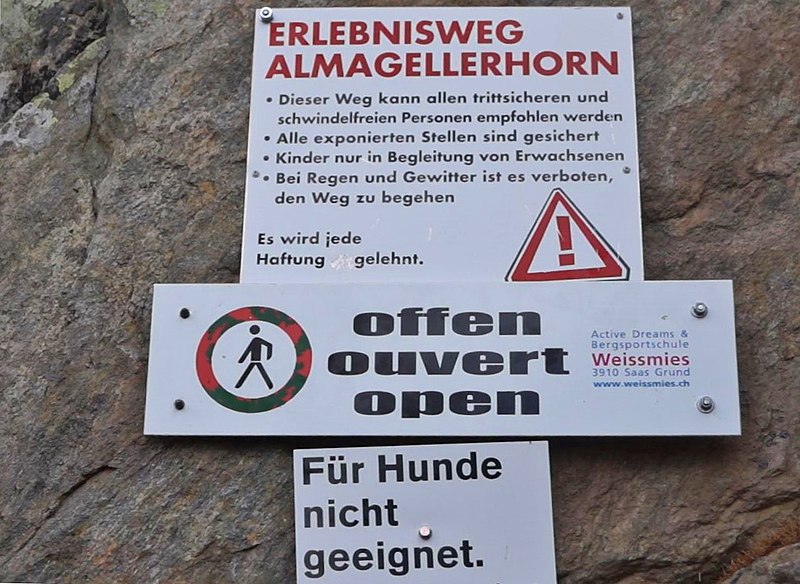
Deutsch: Infotafel auf Furggstaldener Seite des Erlebniswegs, auch Höhenweg Almagelleralp. |
Date | Taken on 30 July 2013, 10:25:00 |
Source | Own work |
Author | FkMohr |
Camera location | 46° 05′ 34.8″ N, 7° 57′ 56.64″ E ![]() ![]() | View this and other nearby images on: OpenStreetMap | ![]() |
---|
VS {BV130730-1025}
Licensing
editFriedrich-Karl Mohr, the copyright holder of this work, hereby publishes it under the following license:
![w:en:Creative Commons](https://upload.wikimedia.org/wikipedia/commons/thumb/7/79/CC_some_rights_reserved.svg/90px-CC_some_rights_reserved.svg.png)
![attribution](https://upload.wikimedia.org/wikipedia/commons/thumb/1/11/Cc-by_new_white.svg/24px-Cc-by_new_white.svg.png)
![share alike](https://upload.wikimedia.org/wikipedia/commons/thumb/d/df/Cc-sa_white.svg/24px-Cc-sa_white.svg.png)
This file is licensed under the Creative Commons Attribution-Share Alike 3.0 Germany license.
Attribution: Friedrich-Karl Mohr
- You are free:
- to share – to copy, distribute and transmit the work
- to remix – to adapt the work
- Under the following conditions:
- attribution – You must give appropriate credit, provide a link to the license, and indicate if changes were made. You may do so in any reasonable manner, but not in any way that suggests the licensor endorses you or your use.
- share alike – If you remix, transform, or build upon the material, you must distribute your contributions under the same or compatible license as the original.
![](https://upload.wikimedia.org/wikipedia/commons/thumb/b/ba/Flag_of_Germany.svg/90px-Flag_of_Germany.svg.png)
File history
Click on a date/time to view the file as it appeared at that time.
Date/Time | Thumbnail | Dimensions | User | Comment | |
---|---|---|---|---|---|
current | 14:13, 13 November 2021 | ![]() | 1,220 × 891 (477 KB) | FkMohr (talk | contribs) | Uploaded own work with UploadWizard |
You cannot overwrite this file.
File usage on Commons
The following page uses this file:
Metadata
This file contains additional information such as Exif metadata which may have been added by the digital camera, scanner, or software program used to create or digitize it. If the file has been modified from its original state, some details such as the timestamp may not fully reflect those of the original file. The timestamp is only as accurate as the clock in the camera, and it may be completely wrong.
Image title |
|
---|---|
Author | MAH00882;Friedo |
Copyright holder |
|
Date and time of data generation | 10:25, 30 July 2013 |
Latitude | 46° 5′ 34.8″ N |
Longitude | 7° 57′ 56.64″ E |
Altitude | 1,939 meters above sea level |
Short title |
|
City shown | Walliser Alpen |
Orientation | Normal |
File change date and time | 13:37, 13 November 2021 |
Date and time of digitizing | 10:25, 30 July 2013 |
DateTimeOriginal subseconds | 07 |
DateTimeDigitized subseconds | 07 |
Unique image ID | 8C3ABE1B456948EBBE8690724710143B |
GPS time (atomic clock) | 08:25 |
Reference for direction of image | True direction |
Direction of image | 5.21 |
Geodetic survey data used | WGS-84 |
Latitude destination | 46° 5′ 35.09″ N |
Longitude of destination | 7° 57′ 56.68″ E |
GPS date | 30 July 2013 |
GPS tag version | 2.2.0.0 |
Software used | Microsoft Photo Gallery 16.4.3528.331 |
Code for country shown | CHE |
Sublocation of city shown | Furggstalden |
Country shown | Schweiz |
Province or state shown | Wallis |
IIM version | 4 |