File:Hohnbach.jpg
Size of this preview: 800 × 600 pixels. Other resolutions: 320 × 240 pixels | 640 × 480 pixels | 1,024 × 768 pixels | 1,280 × 960 pixels | 2,560 × 1,920 pixels.
Original file (2,560 × 1,920 pixels, file size: 1.79 MB, MIME type: image/jpeg)
Captions
Captions
Add a one-line explanation of what this file represents
Summary
edit
| Description |
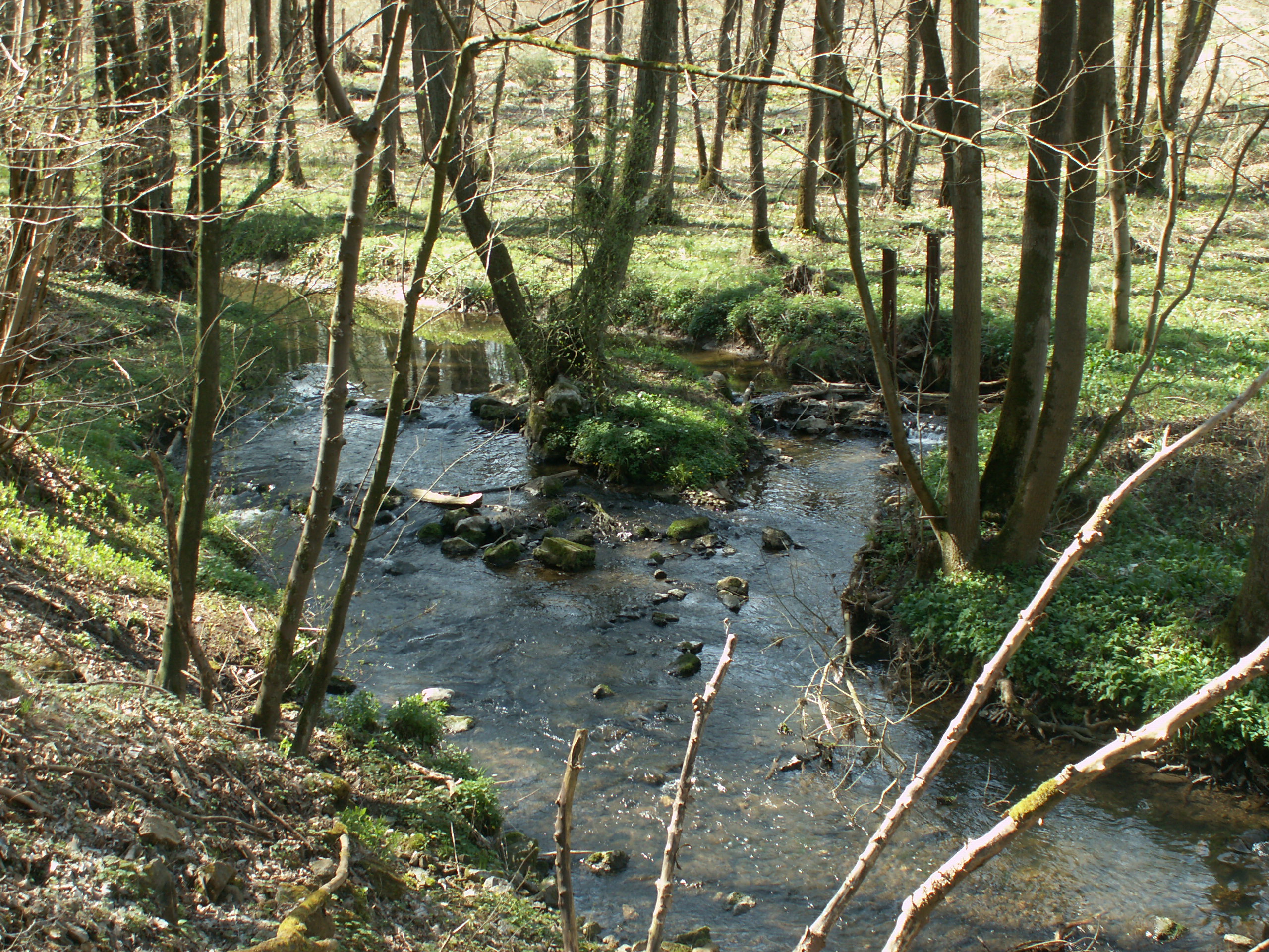
Deutsch: Der Hohnbach ist die Lebensader des Hohnbachtales. Aber auch eine Todesader. Durch den Blei- und Zinkabbau in den Jahren 1862-1931 in der Grube Schmalgraf und durch die schwermetallhaltige Abraumhalde am Bach beim Oskarstollen wurde das Gebiet bachabwärts verseucht. Es wurde den Anwohnern davon abgeraten, Gemüse aus dem eigenen Garten zu essen. Aber dieselbe Aktivität brachte auch die interessante Galmeiflora hervor. Auch die höher gelegenen Teile des Tales besitzen eine bemerkenswerte Biodiversität. Nederlands: De Hohn is de levensader van het Hohnbachdal. Maar ook een doodsader. Door de lood- en zinkwinning in de jaren 1862-1931 in de mijn Schmalgraf en door de mijnstorthoop vol zware metalen aan de beek bij de afwateringsgang Oskarstollen werd het gebied beekafwaarts gecontamineerd. De aanwonenden kregen de goede raad, geen groente uit eigen tuin meer te eten. Maar dezelfde activiteit bracht ook de interessante zinkflora voort. Ook de hoger gelegen delen van het dal hebben een opmerkelijke biodiversiteit. English: The Hohn creek is the lifeline of its valley. But it also brings death. By the mining of zinc and lead during the years 1862-1931 in the pit Schmalgraf and by the heavy metalliferous mining debris stockpile next to the creek near the Oskarstollen, the area was contaminated downriver. The residents were warned against eating vegetables from their own gardens. But the same activity also brought the interesting zinc flora. Also the higher parts of the valley have a remarkable biodiversity. Français : La Hohn est un élément vital de sa vallée. Mais elle entraîne aussi la mort. Par l'exploitation de plomb et de zinc dans les années 1862-1931 dans la mine Schmalgraf et par le terril de déblais contenant des métaux lourds au ruisseau près de l'Oskarstollen, la zone en aval a été contaminée. Les habitants ont été prévenus contre la consommation de légumes de leurs propres jardins. Mais la même activité a aussi apporté la flore intéressante de zinc. Les parties plus hautes de la forêt ont aussi une biodiversité remarquable.
|
||
| Date | |||
| Source | Own work | ||
| Author | 19Arnold45 |
| Camera location | | View this and other nearby images on: OpenStreetMap |
|---|
Licensing
edit
I, the copyright holder of this work, hereby publish it under the following license:
This file is licensed under the Creative Commons Attribution-Share Alike 3.0 Unported license.
- You are free:
- to share – to copy, distribute and transmit the work
- to remix – to adapt the work
- Under the following conditions:
- attribution – You must give appropriate credit, provide a link to the license, and indicate if changes were made. You may do so in any reasonable manner, but not in any way that suggests the licensor endorses you or your use.
- share alike – If you remix, transform, or build upon the material, you must distribute your contributions under the same or compatible license as the original.

|
This image was uploaded as part of Wiki Loves Monuments 2013.
|
 |
File history
Click on a date/time to view the file as it appeared at that time.
| Date/Time | Thumbnail | Dimensions | User | Comment | |
|---|---|---|---|---|---|
| current | 00:33, 28 September 2013 | | 2,560 × 1,920 (1.79 MB) | 19Arnold45 (talk | contribs) | User created page with UploadWizard |
You cannot overwrite this file.
File usage on Commons
There are no pages that use this file.