File:Hollandsche Electrische-Spoorweg-Maatschappij 001.PNG
Size of this preview: 800 × 429 pixels. Other resolutions: 320 × 171 pixels | 640 × 343 pixels | 1,024 × 549 pixels | 1,697 × 909 pixels.
Original file (1,697 × 909 pixels, file size: 123 KB, MIME type: image/png)
Captions
Captions
Add a one-line explanation of what this file represents
| Description |
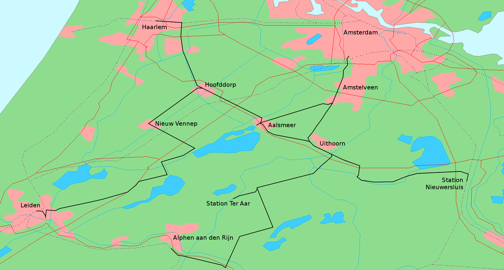
Deutsch: Karte mit dem Streckennetz der Hollandsche Electrische-Spoorweg-Maatschappij
Nederlands: Kaart van het tracé van de Hollandsche Electrische-Spoorweg-Maatschappij |
| Date | |
| Source | Bearbeitung einer Karte von http://www2.demis.nl/openlayers.htm |
| Author | Open Layers |
Licensing
edit
This image is in the public domain because it came from the site https://www.demis.nl/products/web-map-server/examples/ and was released by the copyright holder. Permission is granted to copy, distribute and/or modify this map since it is based on free of copyright images from: www.demis.nl. See also approval email on de.wp and its clarification.
|
| This work has been released into the public domain by its copyright holder, www.demis.nl. This applies worldwide. In some countries this may not be legally possible; if so: www.demis.nl grants anyone the right to use this work for any purpose, without any conditions, unless such conditions are required by law.
|
File history
Click on a date/time to view the file as it appeared at that time.
| Date/Time | Thumbnail | Dimensions | User | Comment | |
|---|---|---|---|---|---|
| current | 02:19, 4 July 2009 | | 1,697 × 909 (123 KB) | Janericloebe (talk | contribs) | {{Information |Description={{de|1=Karte mit dem Streckennetz der Hollandsche Electrische-Spoorweg-Maatschappij}} {{nl|1=Kaart van het tracé van de [[:nl:Hollandsche Electrische-Spoorweg-Maatschappij|H |
You cannot overwrite this file.
File usage on Commons
There are no pages that use this file.