File:Holm Dale, East Yorks - northern end (geograph 4457074).jpg
No higher resolution available.
Holm_Dale,_East_Yorks_-_northern_end_(geograph_4457074).jpg (640 × 432 pixels, file size: 197 KB, MIME type: image/jpeg)
Captions
Captions
Add a one-line explanation of what this file represents
Summary
edit.jpg&action=edit§ion=1)
| Description |
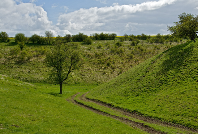
English: Holm Dale, Huggate, East Riding of Yorkshire, England. Northern end. Looking towards the dale proper along the western of the two arms at its northern end. |
| Date | |
| Source | From geograph.org.uk |
| Author | Paul Harrop |
| Permission (Reusing this file) |
Creative Commons Attribution Share-alike license 2.0 |
| Attribution (required by the license) | Paul Harrop / Holm Dale, East Yorks - northern end / |
| Camera location | | View this and other nearby images on: OpenStreetMap |
|---|
.jpg¶ms=054.012970_N_-000.668193_E_globe:Earth_type:camera_source:geograph-osgb36(SE87375826)_heading:22.00&language=en)
| Object location | | View this and other nearby images on: OpenStreetMap |
|---|
.jpg¶ms=054.013770_N_-000.667400_E_globe:Earth_class:object_type:object_source:geograph-osgb36(SE87425835)_heading:22.00&language=en)
Licensing
edit.jpg&action=edit§ion=2)

|
This image was taken from the Geograph project collection. See this photograph's page on the Geograph website for the photographer's contact details. The copyright on this image is owned by Paul Harrop and is licensed for reuse under the Creative Commons Attribution-ShareAlike 2.0 license.
|
This file is licensed under the Creative Commons Attribution-Share Alike 2.0 Generic license.
Attribution: Paul Harrop
- You are free:
- to share – to copy, distribute and transmit the work
- to remix – to adapt the work
- Under the following conditions:
- attribution – You must give appropriate credit, provide a link to the license, and indicate if changes were made. You may do so in any reasonable manner, but not in any way that suggests the licensor endorses you or your use.
- share alike – If you remix, transform, or build upon the material, you must distribute your contributions under the same or compatible license as the original.
File history
Click on a date/time to view the file as it appeared at that time.
| Date/Time | Thumbnail | Dimensions | User | Comment | |
|---|---|---|---|---|---|
| current | 23:52, 7 December 2021 | | 640 × 432 (197 KB) | Keith D (talk | contribs) | == {{int:filedesc}} == {{Information |Description={{en|1=Holm Dale, Huggate, East Riding of Yorkshire, England.<br />Northern end. Looking towards the dale proper along the western of the two arms at its northern end.}} |Source=From [https://www.geograph.org.uk/photo/4457074 geograph.org.uk] |Date=2015-05-01 |Author=[https://www.geograph.org.uk/profile/13364 Paul Harrop] |Permission=Creative Commons Attribution Share-alike license 2.0 |Other fi... |
You cannot overwrite this file.
File usage on Commons
There are no pages that use this file.
.jpg&oldid=716078492)