File:Hot springs area map.jpg

No higher resolution available.
Hot_springs_area_map.jpg (576 × 480 pixels, file size: 72 KB, MIME type: image/jpeg)
Captions
Captions
Add a one-line explanation of what this file represents
| Description |
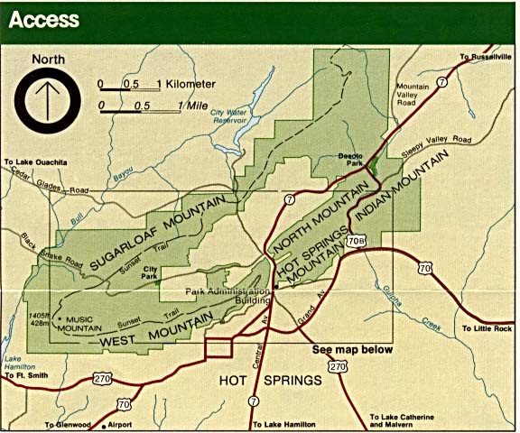
English: Hot Springs National Park area and access map, originally listed as a work of the national park service at http://www.lib.utexas.edu/maps/arkansas.html |
|||
| Source | http://www.lib.utexas.edu/maps/national_parks/hot_springs_access.jpg | |||
| Author | US National Park Service | |||
| Permission (Reusing this file) |
|
File history
Click on a date/time to view the file as it appeared at that time.
| Date/Time | Thumbnail | Dimensions | User | Comment | |
|---|---|---|---|---|---|
| current | 15:55, 9 December 2017 | | 576 × 480 (72 KB) | MarginalCost (talk | contribs) | {{Information |Description ={{en|1=Hot Springs National Park area and access map, originally listed as a work of the national park service at http://www.lib.utexas.edu/maps/arkansas.html}} |Source =http://www.lib.utexas.edu/maps/national_par... |
You cannot overwrite this file.
File usage on Commons
There are no pages that use this file.