File:Hron River - location and watershed map.svg

Size of this PNG preview of this SVG file: 800 × 430 pixels. Other resolutions: 320 × 172 pixels | 640 × 344 pixels | 1,024 × 551 pixels | 1,280 × 689 pixels | 2,560 × 1,377 pixels | 4,680 × 2,518 pixels.
Original file (SVG file, nominally 4,680 × 2,518 pixels, file size: 121 KB)
Captions
Captions
Add a one-line explanation of what this file represents
Summary edit
| Description |
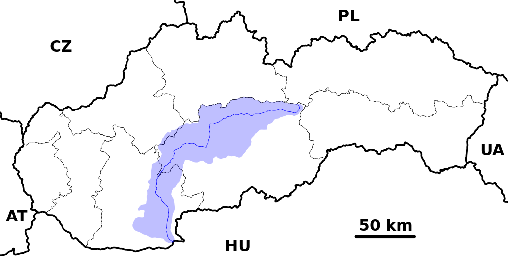
English: Location and watershed map of the Hron River in Slovakia, ready for the Geobox template, calibrated at en:Template:Geobox locator Slovakia |
| Date | |
| Source | Own work |
| Author | Caroig |
| Other versions | Derivative works of this file: Ipeľ River (SVK) - location and watershed.svg |
_-_location_and_watershed.svg)
Licensing edit
I, the copyright holder of this work, hereby publish it under the following license:
This file is licensed under the Creative Commons Attribution-Share Alike 2.5 Generic license.
- You are free:
- to share – to copy, distribute and transmit the work
- to remix – to adapt the work
- Under the following conditions:
- attribution – You must give appropriate credit, provide a link to the license, and indicate if changes were made. You may do so in any reasonable manner, but not in any way that suggests the licensor endorses you or your use.
- share alike – If you remix, transform, or build upon the material, you must distribute your contributions under the same or compatible license as the original.
File history
Click on a date/time to view the file as it appeared at that time.
| Date/Time | Thumbnail | Dimensions | User | Comment | |
|---|---|---|---|---|---|
| current | 21:21, 1 November 2007 | | 4,680 × 2,518 (121 KB) | Caroig (talk | contribs) | {{Information |Description={{en|Location and watershed map of the Hron River in Slovakia, ready for the Geobox template, calibrated at en:Template:Geobox locator Slovakia}} |Source=self-made |Date=2007-11-01 |Author=[[:en:User |
You cannot overwrite this file.
File usage on Commons
The following 3 pages use this file:
File usage on other wikis
The following other wikis use this file:
- Usage on be.wikipedia.org
- Usage on bs.wikipedia.org
- Usage on cs.wikipedia.org
- Usage on en.wikipedia.org
- Usage on eo.wikipedia.org
- Usage on es.wikipedia.org
- Usage on fr.wikipedia.org
- Usage on he.wikipedia.org
- Usage on hu.wikipedia.org
- Usage on it.wikipedia.org
- Usage on no.wikipedia.org
- Usage on sk.wikipedia.org
- Usage on xmf.wikipedia.org
- Usage on zh.wikipedia.org