File:Hugo 1989 rainfall.gif

Size of this preview: 556 × 600 pixels. Other resolutions: 223 × 240 pixels | 445 × 480 pixels | 842 × 908 pixels.
Original file (842 × 908 pixels, file size: 29 KB, MIME type: image/gif)
Captions
Captions
Add a one-line explanation of what this file represents
Summary
| Description |
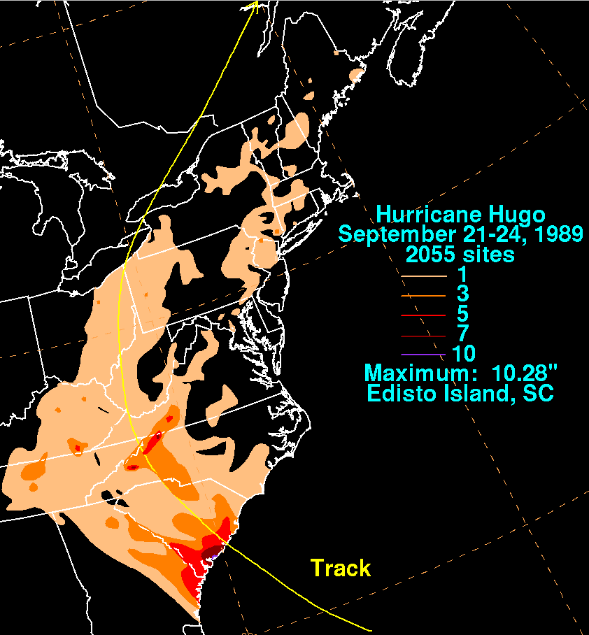
English: Storm total rainfall map of Hurricane Hugo during September 1989. |
|||
| Date | ||||
| Source | WPC tropical cyclone rainfall data | |||
| Author | David Roth, Weather Prediction Center, Camp Springs, Maryland | |||
| Permission (Reusing this file) |
|
File history
Click on a date/time to view the file as it appeared at that time.
| Date/Time | Thumbnail | Dimensions | User | Comment | |
|---|---|---|---|---|---|
| current | 22:56, 7 August 2008 | | 842 × 908 (29 KB) | Pierre cb (talk | contribs) | {{Information |Description={{en|1=Storm total rainfall for Hurricane Hugo. Note the maxima near the point of landfall in South Carolina, and where the best upslope into the Appalachians occu |
You cannot overwrite this file.
File usage on Commons
The following page uses this file:
- File:Hurricane Hugo 1989 rain in US.gif (file redirect)
File usage on other wikis
The following other wikis use this file:
- Usage on en.wikipedia.org
- Usage on fr.wikipedia.org