File:Hurricane Emily July 2005.jpg

Original file (5,600 × 7,200 pixels, file size: 4.37 MB, MIME type: image/jpeg)
Captions
Captions
Summary edit
| Description |
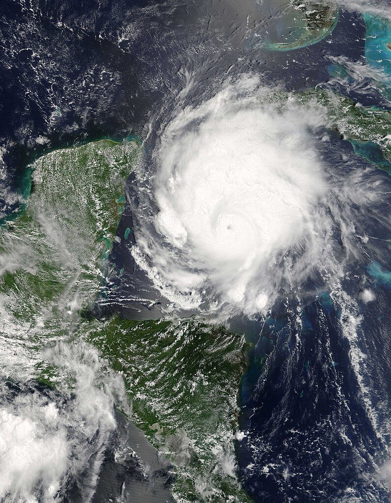
Hurricane Emily is shown here in the Caribbean bearing down on the Yucatan Peninsula on the morning of July 17, 2005. The image was captured by the Moderate Resolution Imaging Spectroradiometer (MODIS) on the Terra satellite at 16:25 UTC (12:25 p.m. Eastern Daylight Time). At this time, it was a well-developed and powerful hurricane with winds over 250 kilometers an hour (130 knots) and gusts as high as 300 km/hr (160 knots). Tourists in the Yucatan Peninsula are being evacuated from resort areas and beaches as the hurricane continues on track to make landfall there during the morning of July 18, 2005. The image has been compressed to 4 mb from 9mb. The image in the link above is the original 9mb version. |
|||||
| Date | ||||||
| Source | http://earthobservatory.nasa.gov/NaturalHazards/natural_hazards_v2.php3?img_id=12971 | |||||
| Author | NASA image provided courtesy of Jeff Schmaltz, MODIS Rapid Response team. | |||||
| Permission (Reusing this file) |
|

File history
Click on a date/time to view the file as it appeared at that time.
| Date/Time | Thumbnail | Dimensions | User | Comment | |
|---|---|---|---|---|---|
| current | 02:08, 31 July 2005 | | 5,600 × 7,200 (4.37 MB) | Tom (talk | contribs) | {{PD-USGov-NASA}} source: http://www1.nasa.gov/images/content/122715main_image_feature_369_ys_full.jpg Note: The image has been compressed to 4 mb from 9mb. The image in the link above is the original 9mb version. Hurricane Emily |
You cannot overwrite this file.
File usage on Commons
The following page uses this file:
File usage on other wikis
The following other wikis use this file:
- Usage on ca.wikipedia.org
- Usage on en.wikipedia.org
- Usage on es.wikipedia.org
- Usage on pl.wikipedia.org
- Usage on pt.wikipedia.org
- Usage on zh.wikipedia.org