File:Hurricane Ian - GOES-East GEOCOLOR satellite image on 29 September 2022, east of peninsula center, up to 0340 UTC.gif
Size of this preview: 600 × 600 pixels. Other resolutions: 240 × 240 pixels | 480 × 480 pixels.
Original file (800 × 800 pixels, file size: 12.59 MB, MIME type: image/gif, looped, 36 frames, 3.8 s)
Captions
Captions
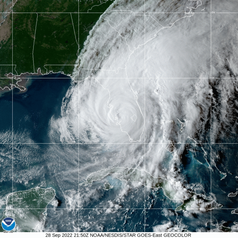
Hurricane Ian - GOES-East GEOCOLOR satellite image on 29 September 2022, east of peninsula center, up to 0340 UTC
Summary
edit
| Description |
English: Hurricane Ian - GOES-East GEOCOLOR satellite image on 29 September 2022, east of peninsula center, up to 0340 UTC |
| Date | |
| Source | https://www.star.nesdis.noaa.gov/GOES/floater.php?stormid=AL092022 |
| Author | NOAA |
Licensing
edit
This image is in the public domain because it contains materials that originally came from the U.S. National Oceanic and Atmospheric Administration, taken or made as part of an employee's official duties.
|
File history
Click on a date/time to view the file as it appeared at that time.
| Date/Time | Thumbnail | Dimensions | User | Comment | |
|---|---|---|---|---|---|
| current | 05:01, 29 September 2022 | | 800 × 800 (12.59 MB) | Ooligan (talk | contribs) | Uploaded a work by NOAA from https://www.star.nesdis.noaa.gov/GOES/floater.php?stormid=AL092022 with UploadWizard |
You cannot overwrite this file.
File usage on Commons
There are no pages that use this file.
File usage on other wikis
The following other wikis use this file:
- Usage on en.wikipedia.org
- Usage on hu.wikipedia.org
- Usage on simple.wikipedia.org