File:Hypothèses Mulucha.jpg
Size of this preview: 800 × 218 pixels. Other resolutions: 320 × 87 pixels | 1,503 × 409 pixels.
Original file (1,503 × 409 pixels, file size: 108 KB, MIME type: image/jpeg)
Captions
Captions
Add a one-line explanation of what this file represents
Summary
edit
| Description |
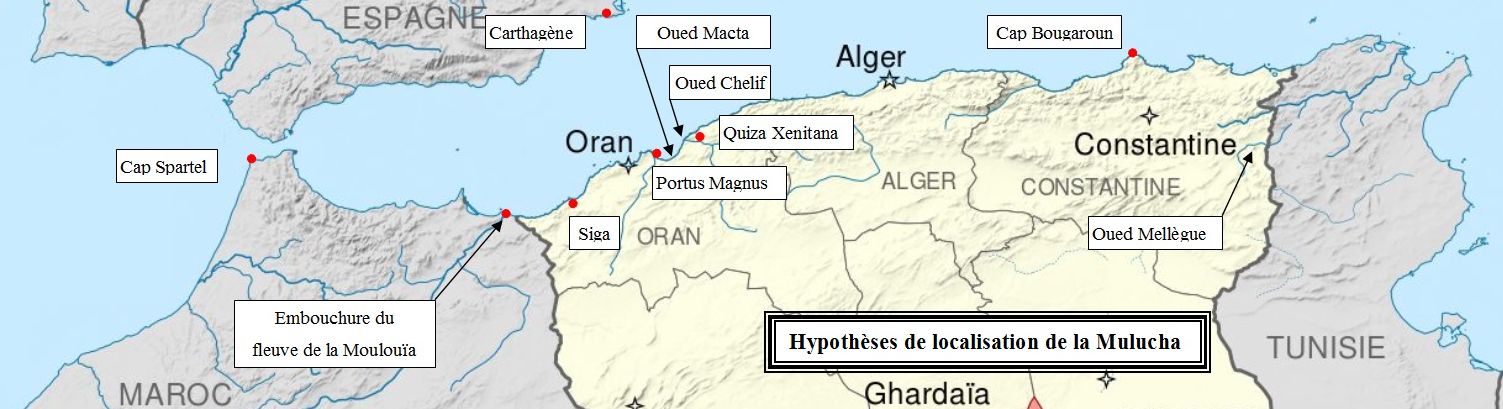
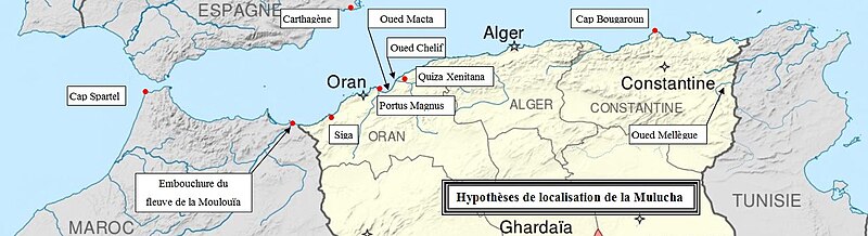
Français : Elements d'identification de la localisation du fleuve Mulucha, frontière de la Numidie à l'époque antique |
| Date | |
| Source | File:Oasis territory 1934-1955 map-fr.svg |
| Author | Sémhur retouché par Camille56 |
Licensing
edit
This file is licensed under the Creative Commons Attribution 4.0 International license.
- You are free:
- to share – to copy, distribute and transmit the work
- to remix – to adapt the work
- Under the following conditions:
- attribution – You must give appropriate credit, provide a link to the license, and indicate if changes were made. You may do so in any reasonable manner, but not in any way that suggests the licensor endorses you or your use.
File history
Click on a date/time to view the file as it appeared at that time.
| Date/Time | Thumbnail | Dimensions | User | Comment | |
|---|---|---|---|---|---|
| current | 20:33, 30 October 2016 | 1,503 × 409 (108 KB) | Camille56 (talk | contribs) | User created page with UploadWizard |
You cannot overwrite this file.
File usage on Commons
There are no pages that use this file.
File usage on other wikis
The following other wikis use this file:
- Usage on fr.wikipedia.org