File:I-55 North Aerial Near Ruddock LA (28409169857).jpg
Size of this preview: 400 × 600 pixels. Other resolutions: 160 × 240 pixels | 320 × 480 pixels | 512 × 768 pixels | 682 × 1,024 pixels | 1,600 × 2,400 pixels.
Original file (1,600 × 2,400 pixels, file size: 1.96 MB, MIME type: image/jpeg)
Captions
Captions
Add a one-line explanation of what this file represents
Summary
edit.jpg&action=edit§ion=1)
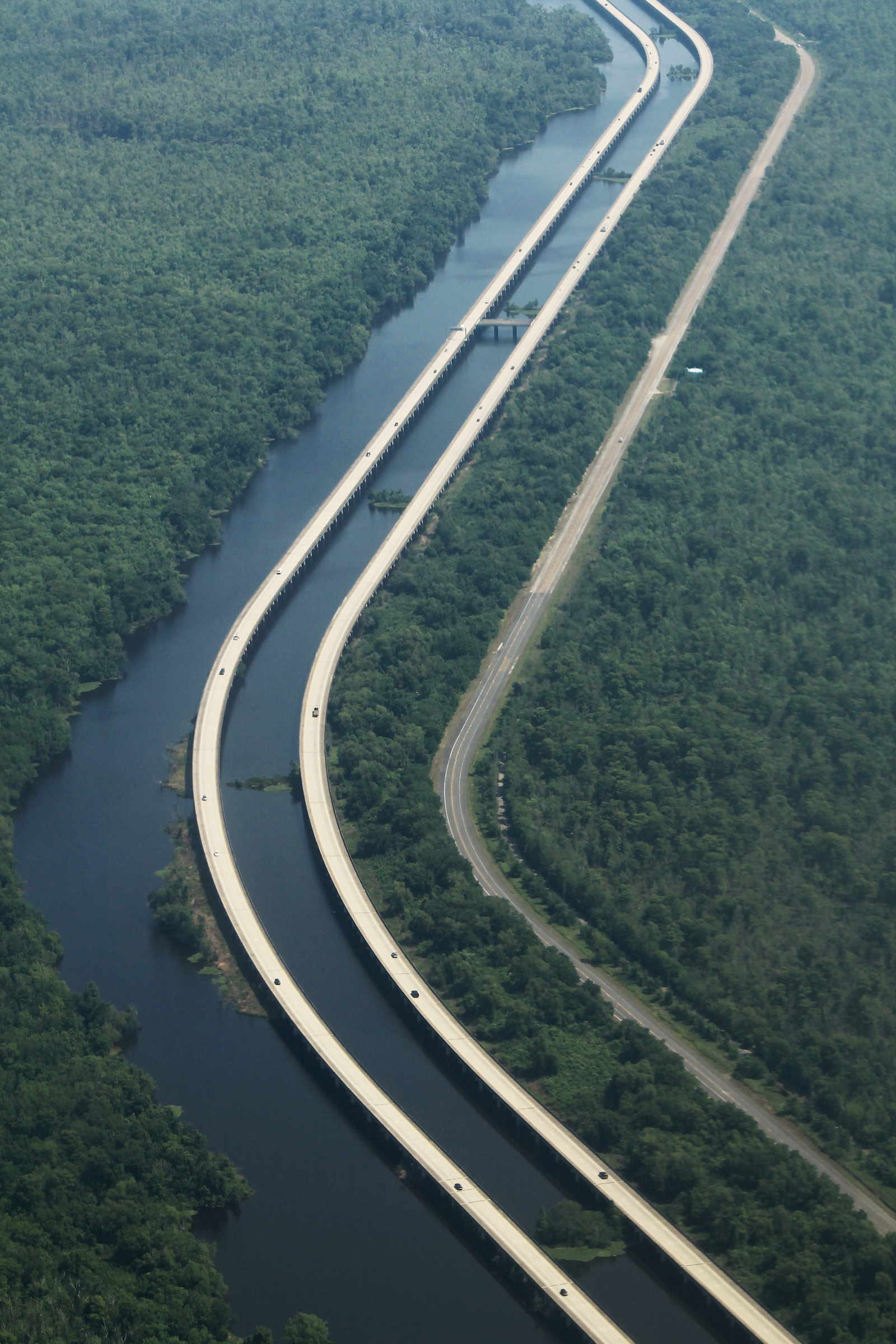
| Description | Interstate 55 is one of the longest continuous spans across water, and serves the western (uninhabited) reaches of the greater New Orleans area, all the way to Chicago. About 20 miles of it are entirely lifted above water, with the former alignment of US Route 51 standing by in case of an emergency or desire to actually see some thing other than an enormous swath of concrete. |
| Date | |
| Source | I-55 North Aerial Near Ruddock LA |
| Author | formulanone from Huntsville, United States |
Licensing
edit.jpg&action=edit§ion=2)
This file is licensed under the Creative Commons Attribution-Share Alike 2.0 Generic license.
- You are free:
- to share – to copy, distribute and transmit the work
- to remix – to adapt the work
- Under the following conditions:
- attribution – You must give appropriate credit, provide a link to the license, and indicate if changes were made. You may do so in any reasonable manner, but not in any way that suggests the licensor endorses you or your use.
- share alike – If you remix, transform, or build upon the material, you must distribute your contributions under the same or compatible license as the original.
| This image was originally posted to Flickr by formulanone at https://flickr.com/photos/30552029@N00/28409169857 (archive). It was reviewed on 25 November 2018 by FlickreviewR 2 and was confirmed to be licensed under the terms of the cc-by-sa-2.0. |
File history
Click on a date/time to view the file as it appeared at that time.
| Date/Time | Thumbnail | Dimensions | User | Comment | |
|---|---|---|---|---|---|
| current | 15:52, 25 November 2018 | | 1,600 × 2,400 (1.96 MB) | Tyler ser Noche (talk | contribs) | Transferred from Flickr via #flickr2commons |
You cannot overwrite this file.
File usage on Commons
There are no pages that use this file.
.jpg&oldid=647467612)