File:IBRA 6.1 MAL1.png
Size of this preview: 800 × 596 pixels. Other resolutions: 320 × 238 pixels | 640 × 477 pixels | 1,024 × 763 pixels | 1,257 × 936 pixels.
Original file (1,257 × 936 pixels, file size: 105 KB, MIME type: image/png)
Captions
Captions
Add a one-line explanation of what this file represents
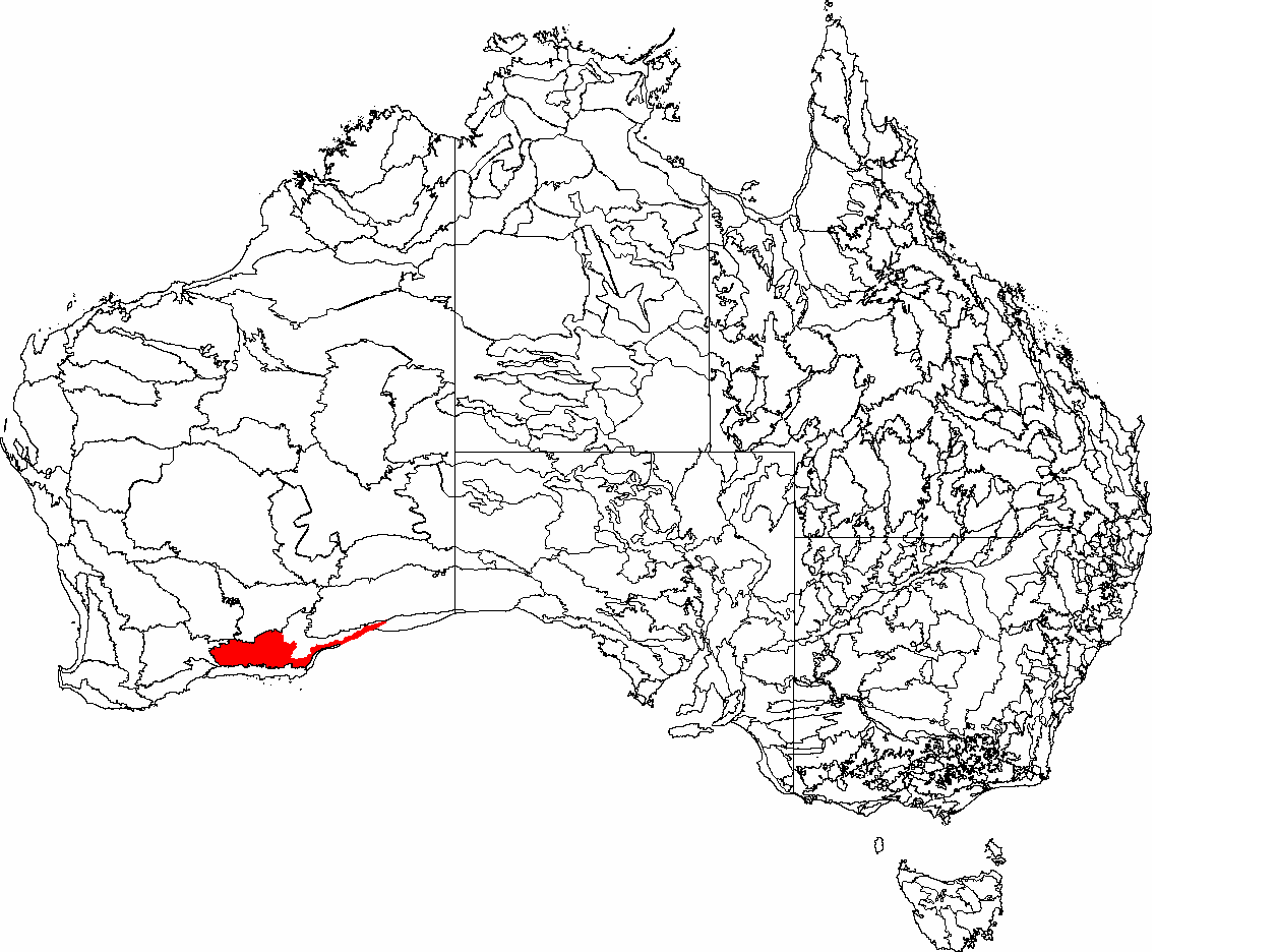
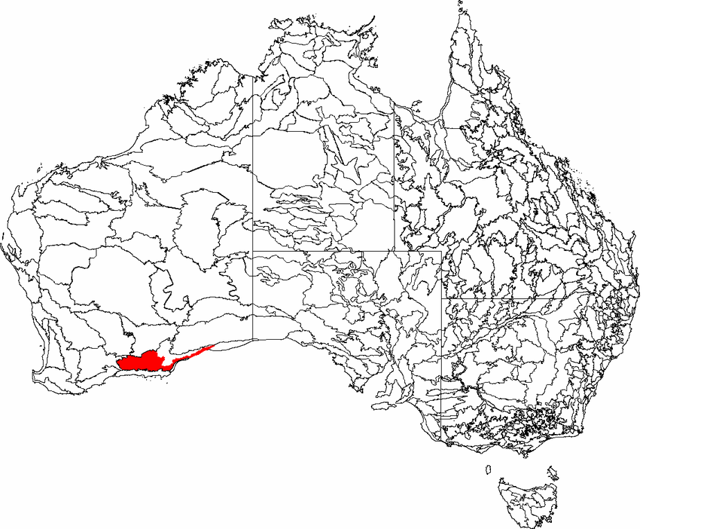
| Description | This is a map of the Interim Biogeographic Regionalisation of Australia (IBRA) subregions, with state boundaries overlaid. The Eastern Mallee region (MAL1) is shown in red. | ||||||||
| Date | |||||||||
| Source | It was created by the uploader. | ||||||||
| Author | Hesperian | ||||||||
| Permission (Reusing this file) |
I, the copyright holder of this work, hereby publish it under the following licenses:
This file is licensed under the Creative Commons Attribution-Share Alike 2.5 Generic, 2.0 Generic and 1.0 Generic license.
You may select the license of your choice. |

File history
Click on a date/time to view the file as it appeared at that time.
| Date/Time | Thumbnail | Dimensions | User | Comment | |
|---|---|---|---|---|---|
| current | 05:17, 26 April 2007 | | 1,257 × 936 (105 KB) | Hesperian (talk | contribs) | {{Information |Description=This is a map of the Interim Biogeographic Regionalisation of Australia (IBRA) subregions, with state boundaries overlaid. The '''Eastern Mallee''' region ('''MAL1''') is shown in red. |Source=It was created by the uploader. |Da |
You cannot overwrite this file.
File usage on Commons
There are no pages that use this file.
File usage on other wikis
The following other wikis use this file:
- Usage on en.wikipedia.org