File:ISS-26 Tidal flats and channels on Long Island, Bahamas.jpg
Size of this preview: 800 × 531 pixels. Other resolutions: 320 × 213 pixels | 640 × 425 pixels | 1,024 × 680 pixels | 1,280 × 850 pixels | 2,560 × 1,700 pixels | 4,288 × 2,848 pixels.
Original file (4,288 × 2,848 pixels, file size: 3.9 MB, MIME type: image/jpeg)
Captions
Captions
Add a one-line explanation of what this file represents
Summary edit
| Description |
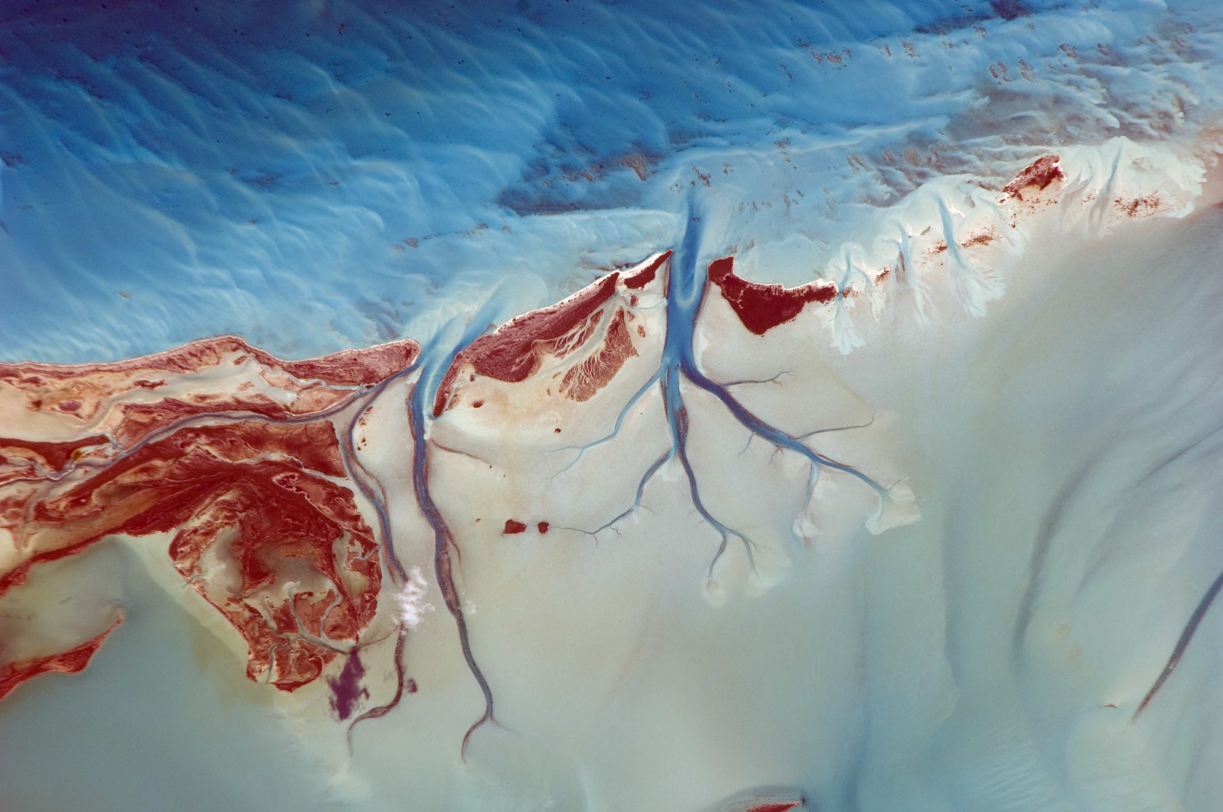
English: Tidal flats and channels on Long Island, Bahamas are featured in this image photographed by an Expedition 26 crew member on the International Space Station.
|
| Date | |
| Source | http://spaceflight.nasa.gov/gallery/images/station/crew-26/html/iss026e005121.html |
| Author | NASA |
This image or video was catalogued by Johnson Space Center of the United States National Aeronautics and Space Administration (NASA) under Photo ID: ISS026-E-005121. This tag does not indicate the copyright status of the attached work. A normal copyright tag is still required. See Commons:Licensing. Other languages:
|
Licensing edit
This file is in the public domain in the United States because it was created by the Image Science & Analysis Laboratory, of the NASA Johnson Space Center. NASA copyright policy states that "NASA material is not protected by copyright unless noted". (NASA media use guidelines or Conditions of Use of Astronaut Photographs).
Photo source: ISS026-E-5121.
|
File history
Click on a date/time to view the file as it appeared at that time.
| Date/Time | Thumbnail | Dimensions | User | Comment | |
|---|---|---|---|---|---|
| current | 16:19, 1 November 2015 | | 4,288 × 2,848 (3.9 MB) | Ras67 (talk | contribs) | new rendered in high quality from NASA's raw data |
| 14:26, 23 June 2012 |  | 4,288 × 2,848 (720 KB) | Ras67 (talk | contribs) | {{Information |Description ={{en|1=Tidal flats and channels on Long Island, Bahamas are featured in this image photographed by an Expedition 26 crew member on the International Space Station. * The islands of the Bahamas in the Caribbean Sea are sit... |
You cannot overwrite this file.
File usage on Commons
The following page uses this file:
File usage on other wikis
The following other wikis use this file:
- Usage on de.wikipedia.org
- Usage on en.wikipedia.org
- Usage on lt.wikipedia.org
- Usage on uk.wikipedia.org