File:ISS060-E-37819 - View of Earth.jpg

Size of this preview: 800 × 533 pixels. Other resolutions: 320 × 213 pixels | 640 × 427 pixels | 1,024 × 683 pixels | 1,280 × 853 pixels | 2,560 × 1,707 pixels | 5,568 × 3,712 pixels.
Original file (5,568 × 3,712 pixels, file size: 3.21 MB, MIME type: image/jpeg)
Captions
Captions
Add a one-line explanation of what this file represents
Summary
edit
| Description |
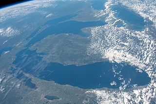
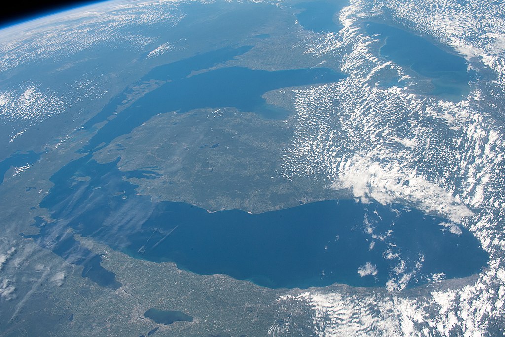
English: View of the Lower Peninsula of Michigan taken on August 19, 2019 during ISS Expedition 60. The Door Peninsula is at the lower left, to the right of Green Bay. The North Channel of Lake Huron is at the upper left. |
| Date | |
| Source | JSC Gateway to Astronaut Photography of Earth |
| Author | Earth Science and Remote Sensing Unit, NASA Johnson Space Center |
| Sun Azimuth | 228° |
| Sun Elevatation | 51° |
| Altitude | 224 nautical miles (415 km) |
| Mission | ISS060 |
| Roll | E |
| Frame | 37819 |
| Camera | NIKON D5 S/N: 3502461 |
| Focal length | 50 mm |
| Camera location | | View this and other nearby images on: OpenStreetMap |
|---|
This image or video was catalogued by Johnson Space Center of the United States National Aeronautics and Space Administration (NASA) under Photo ID: ISS060-E-37819. This tag does not indicate the copyright status of the attached work. A normal copyright tag is still required. See Commons:Licensing. Other languages:
|
Licensing
edit
| This file is in the public domain in the United States because it was solely created by NASA. NASA copyright policy states that "NASA material is not protected by copyright unless noted". (See Template:PD-USGov, NASA copyright policy page or JPL Image Use Policy.) | ||
 |
Warnings:
|
File history
Click on a date/time to view the file as it appeared at that time.
| Date/Time | Thumbnail | Dimensions | User | Comment | |
|---|---|---|---|---|---|
| current | 21:52, 23 April 2021 | | 5,568 × 3,712 (3.21 MB) | Askeuhd (talk | contribs) |
You cannot overwrite this file.
File usage on Commons
There are no pages that use this file.