File:Ibaraki&Chiba pref road 17.JPG
Size of this preview: 800 × 600 pixels. Other resolutions: 320 × 240 pixels | 640 × 480 pixels | 1,024 × 768 pixels | 1,280 × 960 pixels | 2,560 × 1,920 pixels.
Original file (2,560 × 1,920 pixels, file size: 484 KB, MIME type: image/jpeg)
Captions
Captions
Add a one-line explanation of what this file represents
Summary
edit
| Description |
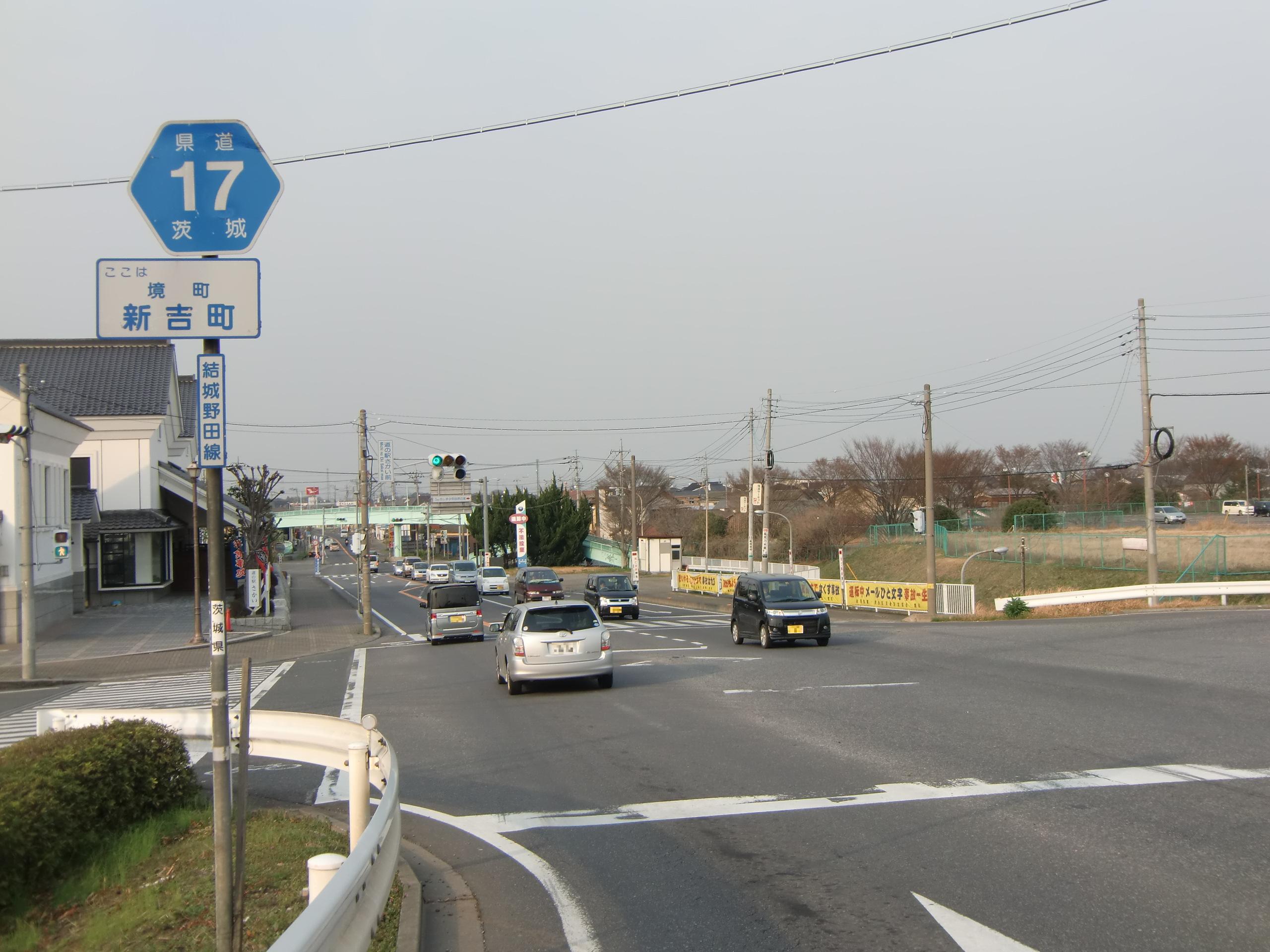
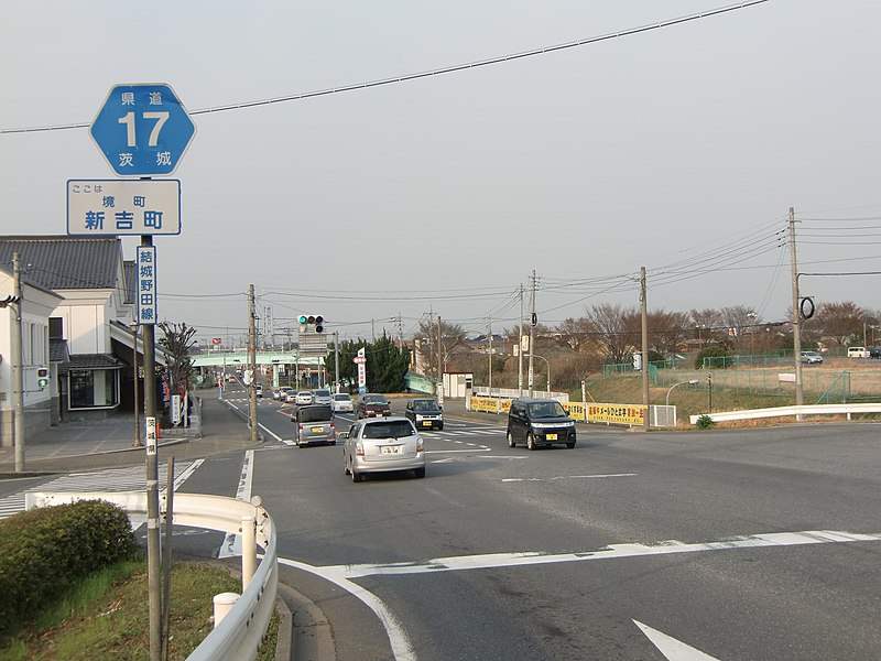
English: Ibaraki/Chiba prefectural road 17(Yuki-Noda line)in Shinyoshi-machi, Sakai-town, Ibaraki-pref, Japan. This picture was taken near Michino-eki SAKAI.
日本語: 茨城県道・千葉県道17号結城野田線(茨城県猿島郡境町新吉町)。道の駅さかい付近。 |
| Date | Taken on 2 April 2011 |
| Source | Own work |
| Author | On-chan |
| Camera location | | View this and other nearby images on: OpenStreetMap |
|---|
Licensing
edit
I, the copyright holder of this work, hereby publish it under the following license:
| This file is made available under the Creative Commons CC0 1.0 Universal Public Domain Dedication. | |
| The person who associated a work with this deed has dedicated the work to the public domain by waiving all of their rights to the work worldwide under copyright law, including all related and neighboring rights, to the extent allowed by law. You can copy, modify, distribute and perform the work, even for commercial purposes, all without asking permission.
|
File history
Click on a date/time to view the file as it appeared at that time.
| Date/Time | Thumbnail | Dimensions | User | Comment | |
|---|---|---|---|---|---|
| current | 11:19, 2 April 2011 | | 2,560 × 1,920 (484 KB) | On-chan (talk | contribs) | {{Information |Description ={{en|1=Ibaraki/Chiba prefectural road 17(Yuki-Noda line)in Shinyoshi-machi, Sakai-town, Ibaraki-pref, Japan. This picture was taken near Michino-eki SAKAI.}} {{ja|1=茨城県道・千葉県道17号結城野田線(茨城県 |
You cannot overwrite this file.
File usage on Commons
There are no pages that use this file.
File usage on other wikis
The following other wikis use this file:
- Usage on es.wikipedia.org
- Usage on ja.wikipedia.org