File:Icebergs A69A, A69B, A69C floating off Larsen-D Ice Shelf (MODIS 2021-11-17).jpg

Original file (1,911 × 1,488 pixels, file size: 394 KB, MIME type: image/jpeg)
Captions
Captions
Summary edit
.jpg&action=edit§ion=1)
| Description |
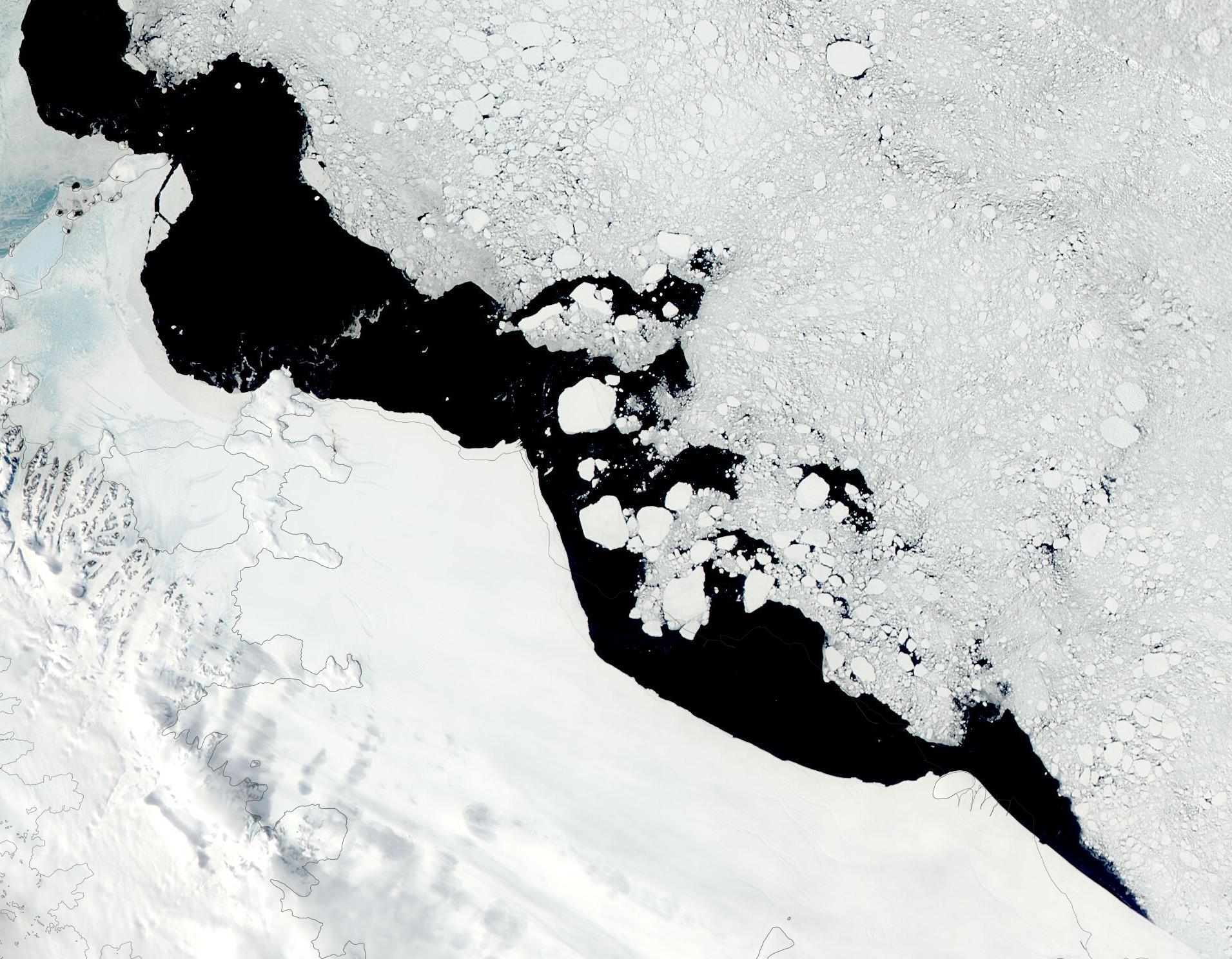
English: Icebergs are common sights in both Antarctica and the Arctic, where they are “born” as large pieces of ice break off from glaciers, ice shelves or a larger iceberg, usually in the warmer days of summer. This also is the season in which they float along ocean currents, sometimes smashing into the shore, hanging up in shallow waters, or breaking up into smaller pieces. As winter’s frigid temperatures return, ice bergs are often literally frozen in place as sea ice covers the surrounding waters.
In the summer of 2020, Antarctica’s Larsen-D Ice Shelf calved a new iceberg. The U.S. National Ice Center (USNIC) confirmed the calving on June 26 and gave the location of the new iceberg, dubbed A-69, at 68°59’ South, 60°38’ West in the Weddell Sea. At that time, the iceberg measured about 21.9 miles (35.2 km) on its longest axis and 11.5 miles (18.5 km) on its widest axis, with an area of about 179 square miles (463.6 sq. km). Less than two weeks later, on July 7, USNIC confirmed that the new iceberg had broken into two ‘bergs large enough to warrant a name. At that time, A-69A measured about 11.5 miles (18.5 km) by 10.4 mi (16.7 km). The smaller section was dubbed A-69B and measured about 11.5 miles (18.5 km) by 8 miles (12.9 km). Both were floating in the Weddell Sea and remained close to each other. More than a year after initial calving, on October 28, 2021, another large piece split off of A-69B, breaking it nearly in half. The USNIC reported this third ‘berg was named A-69C and estimated it size as about 11.5 miles (18.5 km) by 3.5 mi (5.6 km). At that time, A-69C is located at 66°51’ South, 59°39’ West, in the Weddell Sea. The Moderate Resolution Imaging Spectroradiometer (MODIS) on board NASA’s Terra satellite caught up with the iceberg family adrift in the Weddell Sea and acquired a true-color image of the ‘bergs on November 15. The three largest chunks of ice sit on the edge of open water, partially surrounded by melting sea ice, bergy bits, growlers, and other smaller bits of ice. USNIC uses satellite data to monitor icebergs floating near Antarctica. However, it only tracks (and names) icebergs larger than 5,400 square feet (500 square meters). |
||
| Date | Taken on 15 November 2021 | ||
| Source |
Icebergs A69A, A69B, A69C floating off Larsen-D Ice Shelf (direct link)
|
||
| Author | MODIS Land Rapid Response Team, NASA GSFC |
| This media is a product of the Aqua mission Credit and attribution belongs to the mission team, if not already specified in the "author" row |
Licensing edit
.jpg&action=edit§ion=2)
| This file is in the public domain in the United States because it was solely created by NASA. NASA copyright policy states that "NASA material is not protected by copyright unless noted". (See Template:PD-USGov, NASA copyright policy page or JPL Image Use Policy.) | ||
 |
Warnings:
|
File history
Click on a date/time to view the file as it appeared at that time.
| Date/Time | Thumbnail | Dimensions | User | Comment | |
|---|---|---|---|---|---|
| current | 14:25, 20 January 2024 | | 1,911 × 1,488 (394 KB) | OptimusPrimeBot (talk | contribs) | #Spacemedia - Upload of http://modis.gsfc.nasa.gov/gallery/images/image11172021_250m.jpg via Commons:Spacemedia |
You cannot overwrite this file.
File usage on Commons
There are no pages that use this file.
.jpg&oldid=843666784)