File:Icebergs B09F, C28B, B15T, and B15Z in the South Atlantic Ocean (MODIS 2017-12-01).jpg

Size of this preview: 750 × 600 pixels. Other resolutions: 300 × 240 pixels | 600 × 480 pixels | 960 × 768 pixels | 1,280 × 1,024 pixels | 2,000 × 1,600 pixels.
Original file (2,000 × 1,600 pixels, file size: 634 KB, MIME type: image/jpeg)
Captions
Captions
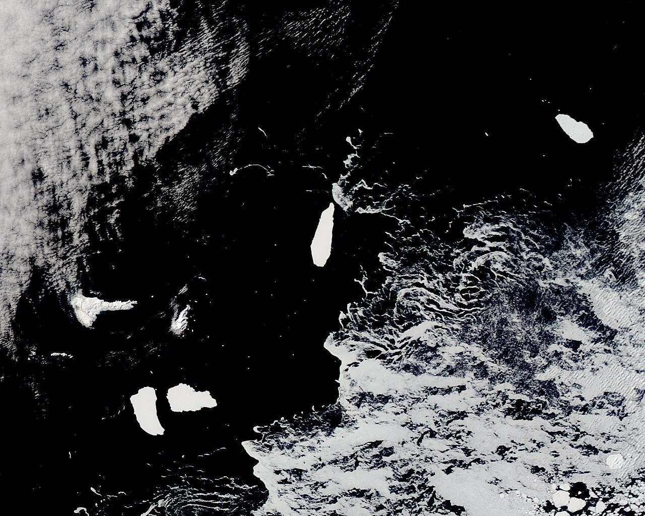
On November 22, 2017 the Moderate Resolution Imaging Spectroradiometer (MODIS) aboard NASA’s Aqua satellite acquired a true-color image of a cluster of icebergs adrift in the South Atlantic Ocean.
Summary
edit.jpg&action=edit§ion=1)
| Description |
English: On November 22, 2017 the Moderate Resolution Imaging Spectroradiometer (MODIS) aboard NASA’s Aqua satellite acquired a true-color image of a cluster of icebergs adrift in the South Atlantic Ocean. Each of these icebergs are fragments of larger ‘bergs and have been dubbed B09F, C28B, B15T, and B15Z, each name representing the location they were first seen, the relative time of first identification, and the fragment number.
These icebergs originated in different locations – B09, B15T, and B15Z were first seen in the Amundsen/Eastern Ross Sea while C28B originated in the Western Ross Sea/Wilkesland area. Although the origins were different, they have been travelling together and drifting slowly westward and northward with the currents in the Southern Ocean. The same cluster of icebergs was located south of the Orkney Islands on October 20, 2017. As of November 22, they had drifted more than 100 miles (161 km) to the west, nearing the outer reaches of the South Shetland Islands. |
||
| Date | Taken on 22 November 2017 | ||
| Source |
Icebergs B09F, C28B, B15T, and B15Z in the South Atlantic Ocean (direct link)
|
||
| Author | Jeff Schmaltz, MODIS Land Rapid Response Team, NASA GSFC |
| This media is a product of the Aqua mission Credit and attribution belongs to the mission team, if not already specified in the "author" row |
Licensing
edit.jpg&action=edit§ion=2)
| This file is in the public domain in the United States because it was solely created by NASA. NASA copyright policy states that "NASA material is not protected by copyright unless noted". (See Template:PD-USGov, NASA copyright policy page or JPL Image Use Policy.) | ||
 |
Warnings:
|
File history
Click on a date/time to view the file as it appeared at that time.
| Date/Time | Thumbnail | Dimensions | User | Comment | |
|---|---|---|---|---|---|
| current | 17:09, 16 February 2024 | | 2,000 × 1,600 (634 KB) | OptimusPrimeBot (talk | contribs) | #Spacemedia - Upload of http://modis.gsfc.nasa.gov/gallery/images/image12012017_250m.jpg via Commons:Spacemedia |
You cannot overwrite this file.
File usage on Commons
There are no pages that use this file.
.jpg&oldid=852761257)