File:Iceland, Hvalfjörður (08), Botnsvogur, Botnsá river.jpg
Size of this preview: 800 × 450 pixels. Other resolutions: 320 × 180 pixels | 640 × 360 pixels | 1,024 × 576 pixels | 1,280 × 720 pixels | 2,560 × 1,440 pixels | 4,000 × 2,250 pixels.
Original file (4,000 × 2,250 pixels, file size: 4.71 MB, MIME type: image/jpeg)
Captions
Captions
Add a one-line explanation of what this file represents
Summary
edit,_Botnsvogur,_Botns%C3%A1_river.jpg&action=edit§ion=1)
| Description |
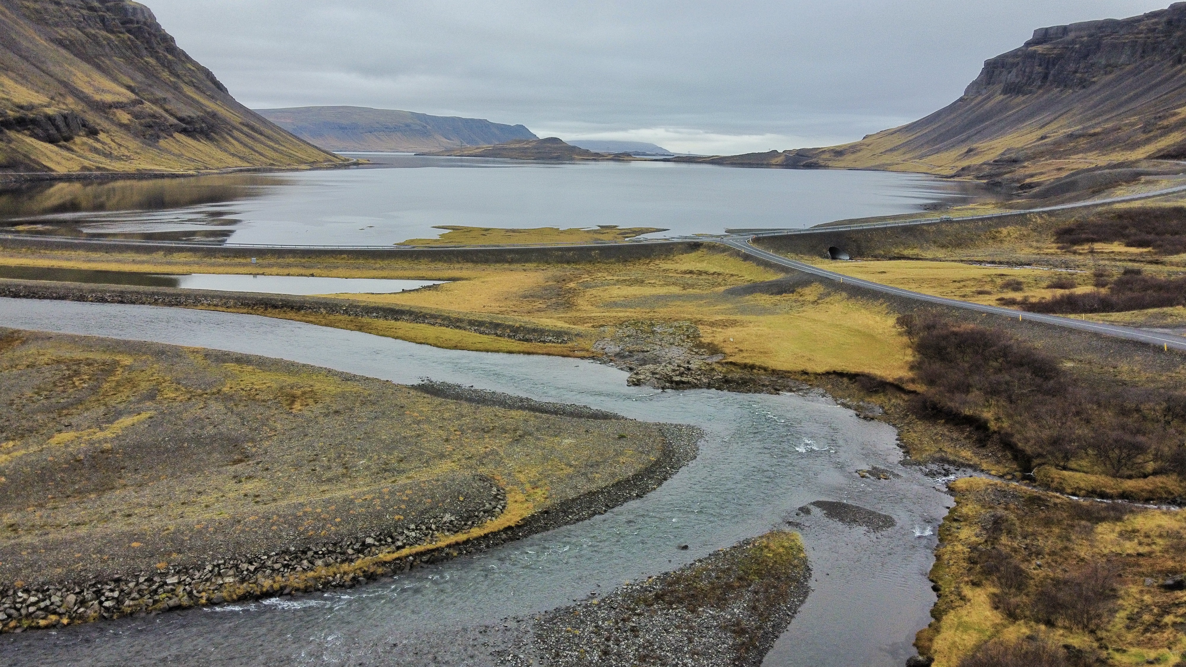
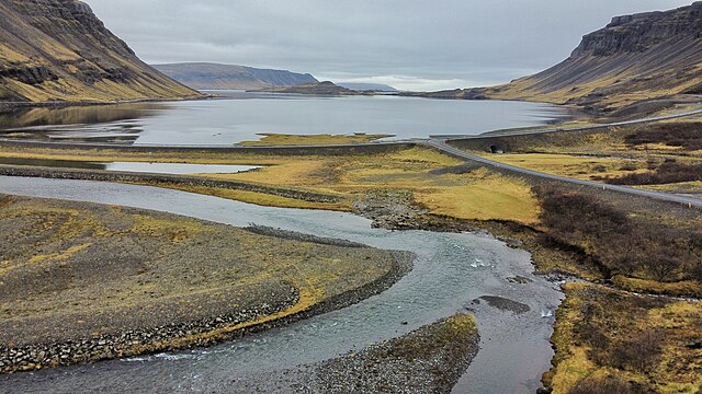
English: Botnsvogur (bay) at the head of the Hvalfjörður ('Whale Fjord') in western Iceland. The mountain on the left is Múlafjall; on the right is Þyrill. In the foreground the Botnsá river, shortly before it flows into Botnsvogur. The road that crosses the picture from left to right is de former ringroad, now road 47 (Hvalfjarðarvegur). The road that branches off on the right goes into Botnsdalur.
Nederlands: De Botnsvogur (baai) is het meest landinwaartse deel (de 'kop') van de Hvalfjörður ('Walvisfjord') in West-IJsland. De berg links is Múlafjall; rechts is Þyrill. Op de voorgrond de rivier Botnsá, vlak voor de monding in de Botnsvogur. De weg die van links naar rechts door het beeld loopt is de oude ringweg rond IJsland, maar heet nu weg nr. 47 (Hvalfjarðarvegur). De zijweg rechts gaat naar het Botnsdalur. |
| Date | |
| Source | Own work |
| Author | Vincent van Zeijst |
Looking to the West from:
| Camera location | | View this and other nearby images on: OpenStreetMap |
|---|
,_Botnsvogur,_Botns%C3%A1_river.jpg¶ms=064.385492_N_-021.349225_E_globe:Earth_type:camera__&language=en)
Licensing
edit,_Botnsvogur,_Botns%C3%A1_river.jpg&action=edit§ion=2)
I, the copyright holder of this work, hereby publish it under the following license:
This file is licensed under the Creative Commons Attribution-Share Alike 3.0 Unported license.
- You are free:
- to share – to copy, distribute and transmit the work
- to remix – to adapt the work
- Under the following conditions:
- attribution – You must give appropriate credit, provide a link to the license, and indicate if changes were made. You may do so in any reasonable manner, but not in any way that suggests the licensor endorses you or your use.
- share alike – If you remix, transform, or build upon the material, you must distribute your contributions under the same or compatible license as the original.
File history
Click on a date/time to view the file as it appeared at that time.
| Date/Time | Thumbnail | Dimensions | User | Comment | |
|---|---|---|---|---|---|
| current | 15:17, 24 November 2023 | | 4,000 × 2,250 (4.71 MB) | Loranchet (talk | contribs) | {{Information |Description ={{en|1=Botnsvogur (bay) at the head of the Hvalfjörður ('Whale Fjord') in western Iceland. The mountain on the left is Múlafjall; on the right is Þyrill. In the foreground the Botnsá river, shortly before it flows into Botnsvogur. The road that crosses the picture from left to right is de former ringroad, now road 47 (Hvalfjarðarvegur).}} {{nl|1=De Botnsvogur (baai) is het meest landinwaartse deel (de 'kop') van de Hvalfjörður ('Walvisfjord') in West-IJsland. De... |
You cannot overwrite this file.
File usage on Commons
There are no pages that use this file.
File usage on other wikis
The following other wikis use this file:
- Usage on is.wikipedia.org
- Usage on nl.wikipedia.org
- Usage on sv.wikipedia.org
,_Botnsvogur,_Botnsá_river.jpg&oldid=825011927)