File:Iceni lands.svg

Size of this PNG preview of this SVG file: 683 × 600 pixels. Other resolutions: 273 × 240 pixels | 546 × 480 pixels | 874 × 768 pixels | 1,166 × 1,024 pixels | 2,331 × 2,048 pixels | 691 × 607 pixels.
Original file (SVG file, nominally 691 × 607 pixels, file size: 218 KB)
Captions
Captions
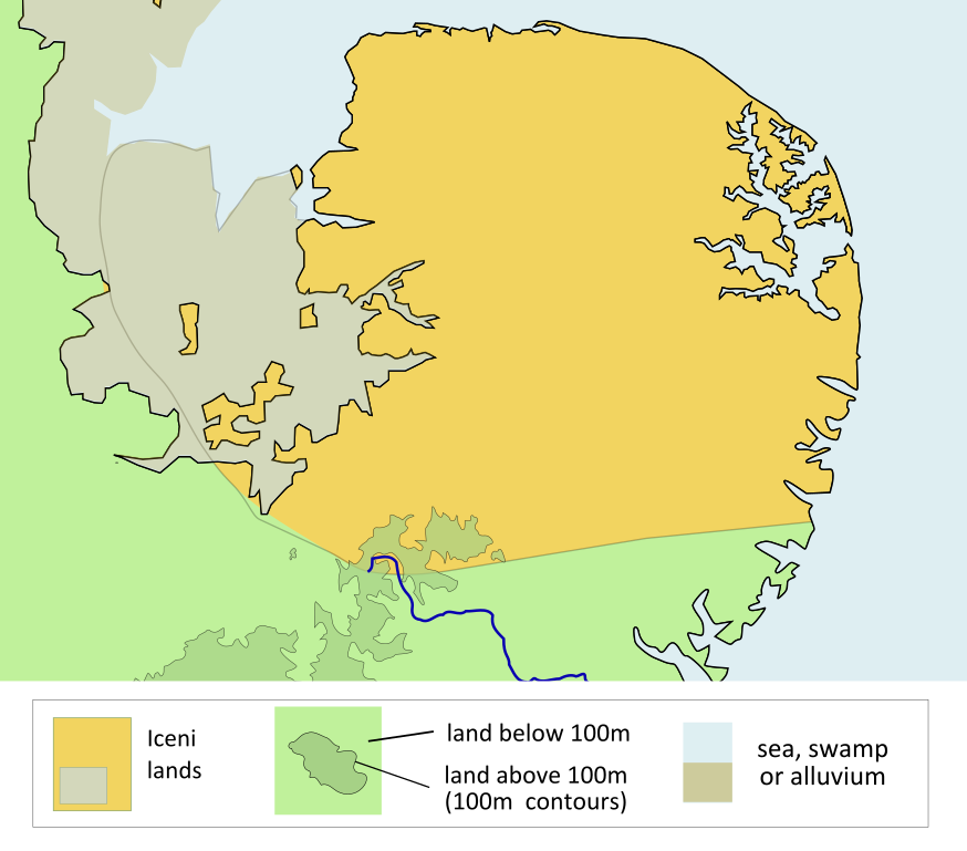
Iceni lands
Summary
edit
| Description |
English: Iceni lands |
| Date | |
| Source | Own work based on File:Williamson p16 3.svg and File:Map of the Territory of the Iceni.svg |
| Author | Amitchell125 |
| Permission (Reusing this file) |
I, the copyright holder of this work, hereby publish it under the following license: This file is licensed under the Creative Commons Attribution-Share Alike 4.0 International license.
|
File history
Click on a date/time to view the file as it appeared at that time.
| Date/Time | Thumbnail | Dimensions | User | Comment | |
|---|---|---|---|---|---|
| current | 17:12, 12 October 2022 | | 691 × 607 (218 KB) | Amitchell125 (talk | contribs) | slight amendment |
| 16:47, 12 October 2022 |  | 691 × 607 (218 KB) | Amitchell125 (talk | contribs) | Uploaded own work with UploadWizard |
You cannot overwrite this file.
File usage on Commons
There are no pages that use this file.
File usage on other wikis
The following other wikis use this file:
- Usage on en.wikipedia.org
- Usage on eu.wikipedia.org