File:Igm map FCTT area.pdf

Size of this JPG preview of this PDF file: 675 × 599 pixels. Other resolutions: 270 × 240 pixels | 541 × 480 pixels | 722 × 641 pixels.
Original file (722 × 641 pixels, file size: 996 KB, MIME type: application/pdf)
Captions
Captions
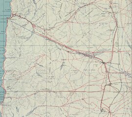
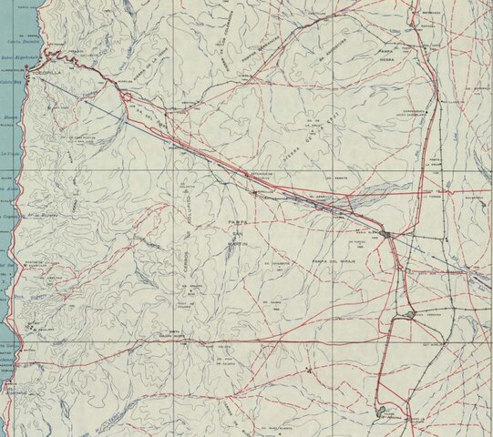
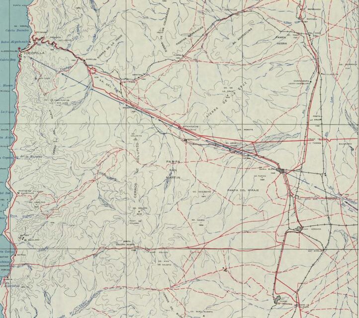
area of nitrate railways feeding port of Tocopilla
Summary
edit| Description |
English: detail 1940s Chile Military Geographical Institute map showing network of nitrate railways feeding port of Tocopilla |
| Date | |
| Source | cropped area from http://www.bibliotecanacionaldigital.gob.cl/bnd/631/w3-article-157119.html |
| Author | Original: Instituto Geografico Militar, Chile. Cropped by me |
Licensing
edit| This file is made available under the Creative Commons CC0 1.0 Universal Public Domain Dedication. | |
| The person who associated a work with this deed has dedicated the work to the public domain by waiving all of their rights to the work worldwide under copyright law, including all related and neighboring rights, to the extent allowed by law. You can copy, modify, distribute and perform the work, even for commercial purposes, all without asking permission.
|
File history
Click on a date/time to view the file as it appeared at that time.
| Date/Time | Thumbnail | Dimensions | User | Comment | |
|---|---|---|---|---|---|
| current | 00:57, 3 November 2020 |  | 722 × 641 (996 KB) | Oldboltonian (talk | contribs) | Uploaded a work by Original: Instituto Geografico Militar, Chile. Cropped by me from cropped area from http://www.bibliotecanacionaldigital.gob.cl/bnd/631/w3-article-157119.html with UploadWizard |
You cannot overwrite this file.
File usage on Commons
There are no pages that use this file.