File:Ile du Petit Mecatina.PNG

Size of this preview: 300 × 600 pixels. Other resolutions: 120 × 240 pixels | 512 × 1,024 pixels.
Original file (512 × 1,024 pixels, file size: 167 KB, MIME type: image/png)
Captions
Captions
Add a one-line explanation of what this file represents
Summary edit
| Description |
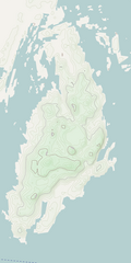
Français : Île du Petit Mécatina, Québec, Canada |
| Date | |
| Source | Own work à partir de OpenStreetMap |
| Author | Jeangagnon |
| Camera location | | View this and other nearby images on: OpenStreetMap |
|---|
Licensing edit
| This work has been released into the public domain by its author, OpenStreetMap. This applies worldwide. In some countries this may not be legally possible; if so: OpenStreetMap grants anyone the right to use this work for any purpose, without any conditions, unless such conditions are required by law. |
File history
Click on a date/time to view the file as it appeared at that time.
| Date/Time | Thumbnail | Dimensions | User | Comment | |
|---|---|---|---|---|---|
| current | 17:22, 12 January 2013 | | 512 × 1,024 (167 KB) | Jeangagnon (talk | contribs) | User created page with UploadWizard |
You cannot overwrite this file.
File usage on Commons
The following page uses this file:
File usage on other wikis
The following other wikis use this file:
- Usage on de.wikipedia.org
- Usage on fr.wikipedia.org
- Usage on www.wikidata.org