File:Imendyashevo on river Zilim.jpg

Size of this preview: 599 × 599 pixels. Other resolutions: 240 × 240 pixels | 480 × 480 pixels | 767 × 768 pixels | 1,023 × 1,024 pixels | 1,383 × 1,384 pixels.
Original file (1,383 × 1,384 pixels, file size: 698 KB, MIME type: image/jpeg)
Captions
Captions
Add a one-line explanation of what this file represents
Summary
edit
| Description |
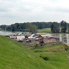
English: Imendyashevo on the river Zilim, Gafuriysky district of Bashkortostan. Hrvatski: Imendjaševo na rijeci Zilim, Gafurijski rajon Baškirska. Русский: Имендяшево на реке Зилим, Гафурийский район, Башкортостан. |
| Date | |
| Source | panoramio |
| Author | Maximovich Nikolay |
| Camera location | | View this and other nearby images on: OpenStreetMap |
|---|
Licensing
edit
This file is licensed under the Creative Commons Attribution 3.0 Unported license.
- You are free:
- to share – to copy, distribute and transmit the work
- to remix – to adapt the work
- Under the following conditions:
- attribution – You must give appropriate credit, provide a link to the license, and indicate if changes were made. You may do so in any reasonable manner, but not in any way that suggests the licensor endorses you or your use.
| This image, which was originally posted to Panoramio, was reviewed on 28 February 2012 by the administrator or trusted user Ginés90, who confirmed that it was available on Panoramio under the above license on that date. |
File history
Click on a date/time to view the file as it appeared at that time.
| Date/Time | Thumbnail | Dimensions | User | Comment | |
|---|---|---|---|---|---|
| current | 01:32, 28 February 2012 | | 1,383 × 1,384 (698 KB) | Vhorvat (talk | contribs) | {{Information |Description={{en|1=Imendyashevo on the river Zilim, Gafuriysky district of Bashkortostan.}}{{hr|Imendjaševo na rijeci Zilim, Gafurijski rajon Baškirska.}}{{ru|Имендяшево на реке Зилим, Гафурийский рай... |
You cannot overwrite this file.
File usage on Commons
The following page uses this file:
File usage on other wikis
The following other wikis use this file:
- Usage on ba.wikipedia.org
- Usage on ce.wikipedia.org
- Usage on crh.wikipedia.org
- Usage on hy.wikipedia.org
- Usage on pl.wikipedia.org
- Usage on ru.wikipedia.org
- Usage on tt.wikipedia.org
- Usage on uk.wikipedia.org
- Usage on www.wikidata.org