File:Imperio Ruso.PNG

Size of this preview: 800 × 370 pixels. Other resolutions: 320 × 148 pixels | 640 × 296 pixels | 1,357 × 628 pixels.
Original file (1,357 × 628 pixels, file size: 16 KB, MIME type: image/png)
Captions
Captions
Add a one-line explanation of what this file represents
| Description |
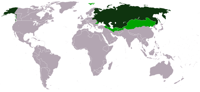
Cánulze: Nebdletcráo Ruscísus odzápna ruscísusa
clútsnuf עברית: האימפריה הרוסית ב-1866
العربية: الإمبراطورية الروسية في 1866
Deutsch: Das Russische Reich 1866
Territorium
Einflussbereich Ελληνικά: Η Ρωσική Αυτοκρατορία το 1866
Ρωσική Επικράτεια
Σφαίρα Επιρροής English: Russian Empire in 1866
Russian territory
Influence sphere Español: Imperio Ruso en 1866
territorio ruso
esfera de influencia rusa Français : Empire Russe en 1866
Territoire Russe
Territoire sous l'influence Russe Italiano: Impero Russo nel 1866
Territorio Russo
Sfera d'influenza russa Malti: Imperu Russu fis-sena 1866
Territorju Russu
Influenza Russa Português: Império Russo em 1866
Território Russo
Influência Russa Русский: Российская Империя в 1866
территория Империи
зоны влияния Svenska: Ryska Imperiet 1866
Ryskt territorium
Område under ryskt inflytande Türkçe: 1866 yılında Rus İmparatorluğu
Rus bölgeleri
Rus etkisi altındaki bölgeler Українська: Російська імперія 1866
території імперії
зони впливу 中文:俄罗斯帝国,1866年
帝国领土
势力范围 |
||||||||
| Date | |||||||||
| Source | Own work | ||||||||
| Author | Mexicano | ||||||||
| Permission (Reusing this file) |
|
||||||||
| Other versions |
|


File history
Click on a date/time to view the file as it appeared at that time.
| Date/Time | Thumbnail | Dimensions | User | Comment | |
|---|---|---|---|---|---|
| current | 08:45, 9 December 2023 | | 1,357 × 628 (16 KB) | Magyar Andreasz (talk | contribs) | Reverted to version as of 21:21, 15 May 2015 (UTC) reverting edit by MAXHO a sockpuppet who has been blocked |
| 09:46, 31 October 2017 |  | 1,357 × 628 (20 KB) | MAXHO (talk | contribs) | Tannu-Tuva chinese in 1866, Afghanistan's borders, emirates of Khiva & Bukhara, influence also in Balkans (Serbs, Bulgarians) | |
| 21:21, 15 May 2015 |  | 1,357 × 628 (16 KB) | RokerHRO (talk | contribs) | optipng -o7 -i0 → 63.91% decrease | |
| 07:08, 21 July 2010 |  | 1,357 × 628 (44 KB) | Omar-Toons (talk | contribs) | min. changes ext. borders | |
| 14:47, 31 May 2009 |  | 1,357 × 628 (28 KB) | Rülpsmann (talk | contribs) | Reverted to version as of 15:36, 15 February 2007: yes, and it's in the 1866 now (on the file) | |
| 09:39, 13 December 2008 |  | 1,357 × 628 (44 KB) | SteveSims~commonswiki (talk | contribs) | Russia had lost its settlements in the continental U.S., like Fort Ross, by 1866. | |
| 15:36, 15 February 2007 |  | 1,357 × 628 (28 KB) | Aivazovsky~commonswiki (talk | contribs) | ||
| 18:08, 14 February 2007 |  | 1,357 × 628 (28 KB) | Aivazovsky~commonswiki (talk | contribs) | Correcting borders of the Russian South Caucasus. | |
| 01:23, 22 October 2006 |  | 1,357 × 628 (44 KB) | Mexicano~commonswiki (talk | contribs) | == Summary == {{en|Russian Empire in 1866 *Russian territory dark green *Influence sphere light green}} {{es|Imperio Ruso en 1866, *Verde oscuro: territorio ruso *Verde claro: esfera de influencia rusa }} {{sv|Ryska Imperiet 1866 *Mörkgrönt:Ryskt T | |
| 03:38, 25 June 2006 |  | 1,357 × 628 (43 KB) | Mexicano~commonswiki (talk | contribs) | Imperio Ruso en 1866, *territorio ruso Verde oscuro *esfera de influencia rusa Verde claro hecho por~~~ |
You cannot overwrite this file.
File usage on Commons
The following 8 pages use this file:
File usage on other wikis
The following other wikis use this file:
- Usage on br.wikipedia.org
- Usage on en.wikipedia.org
- Usage on es.wikipedia.org
- Usage on fr.wikipedia.org
- Usage on it.wikipedia.org
- Usage on ka.wikipedia.org
- Usage on oc.wikipedia.org
- Usage on ru.wikipedia.org
- Участник:Воевода
- Участник:Antonio-cezar
- Участник:Anahoret
- Почтовые марки России
- Участник:Снова дверь прикрыл кондуктор
- Участник:Helgikroha
- Участник:Пишут
- Участник:Анна Муасо
- Участник:Анна Муасо действующая
- Википедия:Сообщения об ошибках/Архив/2011/06
- Участник:The Chief~ruwiki
- Участник:STARSHIP TROOPER/Черновик4
- Участник:Горшков Михаил
- Участник:Brotherzp
- Участник:Михаил Рус
- Участник:9000 udarov
- Участник:Иван Блинов 13
- Участник:Ориенталист
- Участник:Несогласный
- Шаблон:Userbox/Русская цивилизация
- Участник:Arseniy1302/Юзербоксы
- Участник:Просто редактор./Обо мне
- Участник:Custos Honoris Europae
- Участник:FedorkaFend
- Участник:Rutiwasseuffo
- Участник:Kiritsugu21
- Usage on ru.wikinews.org
- Usage on vi.wikipedia.org