File:Incendio-serra-nogueira-visto-de-pinela-braganca.jpg

Size of this preview: 800 × 523 pixels. Other resolutions: 320 × 209 pixels | 640 × 418 pixels | 1,024 × 669 pixels | 1,280 × 837 pixels | 1,790 × 1,170 pixels.
Original file (1,790 × 1,170 pixels, file size: 167 KB, MIME type: image/jpeg)
Captions
Captions
Add a one-line explanation of what this file represents
Summary
edit
| Description |
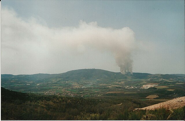
Português: Incêndio e coluna de fumo na Serra da Nogueira visto de Pinela, Bragança, Portugal.
English: Forest fire and smoke column in Mountain of Nogueira as seen from Pinela, Bragança, Portugal. |
| Date | |
| Source | Own work |
| Author | Garsd |
| Camera location | | View this and other nearby images on: OpenStreetMap |
|---|
Licensing
edit
I, the copyright holder of this work, hereby publish it under the following licenses:
This file is licensed under the Creative Commons Attribution-Share Alike 3.0 Unported license.
- You are free:
- to share – to copy, distribute and transmit the work
- to remix – to adapt the work
- Under the following conditions:
- attribution – You must give appropriate credit, provide a link to the license, and indicate if changes were made. You may do so in any reasonable manner, but not in any way that suggests the licensor endorses you or your use.
- share alike – If you remix, transform, or build upon the material, you must distribute your contributions under the same or compatible license as the original.

|
Permission is granted to copy, distribute and/or modify this document under the terms of the GNU Free Documentation License, Version 1.2 or any later version published by the Free Software Foundation; with no Invariant Sections, no Front-Cover Texts, and no Back-Cover Texts. A copy of the license is included in the section entitled GNU Free Documentation License. |
You may select the license of your choice.
| Annotations | This image is annotated: View the annotations at Commons |
File history
Click on a date/time to view the file as it appeared at that time.
| Date/Time | Thumbnail | Dimensions | User | Comment | |
|---|---|---|---|---|---|
| current | 14:14, 1 January 2013 | | 1,790 × 1,170 (167 KB) | Garsd (talk | contribs) | {{Information |Description ={{pt|1=Incêndio e coluna de fumo na Serra da Nogueira visto do Vale de Perdizes. Pinela, Bragança, Portugal.}} {{en|1=Forest fire and smoke column in Mountain of Nogueira as seen from Vale de Perdizes. Pinela, Bragança... |
You cannot overwrite this file.
File usage on Commons
The following 2 pages use this file:
File usage on other wikis
The following other wikis use this file:
- Usage on ceb.wikipedia.org
- Usage on es.wikipedia.org
- Usage on pt.wikipedia.org
- Usage on www.wikidata.org