File:India Assam relief map.svg

Size of this PNG preview of this SVG file: 800 × 553 pixels. Other resolutions: 320 × 221 pixels | 640 × 443 pixels | 1,024 × 708 pixels | 1,280 × 885 pixels | 2,560 × 1,771 pixels | 1,414 × 978 pixels.
Original file (SVG file, nominally 1,414 × 978 pixels, file size: 1.95 MB)
Captions
Captions
Add a one-line explanation of what this file represents
Summary edit
| Description |
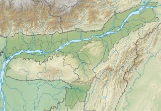
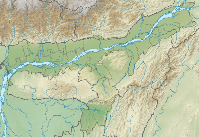
English: Assam relief map. Elevation data from STRM. |
| Date | |
| Source | Assam location map.svg |
| Author | Milenioscuro |
Licensing edit
This file is licensed under the Creative Commons Attribution-Share Alike 3.0 Unported license.
- You are free:
- to share – to copy, distribute and transmit the work
- to remix – to adapt the work
- Under the following conditions:
- attribution – You must give appropriate credit, provide a link to the license, and indicate if changes were made. You may do so in any reasonable manner, but not in any way that suggests the licensor endorses you or your use.
- share alike – If you remix, transform, or build upon the material, you must distribute your contributions under the same or compatible license as the original.
File history
Click on a date/time to view the file as it appeared at that time.
| Date/Time | Thumbnail | Dimensions | User | Comment | |
|---|---|---|---|---|---|
| current | 04:52, 2 July 2022 | | 1,414 × 978 (1.95 MB) | C1MM (talk | contribs) | Updated districts |
| 02:49, 16 July 2021 |  | 1,300 × 899 (2.09 MB) | C1MM (talk | contribs) | Corrected map | |
| 03:28, 17 December 2020 |  | 983 × 679 (4.94 MB) | C1MM (talk | contribs) | Changed elevation colours | |
| 18:01, 31 October 2020 |  | 983 × 679 (4.93 MB) | C1MM (talk | contribs) | Fixed image | |
| 21:03, 29 June 2020 |  | 983 × 680 (5.06 MB) | C1MM (talk | contribs) | Uploaded a work by Milenioscuro from Assam location map.svg with UploadWizard |
You cannot overwrite this file.
File usage on Commons
There are no pages that use this file.
File usage on other wikis
The following other wikis use this file:
- Usage on ban.wikipedia.org
- Usage on de.wikipedia.org
- Usage on en.wikipedia.org
- Kaziranga National Park
- Sankosh River
- Dibru-Saikhowa National Park
- Hajo
- Chabua Air Force Station
- Dipor Bil
- Dihing River
- Dhansiri
- Manas River
- Hoollongapar Gibbon Sanctuary
- Hailakandi Airfield
- Ledo Airfield
- Sookerating Air Force Station
- Chandubi Lake
- Madan Kamdev
- Son Beel
- Kopili River
- Daojali Hading
- Mornoi River
- Module:Location map/data/India Assam
- Module:Location map/data/India Assam/doc
- User:Ty654/List of earthquakes from 1900-1949 exceeding magnitude 7+
- User:Ty654/List of earthquakes from 1950-1954 exceeding magnitude 6+
- Sivasagar Tank (Borpukhuri)
- Bornadi River
- User:Ty654/List of earthquakes from 1980-1984 exceeding magnitude 6+
- Puthimari River
- Lokhaitora River
- Kopili Hydro Electric Project
- User:Ty654/List of earthquakes before 1900 exceeding magnitude 8+
- Baralia River
- Pagladiya River
- Dikhow River
- Jatinga River
- Gabharu River
- Kulsi River
- Jiri River
- Aie River
- Champabati River
- Dikrong River
- Borgang River
- Nona River
- Bharalu River
- Jhanji River
- Dudhnoi River
- Krishnai River
- Ranganadi River
- Tipkai River
View more global usage of this file.