File:India Bihar relief map.svg

Size of this PNG preview of this SVG file: 780 × 600 pixels. Other resolutions: 312 × 240 pixels | 625 × 480 pixels | 999 × 768 pixels | 1,280 × 984 pixels | 2,560 × 1,968 pixels | 921 × 708 pixels.
Original file (SVG file, nominally 921 × 708 pixels, file size: 1.57 MB)
Captions
Captions
Add a one-line explanation of what this file represents
Summary edit
| Description |
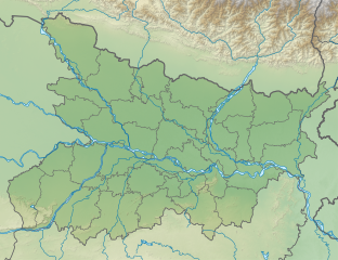
English: Relief map of Bihar. Elevation data from STRM3, accessed via OpenTopogprahy. |
| Date | |
| Source | File:India_Bihar_location_map.svg |
| Author | Own work based on NNW |
Licensing edit
This file is licensed under the Creative Commons Attribution-Share Alike 3.0 Unported license.
- You are free:
- to share – to copy, distribute and transmit the work
- to remix – to adapt the work
- Under the following conditions:
- attribution – You must give appropriate credit, provide a link to the license, and indicate if changes were made. You may do so in any reasonable manner, but not in any way that suggests the licensor endorses you or your use.
- share alike – If you remix, transform, or build upon the material, you must distribute your contributions under the same or compatible license as the original.
File history
Click on a date/time to view the file as it appeared at that time.
| Date/Time | Thumbnail | Dimensions | User | Comment | |
|---|---|---|---|---|---|
| current | 16:48, 22 August 2021 | | 921 × 708 (1.57 MB) | C1MM (talk | contribs) | Corrected borders |
| 03:54, 17 December 2020 |  | 983 × 755 (2.54 MB) | C1MM (talk | contribs) | Changed relief colours | |
| 17:09, 24 October 2020 |  | 983 × 755 (2.88 MB) | C1MM (talk | contribs) | Changed relief map | |
| 04:51, 1 May 2020 |  | 983 × 755 (2.89 MB) | C1MM (talk | contribs) | Uploaded a work by NNW from File:India_Bihar_location_map.svg with UploadWizard |
You cannot overwrite this file.
File usage on Commons
The following 2 pages use this file:
- File:Bihar relief.svg (file redirect)
- File:Bihar relief map.svg (file redirect)
File usage on other wikis
The following other wikis use this file:
- Usage on ban.wikipedia.org
- Usage on bn.wikipedia.org
- Usage on de.wikipedia.org
- Usage on de.wikivoyage.org
- Usage on en.wikipedia.org
- Nalanda mahavihara
- Bodh Gaya
- Mahabodhi Temple
- Vikramashila
- Rajgir Hills
- Odantapuri
- Patna Museum
- Battle of Ghaghra
- Pataliputra
- Sultanganj
- Lauria Nandangarh
- Raxaul Airport
- Airforce Station Purnea
- Muzaffarpur Airport
- Vaishali (ancient city)
- Barabar Caves
- Kakolat Falls
- Kesaria
- Kesaria Stupa
- Bihta Air Force Station
- Rampurva capitals
- Lomas Rishi Cave
- Manjhar Kund
- Dhua Kund
- Module:Location map/data/India Bihar
- Module:Location map/data/Bihar
- Module:Location map/data/India Bihar/doc
- Masarh lion
- Sujata Stupa
- Ghora Katora
- Forbesganj Airport
- Harahi Lake
- Giriyak Stupa
- Usage on eo.wikipedia.org
- Usage on es.wikipedia.org
View more global usage of this file.