File:India Jharkhand relief map.svg

Size of this PNG preview of this SVG file: 800 × 596 pixels. Other resolutions: 320 × 238 pixels | 640 × 476 pixels | 1,024 × 762 pixels | 1,280 × 953 pixels | 2,560 × 1,906 pixels | 1,162 × 865 pixels.
Original file (SVG file, nominally 1,162 × 865 pixels, file size: 2.26 MB)
Captions
Captions
Relief map of Jharkhand
Siam
Summary
edit
| Description |
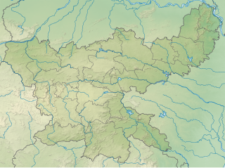
English: Relief map of Jharkhand. Elevation data from STRM3, rivers from GSHHS.
ಕನ್ನಡ: ಜಾರ್ಖಂಡ್ನ ಫೋಟೋ ನಕ್ಷೆ. STRM3 ನಿಂದ ಎತ್ತರ ಮತ್ತು ಜಿಎಸ್ಎ GSHHS ನಿಂದ ನದಿಗಳು |
| Date | |
| Source | Jharkhand_locator_map.svg |
| Author | Milenioscuro |
Licensing
edit
This file is licensed under the Creative Commons Attribution-Share Alike 3.0 Unported license.
- You are free:
- to share – to copy, distribute and transmit the work
- to remix – to adapt the work
- Under the following conditions:
- attribution – You must give appropriate credit, provide a link to the license, and indicate if changes were made. You may do so in any reasonable manner, but not in any way that suggests the licensor endorses you or your use.
- share alike – If you remix, transform, or build upon the material, you must distribute your contributions under the same or compatible license as the original.
File history
Click on a date/time to view the file as it appeared at that time.
| Date/Time | Thumbnail | Dimensions | User | Comment | |
|---|---|---|---|---|---|
| current | 18:24, 14 March 2023 | | 1,162 × 865 (2.26 MB) | C1MM (talk | contribs) | Corrected borders |
| 04:09, 21 May 2021 |  | 848 × 631 (1.97 MB) | C1MM (talk | contribs) | Added better elevation colouring | |
| 21:00, 16 December 2020 |  | 829 × 617 (4.43 MB) | C1MM (talk | contribs) | Fixed elevation colours | |
| 06:05, 28 November 2020 |  | 829 × 617 (3.23 MB) | C1MM (talk | contribs) | Updated map of districts | |
| 00:31, 30 June 2020 |  | 856 × 714 (3.05 MB) | C1MM (talk | contribs) | Fixed relief map | |
| 05:51, 25 April 2020 |  | 856 × 714 (1.18 MB) | C1MM (talk | contribs) | Uploaded a work by Milenioscuro from Jharkhand_locator_map.svg with UploadWizard |
You cannot overwrite this file.
File usage on Commons
The following page uses this file:
- File:Jharkhand relief map.svg (file redirect)
File usage on other wikis
The following other wikis use this file:
- Usage on anp.wikipedia.org
- Usage on bn.wikipedia.org
- Usage on ca.wikipedia.org
- Usage on en.wikipedia.org
- Jonha Falls
- Rajrappa
- Betla National Park
- Parasnath
- Lodh Falls
- Panchet Dam
- Sadni Falls
- Chakulia Airport
- Nawadih Airfield
- Konar Dam
- Usri Falls
- Panchghagh Falls
- Auranga River (Jharkhand)
- Amanat River
- Tenughat Dam
- Tilaiya Dam
- Getalsud Dam
- Dhanbad Airport
- Charowa dam
- Massanjore Dam
- Dhalbhumgarh Airport
- Dumka Airport
- Module:Location map/data/India Jharkhand
- Module:Location map/data/India Jharkhand/doc
- Khukhragarh
- Sita Falls
- Module:Location map/data/India Jharkhand/sandbox
- Perwaghagh Falls
- Chandil Dam
- Dimna Lake
- Saridkel
- Usage on es.wikipedia.org
- Usage on hi.wikipedia.org
- Usage on or.wikipedia.org
- Usage on pa.wikipedia.org
View more global usage of this file.