File:Indian Rashtrakuta Empire map de.svg

Size of this PNG preview of this SVG file: 532 × 599 pixels. Other resolutions: 213 × 240 pixels | 426 × 480 pixels | 682 × 768 pixels | 909 × 1,024 pixels | 1,819 × 2,048 pixels | 1,650 × 1,858 pixels.
Original file (SVG file, nominally 1,650 × 1,858 pixels, file size: 381 KB)
Captions
Captions
Add a one-line explanation of what this file represents
| Description |
Deutsch:
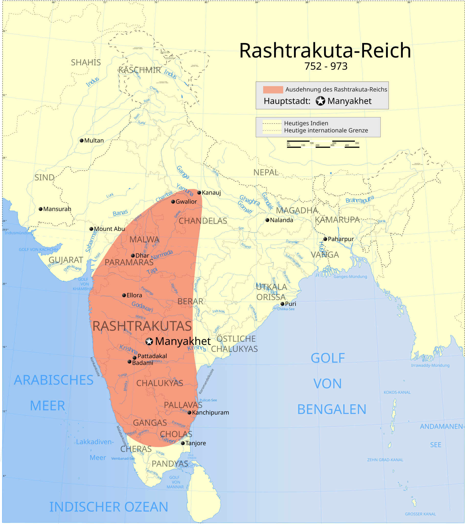
Ausdehnung des Rashtrakuta-Reichs, 780 n. Chr. English: Extent of Rashtrakuta Empire, 780 C.E. |
| Date | (UTC) |
| Source | |
| Author |
|
| This is a retouched picture, which means that it has been digitally altered from its original version. Modifications: Deutsche Übersetzung / German translation.. The original can be viewed here: Indian Rashtrakuta Empire map.svg:
|
I, the copyright holder of this work, hereby publish it under the following license:
This file is licensed under the Creative Commons Attribution-Share Alike 3.0 Unported license.
- You are free:
- to share – to copy, distribute and transmit the work
- to remix – to adapt the work
- Under the following conditions:
- attribution – You must give appropriate credit, provide a link to the license, and indicate if changes were made. You may do so in any reasonable manner, but not in any way that suggests the licensor endorses you or your use.
- share alike – If you remix, transform, or build upon the material, you must distribute your contributions under the same or compatible license as the original.
Original upload log
edit
This image is a derivative work of the following images:
- File:Indian_Rashtrakuta_Empire_map.svg licensed with Cc-by-sa-3.0
- 2007-04-27T18:57:06Z PlaneMad 1639x1852 (462183 Bytes) {{WikiProject_India_Maps |Title=The Rashtrakuta Empire 750-900BC |Description=Map showing the extent of the Rashtrakuta empires. {{legend|#FF9F80|Extent of Rashtrakuta Empire, 780 C.E.}} |Source= "John Keay, History of India
Uploaded with derivativeFX
File history
Click on a date/time to view the file as it appeared at that time.
| Date/Time | Thumbnail | Dimensions | User | Comment | |
|---|---|---|---|---|---|
| current | 18:55, 1 February 2010 | | 1,650 × 1,858 (381 KB) | Furfur (talk | contribs) | {{Information |Description={{de|1={{legend|#FF9F80|Ausdehnung des Rashtrakuta-Reichs, 780 n. Chr.}}}} {{en|1={{legend|#FF9F80|Extent of Rashtrakuta Empire, 780 C.E.}}}} |Source=*File:Indian_Rashtrakuta_Empire_map.svg |Date=2010-0 |
You cannot overwrite this file.
File usage on Commons
There are no pages that use this file.
File usage on other wikis
The following other wikis use this file:
- Usage on de.wikipedia.org
- Usage on nl.wikipedia.org