File:Indian states affected by July 2012 power cuts.svg

Size of this PNG preview of this SVG file: 530 × 599 pixels. Other resolutions: 212 × 240 pixels | 425 × 480 pixels | 680 × 768 pixels | 906 × 1,024 pixels | 1,812 × 2,048 pixels | 1,639 × 1,852 pixels.
Original file (SVG file, nominally 1,639 × 1,852 pixels, file size: 302 KB)
Captions
Captions
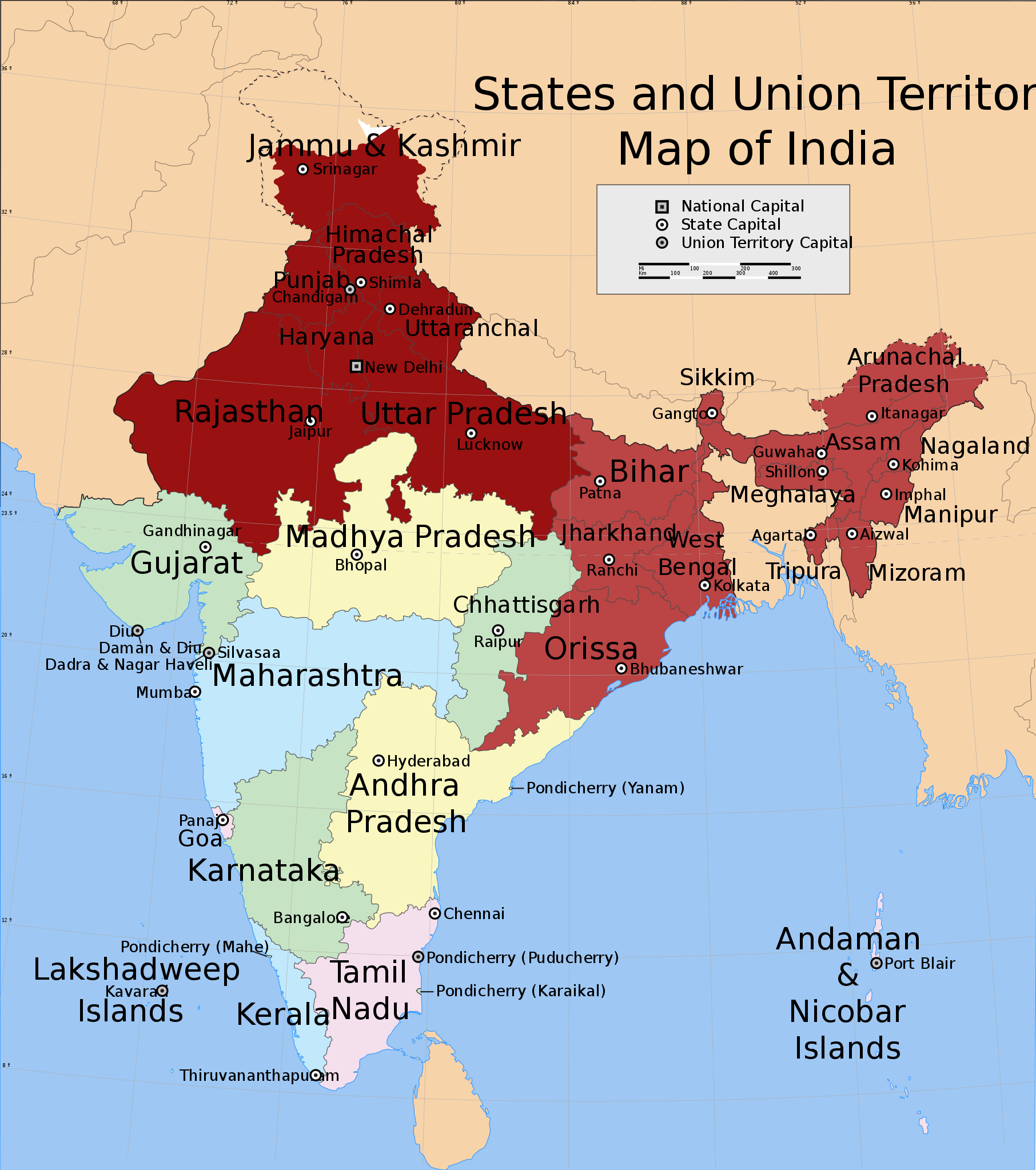
Northern and Eastern regions power blackouts in 2012
Summary edit
| Description |
English: Shows in dark red the states listed at the time of creation: Jammu and Kashmir, Himachal Pradesh, Punjab, Haryana, Delhi, Rajasthan, Uttar Pradesh, Bihar, West Bengal, Orissa, Jharkhand, Sikkim, Assam, Meghalaya, Tripura, Nagaland, Manipur, Mizoram and Arunachal Pradesh.
Derived from India_states_and_union_territories_map.svg by changing the fill colour for those states. |
| Date | Not known. Modified 31 July 2012 |
| Source | File:India_states_and_union_territories_map.svg |
| Author | Whoever uploaded File:India_states_and_union_territories_map.svg to English Wikipedia |
| Permission (Reusing this file) |
http://en.wikipedia.org |
Licensing edit
This file is licensed under the Creative Commons Attribution-Share Alike 1.0 Generic license.
- You are free:
- to share – to copy, distribute and transmit the work
- to remix – to adapt the work
- Under the following conditions:
- attribution – You must give appropriate credit, provide a link to the license, and indicate if changes were made. You may do so in any reasonable manner, but not in any way that suggests the licensor endorses you or your use.
- share alike – If you alter, transform, or build upon this work, you must distribute the resulting work under the same license as the original.
Original upload log edit
Transferred from en.wikipedia to Commons.
The original description page was here. All following user names refer to en.wikipedia.
- 2012-07-31 20:55 Maproom 1639×1852× (309753 bytes) Added Uttaranchal to affected area, removed Assam and states south and east of it.
- 2012-07-31 17:29 Maproom 1639×1852× (309753 bytes) Uploading a file from a free published source using [[Wikipedia:File_Upload_Wizard|File Upload Wizard]]
The original description page was here. All following user names refer to en.wikipedia.
- 2012-08-01 15:07 Maproom 1639×1852× (309753 bytes) altered the status of (Bihar, West Bengal, Jharkhand, Orissa, Chhattisgarh) to 2nd-day only.
- 2012-08-01 08:12 Maproom 1639×1852× (309753 bytes) re-added the north-eastern states, in a lighter colour
- 2012-08-01 08:09 Maproom 1639×1852× (309753 bytes) re-added the north-eastern states, in a lighter colour
- 2012-07-31 20:55 Maproom 1639×1852× (309753 bytes) Added Uttaranchal to affected area, removed Assam and states south and east of it.
- 2012-07-31 17:29 Maproom 1639×1852× (309753 bytes) Uploading a file from a free published source using [[Wikipedia:File_Upload_Wizard|File Upload Wizard]]
File history
Click on a date/time to view the file as it appeared at that time.
| Date/Time | Thumbnail | Dimensions | User | Comment | |
|---|---|---|---|---|---|
| current | 15:17, 9 August 2012 | | 1,639 × 1,852 (302 KB) | Maproom (talk | contribs) | un-marked Chhattisgarh, in accordance with request at http://en.wikipedia.org/wiki/Wikipedia:WikiProject_Maps/Requested_and_orphan_maps |
| 17:34, 1 August 2012 |  | 1,639 × 1,852 (302 KB) | OgreBot (talk | contribs) | (BOT): Uploading old version of file from en.wikipedia; originally uploaded on 2012-08-01 15:07:18 by Maproom | |
| 17:33, 1 August 2012 |  | 1,639 × 1,852 (302 KB) | OgreBot (talk | contribs) | (BOT): Uploading old version of file from en.wikipedia; originally uploaded on 2012-08-01 08:09:17 by Maproom | |
| 17:33, 1 August 2012 |  | 1,639 × 1,852 (302 KB) | OgreBot (talk | contribs) | (BOT): Uploading old version of file from en.wikipedia; originally uploaded on 2012-07-31 17:29:42 by Maproom | |
| 04:36, 1 August 2012 |  | 1,639 × 1,852 (302 KB) | Makecat (talk | contribs) | {{Information |Description={{en|Shows in dark red the states listed at the time of creation: Jammu and Kashmir, Himachal Pradesh, Punjab, Haryana, Delhi, Rajasthan, Uttar Pradesh, Bihar, West Bengal, Orissa, Jharkhand, Sikkim, Assam, Meghalaya, Tripura... |
You cannot overwrite this file.
File usage on Commons
There are no pages that use this file.
File usage on other wikis
The following other wikis use this file:
- Usage on af.wikipedia.org
- Usage on ar.wikipedia.org
- Usage on en.wikipedia.org
- Usage on es.wikipedia.org
- Usage on fr.wikipedia.org
- Usage on he.wikipedia.org
- Usage on ko.wikipedia.org
- Usage on lv.wikipedia.org
- Usage on pt.wikipedia.org
- Usage on ru.wikipedia.org
- Usage on ta.wikipedia.org
- Usage on th.wikipedia.org
- Usage on vi.wikipedia.org
- Usage on zh.wikipedia.org