File:Indonesia Sulawesi location map.svg

Original file (SVG file, nominally 1,011 × 1,228 pixels, file size: 459 KB)
Captions
Captions
Summary
edit| Description |
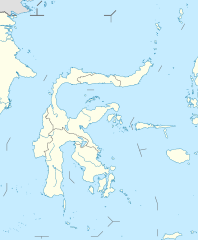
Quadratische Plattkarte. Geographische Begrenzung der Karte:
Equirectangular projection. Geographic limits of the map:
|
|
| Date | ||
| Source |
Own work, using
|
|
| Author | NordNordWest | |
| Permission (Reusing this file) |
This file is licensed under the Creative Commons Attribution-Share Alike 3.0 Germany license.
 This file is licensed under the Creative Commons Attribution-Share Alike 3.0 Unported license.
|
|
| Other versions |
|


|
This map has been made or improved in the German Kartenwerkstatt (Map Lab). You can propose maps to improve as well.
|
File history
Click on a date/time to view the file as it appeared at that time.
| Date/Time | Thumbnail | Dimensions | User | Comment | |
|---|---|---|---|---|---|
| current | 08:51, 19 October 2010 | | 1,011 × 1,228 (459 KB) | NordNordWest (talk | contribs) | =={{int:filedesc}}== {{Information |Description= {{de|Positionskarte von Sulawesi, Indonesien}} Quadratische Plattkarte. Geographische Begrenzung der Karte: * N: 5.0° N * S: 8.0° S * W: 117.0° O * O: 127.7° O {{en|L |
You cannot overwrite this file.
File usage on Commons
The following 3 pages use this file:
File usage on other wikis
The following other wikis use this file:
- Usage on ban.wikipedia.org
- Usage on ba.wikipedia.org
- Usage on bcl.wikipedia.org
- Usage on de.wikipedia.org
- Makassar
- Palu
- Wikipedia:Kartenwerkstatt/Positionskarten/Asien
- Airmadidi
- Poso
- Makale (Sulawesi)
- Rantepao
- Kendari
- Tondano
- Wikipedia:Kartenwerkstatt/Archiv/2010-10
- Vorlage:Positionskarte Indonesien Sulawesi
- Flughafen Haluoleo (Kendari)
- Kete Kesu
- Lemo (Indonesien)
- Londa (Toraja)
- Flughafen Masamba
- Höhlen im Maros-Pangkep Karst
- Mamuju (Stadt)
- Jembatan Palu IV
- Luwuk (Sulawesi)
- Makale (Tana Toraja)
- Rainis (Karakelong)
- Rainis (Talaudinseln)
- Modisi
- Usage on de.wikivoyage.org
View more global usage of this file.