File:Inferioris Saxoniae Circvlvs.png

Size of this preview: 746 × 600 pixels. Other resolutions: 299 × 240 pixels | 597 × 480 pixels | 955 × 768 pixels | 1,274 × 1,024 pixels | 2,547 × 2,048 pixels | 6,733 × 5,414 pixels.
Original file (6,733 × 5,414 pixels, file size: 76.77 MB, MIME type: image/png)
Captions
Captions
Add a one-line explanation of what this file represents
Summary edit
| Description |
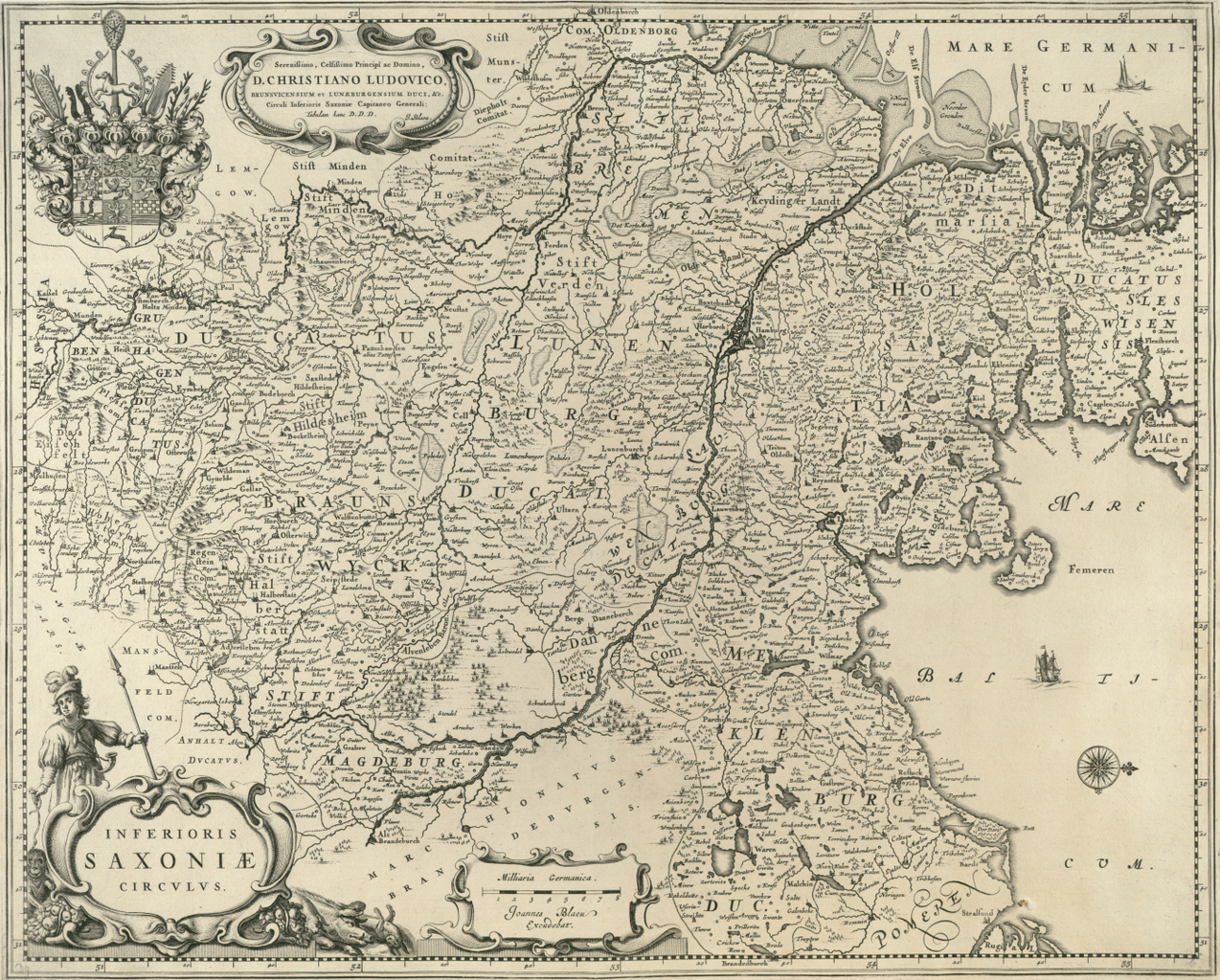
English: Map of the Lower Saxonian Circle of the Holy Roman Empire, between 1641 (inauguration of Christian Ludwig as ruler of Calenberg – and that way one Duke of Brunswick-Luneburg) and the Westphalian Treaty of 1648, which converted the territorial possessions of the (arch)bishoprics of Bremen, Verden and Minden into secular duchies. West is on top, east on the right. |
||||||||||||||||||||||||||
| Date | print between 1641 and 1648 | ||||||||||||||||||||||||||
| Source | http://mapy.mzk.cz/mzk03/001/059/760/2619317182/ | ||||||||||||||||||||||||||
| Author |
|
||||||||||||||||||||||||||
.jpg)
Licensing edit
|
This work is in the public domain in its country of origin and other countries and areas where the copyright term is the author's life plus 100 years or fewer. This work is in the public domain in the United States because it was published (or registered with the U.S. Copyright Office) before January 1, 1929. | |
| This file has been identified as being free of known restrictions under copyright law, including all related and neighboring rights. | |
File history
Click on a date/time to view the file as it appeared at that time.
| Date/Time | Thumbnail | Dimensions | User | Comment | |
|---|---|---|---|---|---|
| current | 00:09, 17 May 2018 | | 6,733 × 5,414 (76.77 MB) | Ulamm (talk | contribs) | {{Information |Description={{en|Map of the Lower Saxonian Circle of the Holy Roman Empire, between 1641 (inauguration of Christian Ludwig as ruler of Calenberg – and that way one Duke of Brunswick-Luneburg) and the Westphalian Treaty of 1848, which converted the territorial possessions of the (arch)bishoprics of Bremen, Verden and Minden into secular duchies. West is on top, east on the right.}} |Source=http://mapy.mzk.cz/mzk03/001/059/760/2619317182/ |Date=print between 1641 and 1648 |Author... |
You cannot overwrite this file.
File usage on Commons
The following page uses this file:
File usage on other wikis
The following other wikis use this file:
- Usage on de.wikipedia.org