File:Inland Northwest.svg

Size of this PNG preview of this SVG file: 563 × 600 pixels. Other resolutions: 225 × 240 pixels | 450 × 480 pixels | 721 × 768 pixels | 961 × 1,024 pixels | 1,922 × 2,048 pixels | 991 × 1,056 pixels.
Original file (SVG file, nominally 991 × 1,056 pixels, file size: 464 KB)
Captions
Captions
Add a one-line explanation of what this file represents
Summary edit
| Description |
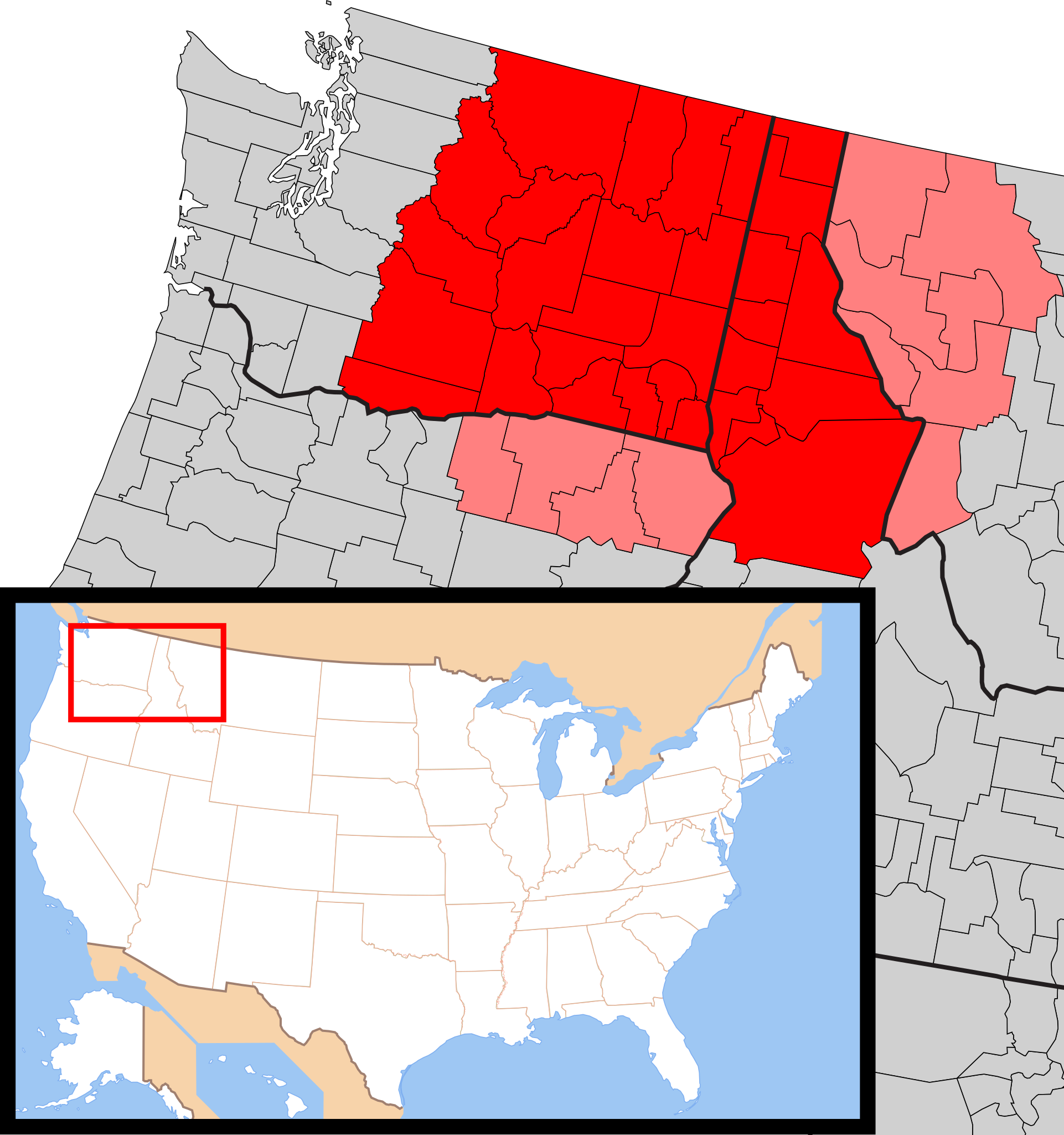
English: Map of the Inland Northwest. Counties always included are in red, while counties sometimes included are in pink |
| Date | |
| Source | Own work |
| Author | Howpper |
Licensing edit
I, the copyright holder of this work, hereby publish it under the following license:
This file is licensed under the Creative Commons Attribution-Share Alike 4.0 International license.
- You are free:
- to share – to copy, distribute and transmit the work
- to remix – to adapt the work
- Under the following conditions:
- attribution – You must give appropriate credit, provide a link to the license, and indicate if changes were made. You may do so in any reasonable manner, but not in any way that suggests the licensor endorses you or your use.
- share alike – If you remix, transform, or build upon the material, you must distribute your contributions under the same or compatible license as the original.
File history
Click on a date/time to view the file as it appeared at that time.
| Date/Time | Thumbnail | Dimensions | User | Comment | |
|---|---|---|---|---|---|
| current | 00:18, 9 July 2019 | | 991 × 1,056 (464 KB) | Howpper (talk | contribs) | Northeastern Oregon. |
| 23:12, 27 March 2017 |  | 991 × 1,056 (464 KB) | Howpper (talk | contribs) | Fixed | |
| 22:19, 8 January 2017 |  | 991 × 1,056 (464 KB) | Howpper (talk | contribs) | Larger file. | |
| 22:16, 8 January 2017 |  | 214 × 228 (460 KB) | Howpper (talk | contribs) | User created page with UploadWizard |
You cannot overwrite this file.
File usage on Commons
There are no pages that use this file.
File usage on other wikis
The following other wikis use this file:
- Usage on de.wikipedia.org
- Usage on en.wikipedia.org
- Usage on en.wiktionary.org
- Usage on fr.wikipedia.org
- Usage on vi.wikipedia.org