File:Ireland medieval location map.svg

Size of this PNG preview of this SVG file: 481 × 599 pixels. Other resolutions: 192 × 240 pixels | 385 × 480 pixels | 616 × 768 pixels | 822 × 1,024 pixels | 1,643 × 2,048 pixels | 1,450 × 1,807 pixels.
Original file (SVG file, nominally 1,450 × 1,807 pixels, file size: 666 KB)
Captions
Captions
Add a one-line explanation of what this file represents
Summary edit
| Description |
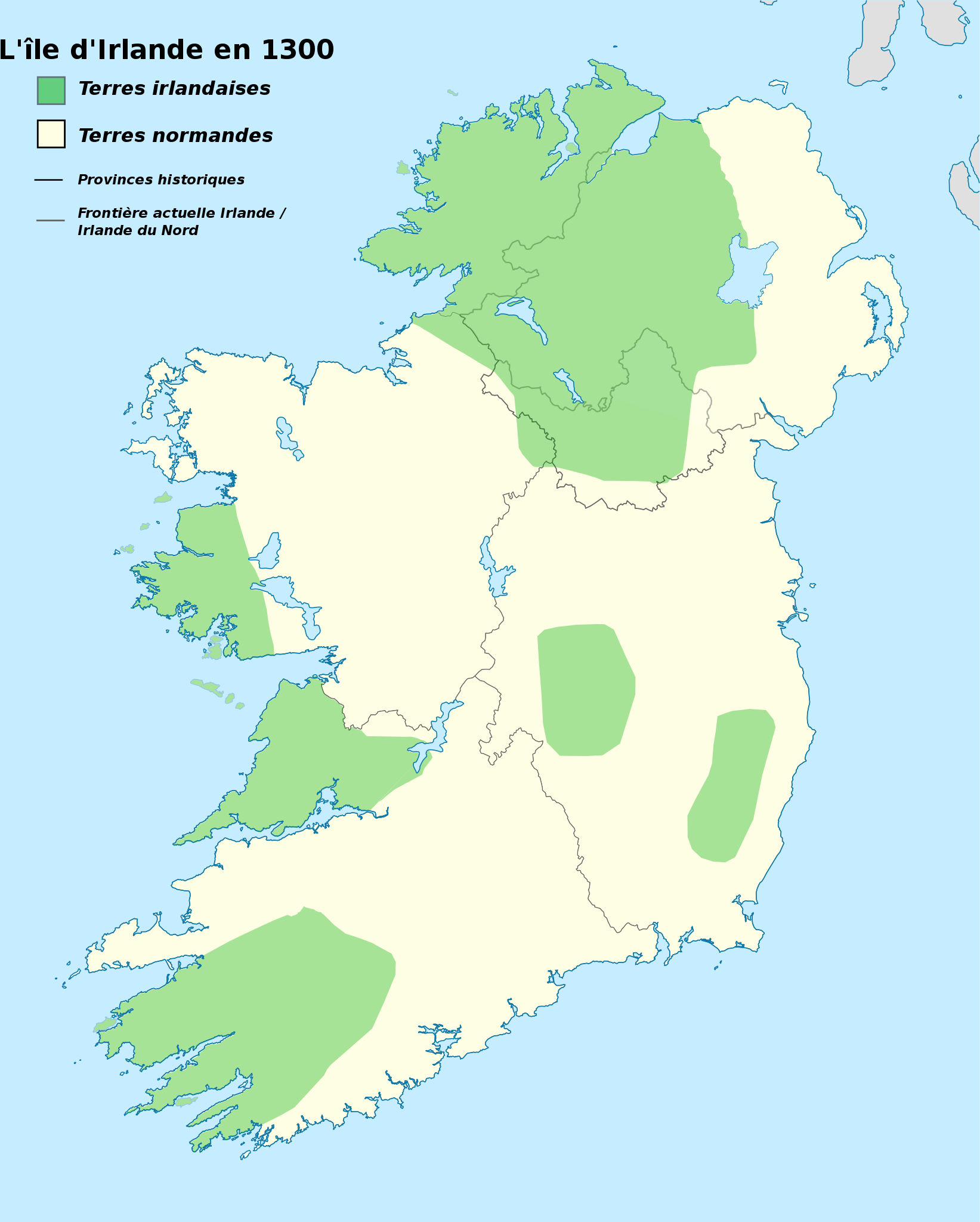
Français : Carte historique de l'Irlande en l'an 1300 destinée à la géolocalisation.
Territoires des natifs irlandais et des normands en rapport avec l'invasion normande de l'Irlande débutée au siècle précédent. English: Historical map of Ireland, year 1300 for geolocation purpose.
Lands held by native Irish and by Normans related to Norman invasion of Ireland started a century ago |
| Date | |
| Source |
This file was derived from: Www.wesleyjohnston.com-users-ireland-maps-historical-map1300.gif |
| Author | Edouard-rainaut |
Licensing edit
I, the copyright holder of this work, hereby publish it under the following license:
This file is licensed under the Creative Commons Attribution-Share Alike 3.0 Unported license.
- You are free:
- to share – to copy, distribute and transmit the work
- to remix – to adapt the work
- Under the following conditions:
- attribution – You must give appropriate credit, provide a link to the license, and indicate if changes were made. You may do so in any reasonable manner, but not in any way that suggests the licensor endorses you or your use.
- share alike – If you remix, transform, or build upon the material, you must distribute your contributions under the same or compatible license as the original.
File history
Click on a date/time to view the file as it appeared at that time.
| Date/Time | Thumbnail | Dimensions | User | Comment | |
|---|---|---|---|---|---|
| current | 11:47, 2 December 2013 | | 1,450 × 1,807 (666 KB) | Edouard-rainaut (talk | contribs) | Problème d'affichage corrigé |
| 11:15, 2 December 2013 |  | 1,450 × 1,807 (664 KB) | Edouard-rainaut (talk | contribs) | problème d'affichage textes | |
| 10:58, 2 December 2013 |  | 1,450 × 1,807 (664 KB) | Edouard-rainaut (talk | contribs) | User created page with UploadWizard |
You cannot overwrite this file.
File usage on Commons
The following page uses this file:
File usage on other wikis
The following other wikis use this file:
- Usage on eu.wikipedia.org
- Usage on fr.wikipedia.org
- Seigneurie d'Irlande
- Langue d'Angleterre
- Liste des commanderies templières dans le Munster
- Château de Rindown
- Commanderie d'Any
- Modèle:Géolocalisation/Irlande médiévale
- Modèle:Géolocalisation/Irlande médiévale/Documentation
- Modèle:Carte/Irlande médiévale
- Commanderie de Killergy
- Commanderie de Rathronan
- Modèle:Infobox Commanderie/Test