File:Islands off the Croatian Coast.jpg

Size of this preview: 600 × 600 pixels. Other resolutions: 240 × 240 pixels | 480 × 480 pixels | 768 × 768 pixels | 1,024 × 1,024 pixels | 2,048 × 2,048 pixels | 4,000 × 4,000 pixels.
Original file (4,000 × 4,000 pixels, file size: 4.59 MB, MIME type: image/jpeg)
Captions
Captions
Add a one-line explanation of what this file represents
Summary
edit| Description |
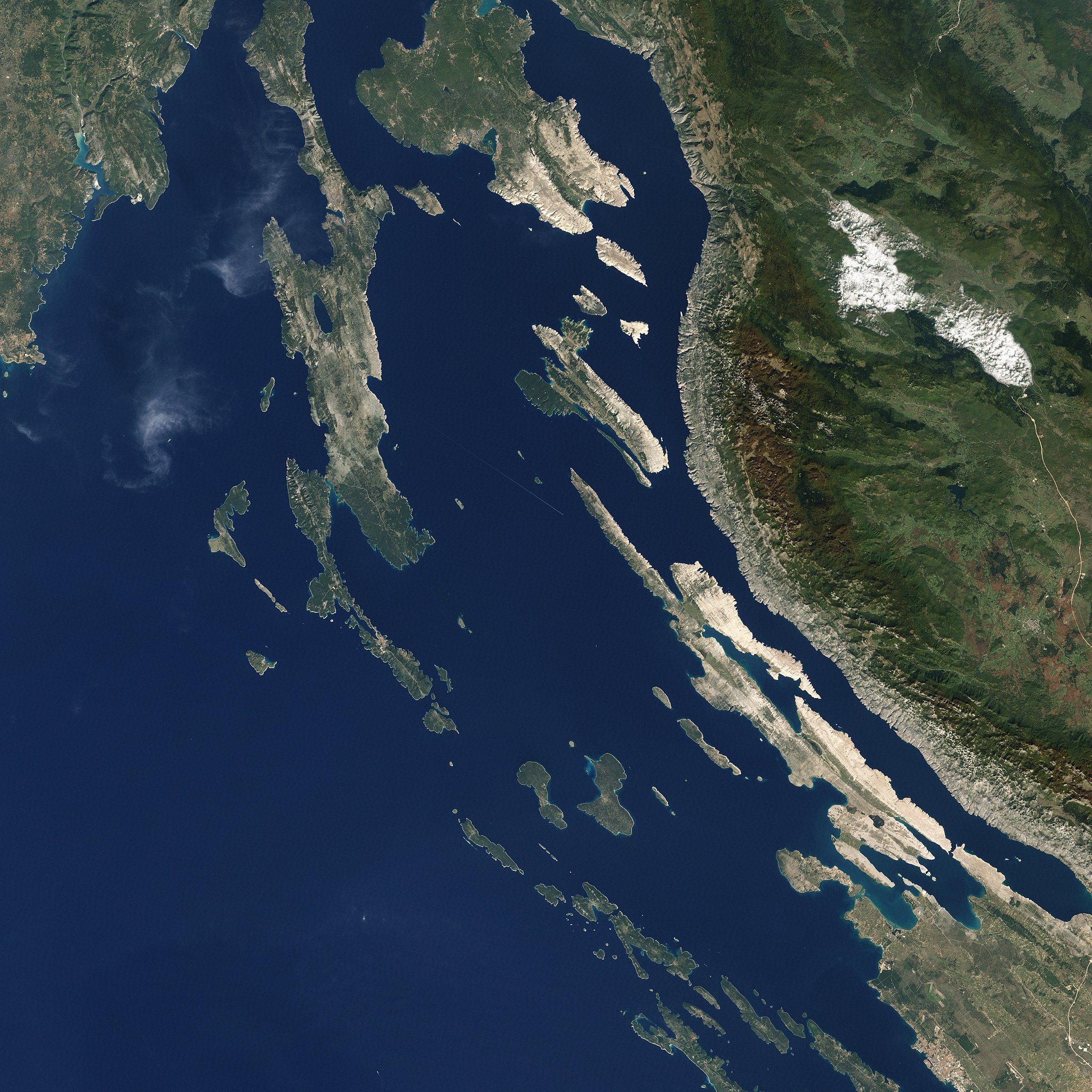
English: This picture shows some of the Croatian Islands in the Adriatic Sea. Image captured by the Enhanced Thematic Mapper (ETM) on NASA’s Landsat 7 satellite. Landsat data provided by the United States Geological Survey. |
| Date | |
| Source | NASA Earth Observatory |
| Author | Jesse Allen and Robert Simmon |
| Other versions |

.jpg)


.jpg)
_and_Tun_Veli.jpg)
.jpg)
.jpg)
.jpg)
.jpg)
.jpg)
Licensing
edit
| This file is in the public domain in the United States because it was solely created by NASA. NASA copyright policy states that "NASA material is not protected by copyright unless noted". (See Template:PD-USGov, NASA copyright policy page or JPL Image Use Policy.) | ||
 |
Warnings:
|
| Annotations | This image is annotated: View the annotations at Commons |
File history
Click on a date/time to view the file as it appeared at that time.
| Date/Time | Thumbnail | Dimensions | User | Comment | |
|---|---|---|---|---|---|
| current | 14:09, 18 April 2011 | | 4,000 × 4,000 (4.59 MB) | Originalwana (talk | contribs) |
You cannot overwrite this file.
File usage on Commons
The following 12 pages use this file:
- File:Islands Ist and Molat (N part).jpg
- File:Islands Molat (S part) and Tun Veli.jpg
- File:Islands off the Croatian Coast (cropped to Prvić, Sv. Grgur, Goli otok).jpg
- File:Islands off the Croatian Coast (cropped to Rab).jpg
- File:Islands off the Croatian Coast (cropped to Rab N).jpg
- File:Islands off the Croatian Coast (cropped to Unije).jpg
- File:Islands off the Croatian Coast (cropped to Velebitski kanal).jpg
- File:Islands off the Croatian Coast (cropped to Vir, Nin, Ljubački Bay).jpg
- File:Molat island, south.jpg
- File:Silba, Olib, Planik.jpg
- File:Zverinac, Tun Veli, Sestrunj, Rivanj.jpg
- File:Škarda, Ist, Molat, Tun Veli.jpg
File usage on other wikis
The following other wikis use this file:
- Usage on mk.wikipedia.org
- Usage on sr.wikipedia.org
- Usage on uk.wikipedia.org