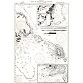
File:Isle of Pines to Uen Island 1944 nautical chart.jpg

Original file(3,272 × 5,000 pixels, file size: 2.47 MB, MIME type: image/jpeg)

Captions

Captions

Add a one-line explanation of what this file represents

Summary

edit
Description
Deutsch: nautical chart of south east part of New Caledonia, including Île des Pins
Date
Source http://alabamamaps.ua.edu/historicalmaps/World%20War%20II/Pacific%20Theatre%20New%20caledonia.htm
Author Hydrographic Office, U.S. Navy

Licensing

edit
Public domain
This file is a work of a sailor or employee of the U.S. Navy, taken or made as part of that person's official duties. As a work of the U.S. federal government, it is in the public domain in the United States.

File history

Click on a date/time to view the file as it appeared at that time.

Date/TimeThumbnailDimensionsUserComment
current21:19, 24 February 2018Thumbnail for version as of 21:19, 24 February 20183,272 × 5,000 (2.47 MB)Ratzer (talk | contribs)Cropped 35 % horizontally using CropTool with lossless mode.
21:16, 24 February 2018Thumbnail for version as of 21:16, 24 February 20185,000 × 5,000 (2.61 MB)Ratzer (talk | contribs)User created page with UploadWizard

There are no pages that use this file.