File:Israel Micronesia Locator.png

Size of this preview: 726 × 600 pixels. Other resolutions: 291 × 240 pixels | 581 × 480 pixels | 760 × 628 pixels.
Original file (760 × 628 pixels, file size: 28 KB, MIME type: image/png)
Captions
Captions
Add a one-line explanation of what this file represents
Summary edit
| Description |
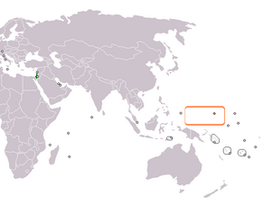
English: Locator map for Israel and the Federated States of Micronesia. |
| Date | |
| Source | Own work |
| Author | Aridd |
Adapted from Wikipedia blank map.
Licensing edit
| I, the copyright holder of this work, release this work into the public domain. This applies worldwide. In some countries this may not be legally possible; if so: I grant anyone the right to use this work for any purpose, without any conditions, unless such conditions are required by law. |
File history
Click on a date/time to view the file as it appeared at that time.
| Date/Time | Thumbnail | Dimensions | User | Comment | |
|---|---|---|---|---|---|
| current | 11:45, 19 January 2010 | | 760 × 628 (28 KB) | Aridd (talk | contribs) | {{Information |Description={{en|1=Locator map for Israel and the Federated States of Micronesia.}} |Source={{own}} |Author=Aridd |Date=January 19, 2010 |Permission= |other_versions= }} Adapted from Wikipedia blank map. |
You cannot overwrite this file.
File usage on Commons
The following 2 pages use this file:
File usage on other wikis
The following other wikis use this file:
- Usage on en.wikipedia.org
- Usage on id.wikipedia.org
- Usage on ru.wikipedia.org
- Usage on www.wikidata.org