File:Italy 400bC es.svg

Size of this PNG preview of this SVG file: 503 × 599 pixels. Other resolutions: 201 × 240 pixels | 403 × 480 pixels | 645 × 768 pixels | 859 × 1,024 pixels | 1,719 × 2,048 pixels | 747 × 890 pixels.
Original file (SVG file, nominally 747 × 890 pixels, file size: 186 KB)
Captions
Captions
Add a one-line explanation of what this file represents
Summary
edit| Description |
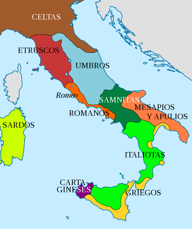
Español: Mapa de la península italiana alrededor del 400 a.C
English: Map of the italian peninsula circa 400 BC |
||
| Date | |||
| Source | spanish version of Image:Italy 400bC It.svg | ||
| Author | Own work | ||
| Permission (Reusing this file) |
I, the copyright holder of this work, hereby publish it under the following licenses:
This file is licensed under the Creative Commons Attribution 3.0 Unported license.
You may select the license of your choice. |
||
| Other versions |
[]
|


File history
Click on a date/time to view the file as it appeared at that time.
| Date/Time | Thumbnail | Dimensions | User | Comment | |
|---|---|---|---|---|---|
| current | 11:01, 5 September 2016 | | 747 × 890 (186 KB) | Rowanwindwhistler (talk | contribs) | https://en.wikipedia.org/wiki/Wikipedia:WikiProject_Maps/Conventions |
| 16:13, 2 November 2013 |  | 747 × 890 (184 KB) | Enok (talk | contribs) | es:Italiotas | |
| 16:27, 14 January 2008 |  | 747 × 890 (184 KB) | Fernando Estel (talk | contribs) | {{Information |Description={{es|Mapa de la península italiana alrededor del 400 a.C}} {{en|Map of the italian peninsula circa 400 BC}} |Source= spanish version of Image:Italy 400bC It.svg |Date=14/01/08 |Author=Own work |Permission= |other_versions= |
You cannot overwrite this file.
File usage on Commons
The following 11 pages use this file:
File usage on other wikis
The following other wikis use this file:
- Usage on ast.wikipedia.org
- Usage on ca.wikipedia.org
- Usage on cy.wikipedia.org
- Usage on es.wikipedia.org
- Usage on fr.wikipedia.org
- Usage on ga.wikipedia.org
- Usage on gl.wikipedia.org
- Usage on pt.wikipedia.org
- Usage on ru.wikipedia.org
- Usage on uk.wikipedia.org