File:Italy location map 1905.svg

Size of this PNG preview of this SVG file: 477 × 599 pixels. Other resolutions: 191 × 240 pixels | 382 × 480 pixels | 611 × 768 pixels | 815 × 1,024 pixels | 1,630 × 2,048 pixels | 1,034 × 1,299 pixels.
Original file (SVG file, nominally 1,034 × 1,299 pixels, file size: 639 KB)
Captions
Captions
Add a one-line explanation of what this file represents
Summary edit
| Description |
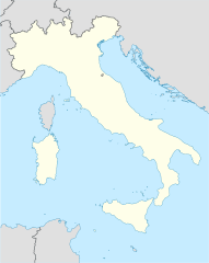
Italiano: Mappa di localizzazione dell'Italia al 1905, Proiezione equirettangolare, allargamento N/S 132,898 %. Limiti geografici della mappa: * N: 47.4° N * S: 35.3° N * W: 6.2° E * E: 19.0° E |
| Date | (UTC) |
| Source |
This file was derived from: Italy location map.svg:  1905 borders based on Bibliothek allgemeinen und praktischen Wissens für Militäranwärter Band I, 1905 / Deutsches Verlaghaus Bong & Co Berlin * Leipzig * Wien * Stuttgart |
| Author |
|
| This is a retouched picture, which means that it has been digitally altered from its original version. Modifications: 1905 borders. The original can be viewed here: Italy location map.svg:
|
Licensing edit
I, the copyright holder of this work, hereby publish it under the following licenses:
This file is licensed under the Creative Commons Attribution-Share Alike 3.0 Unported license.
- You are free:
- to share – to copy, distribute and transmit the work
- to remix – to adapt the work
- Under the following conditions:
- attribution – You must give appropriate credit, provide a link to the license, and indicate if changes were made. You may do so in any reasonable manner, but not in any way that suggests the licensor endorses you or your use.
- share alike – If you remix, transform, or build upon the material, you must distribute your contributions under the same or compatible license as the original.

|
Permission is granted to copy, distribute and/or modify this document under the terms of the GNU Free Documentation License, Version 1.2 or any later version published by the Free Software Foundation; with no Invariant Sections, no Front-Cover Texts, and no Back-Cover Texts. A copy of the license is included in the section entitled GNU Free Documentation License. |
You may select the license of your choice.
Original upload log edit
This image is a derivative work of the following images:
- File:Italy_location_map.svg licensed with Cc-by-sa-3.0, GFDL
- 2010-09-11T06:42:56Z Citypeek 1034x1299 (1484466 Bytes) Made one layer of the entire picture. Better for adding new stuff.
- 2009-08-22T09:58:43Z Erinaceus 1034x1299 (1470342 Bytes) updating borders after important variation (http://www.gazzettaufficiale.it/guridb/dispatcher?service=1&datagu=2009-08-14&task=dettaglio&numgu=188&redaz=009G0127&tmstp=1250276942469)
- 2009-05-06T12:38:21Z NordNordWest 1034x1299 (1035834 Bytes) corr
- 2009-03-12T18:27:05Z NordNordWest 1032x1267 (1032937 Bytes) corr
- 2008-07-06T16:30:54Z NordNordWest 1032x1267 (1034196 Bytes) {{Information |Description= {{de|Positionskarte von [[:de:Italien|Italien]]}} Quadratische Plattkarte, N-S-Streckung 130 %. Geographische Begrenzung der Karte: * N: 47.4° N * S: 35.3° N * W: 6.2° O * O: 19.0° O {{en|Locat
File history
Click on a date/time to view the file as it appeared at that time.
| Date/Time | Thumbnail | Dimensions | User | Comment | |
|---|---|---|---|---|---|
| current | 20:22, 7 April 2014 | | 1,034 × 1,299 (639 KB) | Fulvio314 (talk | contribs) | Deleted regions & Vatican. |
| 19:10, 31 March 2014 |  | 1,034 × 1,299 (709 KB) | Fulvio314 (talk | contribs) | == {{int:filedesc}} == {{Information |Description={{it|Mappa di localizzazione dell'Italia}} al 1905, Proiezione equirettangolare, allargamento N/S 132,898 %. Limiti geografici della mappa: * N: 47.4° N * S: 35.3° N * W: 6.2° E * E: 1... |
You cannot overwrite this file.
File usage on Commons
The following page uses this file:
File usage on other wikis
The following other wikis use this file:
- Usage on en.wikipedia.org
- Usage on es.wikipedia.org
- Usage on fr.wikipedia.org
- Usage on it.wikipedia.org
- Usage on pl.wikipedia.org
- Usage on pl.wikibooks.org
- Usage on smn.wikipedia.org