File:Itasy lake.jpg
No higher resolution available.
Itasy_lake.jpg (268 × 178 pixels, file size: 16 KB, MIME type: image/jpeg)
Captions
Captions
Add a one-line explanation of what this file represents
Summary edit
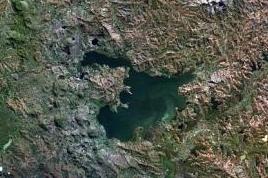
| Description |
English: The Itasy volcanic field in central Madagascar.
|
| Date | Unknown date |
| Source | http://www.volcano.si.edu/world/volcano.cfm?vnum=0303-014&volpage=photos&photo=114074 |
| Author | NASA Landsat7 image (worldwind.arc.nasa.gov) |
| Other versions |

Licensing edit
| This image is in the public domain because it is a screenshot from NASA’s globe software World Wind using a public domain layer, such as Blue Marble, MODIS, Landsat, SRTM, USGS or GLOBE.
|
 |
File history
Click on a date/time to view the file as it appeared at that time.
| Date/Time | Thumbnail | Dimensions | User | Comment | |
|---|---|---|---|---|---|
| current | 09:47, 1 February 2022 | | 268 × 178 (16 KB) | Proeksad (talk | contribs) | File:Itasy Volcanic Field.jpg cropped 58 % horizontally, 58 % vertically using CropTool with precise mode. |
You cannot overwrite this file.
File usage on Commons
The following 2 pages use this file:
File usage on other wikis
The following other wikis use this file:
- Usage on ceb.wikipedia.org
- Usage on en.wikipedia.org
- Usage on fr.wikipedia.org
- Usage on hr.wikipedia.org
- Usage on mg.wikipedia.org
- Usage on nl.wikipedia.org
- Usage on ru.wikipedia.org
- Usage on sl.wikipedia.org
- Usage on www.wikidata.org