File:Izuhanto East Quake 2006.jpg
Size of this preview: 512 × 599 pixels. Other resolutions: 205 × 240 pixels | 612 × 716 pixels.
Original file (612 × 716 pixels, file size: 129 KB, MIME type: image/jpeg)
Captions
Captions
Add a one-line explanation of what this file represents
Summary
edit
| Description |
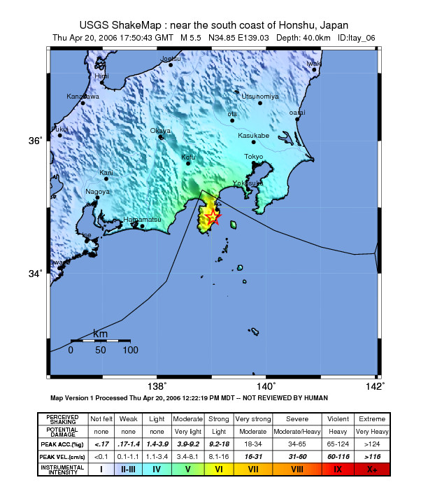
English: Shake map of the magnitude 5.5 earthquake in Izuhanto on Apr 20, 2006. Epicenter marked at star. By USGS.
日本語: 伊豆半島東方沖地震の震源を示した地図。アメリカ地質調査所による。 |
| Date | |
| Source | https://earthquake.usgs.gov/eqcenter/shakemap/global/shake/ltay_06/ |
| Author | USGS |
Licensing
edit
This image is in the public domain in the United States because it only contains materials that originally came from the United States Geological Survey, an agency of the United States Department of the Interior. For more information, see the official USGS copyright policy.
|
File history
Click on a date/time to view the file as it appeared at that time.
| Date/Time | Thumbnail | Dimensions | User | Comment | |
|---|---|---|---|---|---|
| current | 15:16, 28 August 2007 | | 612 × 716 (129 KB) | Monaneko (talk | contribs) | {{Information |Description= {{en|Shake map of the magnitude 5.5 earthquake in Izuhanto on Apr 20, 2006. Epicenter marked at star. By USGS.}} {{ja|伊豆半島東方沖地震の震源を示した地図。アメリカ地質調査所による。}} |Source=ht |
You cannot overwrite this file.
File usage on Commons
There are no pages that use this file.
File usage on other wikis
The following other wikis use this file: