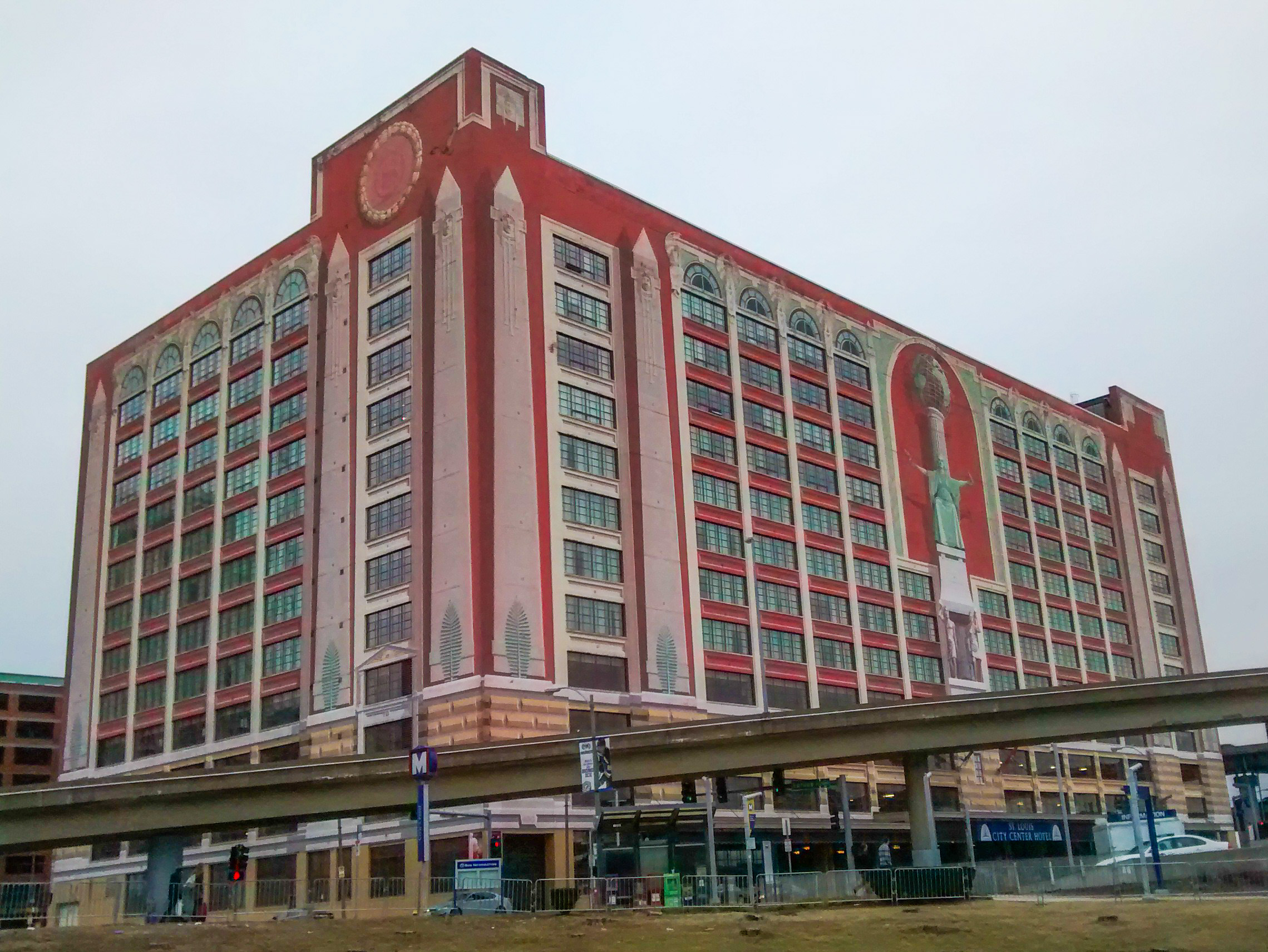
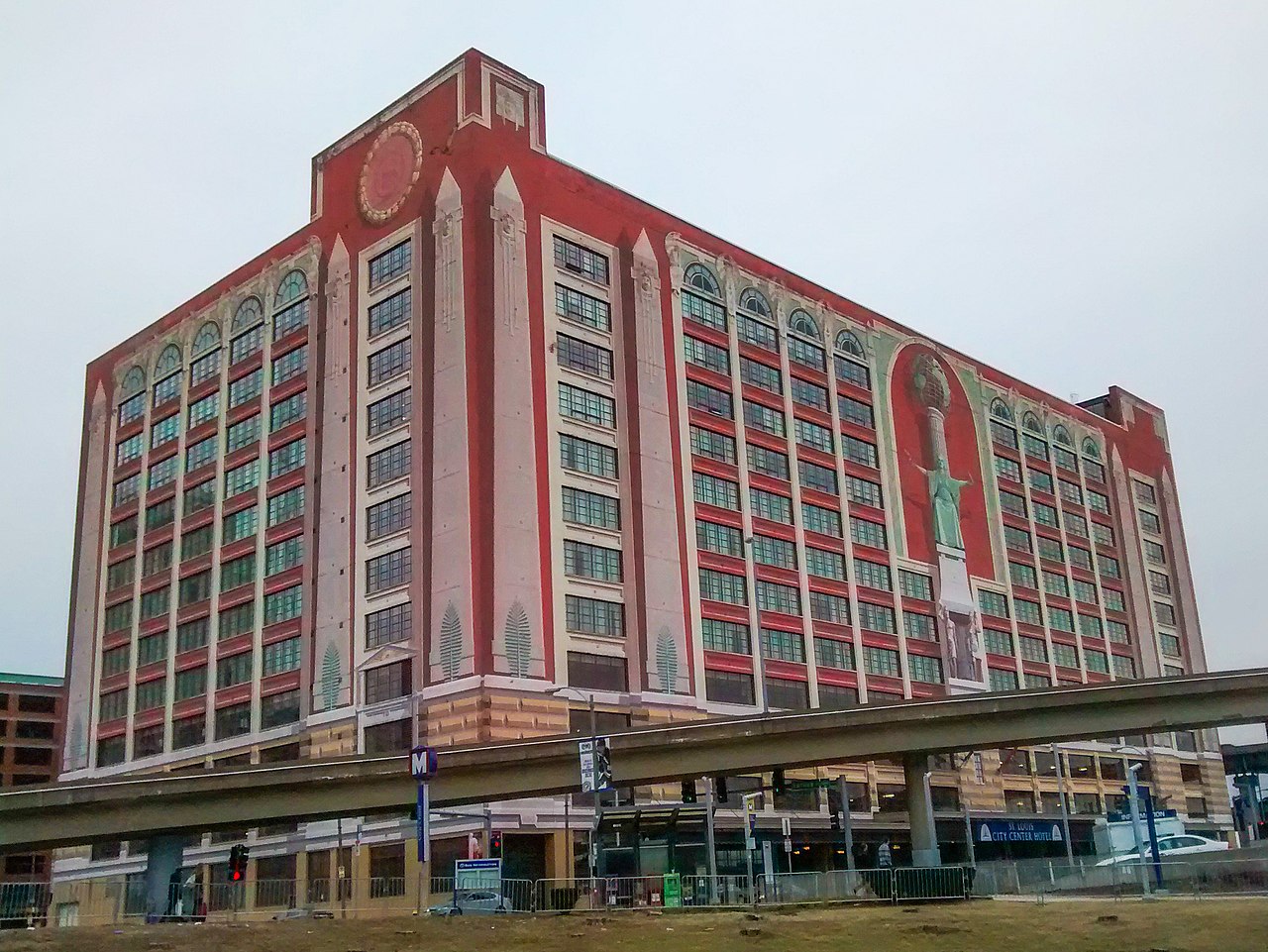
File:J. C. Penney Co. Warehouse Building (St. Louis, Missouri).jpg
Size of this preview: 799 × 600 pixels. Other resolutions: 320 × 240 pixels | 640 × 480 pixels | 1,023 × 768 pixels | 1,280 × 961 pixels | 2,279 × 1,711 pixels.
Original file (2,279 × 1,711 pixels, file size: 983 KB, MIME type: image/jpeg)
Captions
Captions
J. C. Penney Co. Warehouse Building (St. Louis, Missouri)
Summary edit
.jpg&action=edit§ion=1)
| Description | J. C. Penney Co. Warehouse Building (St. Louis, Missouri) |
| Date | |
| Source | Own work |
| Author | Mx. Granger |
| Camera location | | View this and other nearby images on: OpenStreetMap |
|---|
.jpg¶ms=038.625153_N_-090.203918_E_globe:Earth_type:camera_alt:0_source:exif_&language=en)
|
This is an image of a place or building that is listed on the National Register of Historic Places in the United States of America. Its reference number is 98001563. |
Licensing edit
.jpg&action=edit§ion=2)
I, the copyright holder of this work, hereby publish it under the following license:
| This file is made available under the Creative Commons CC0 1.0 Universal Public Domain Dedication. | |
| The person who associated a work with this deed has dedicated the work to the public domain by waiving all of their rights to the work worldwide under copyright law, including all related and neighboring rights, to the extent allowed by law. You can copy, modify, distribute and perform the work, even for commercial purposes, all without asking permission.
|
| This file was uploaded via Mobile Android App (Commons mobile app) 1.0. |
File history
Click on a date/time to view the file as it appeared at that time.
| Date/Time | Thumbnail | Dimensions | User | Comment | |
|---|---|---|---|---|---|
| current | 13:10, 12 May 2018 | | 2,279 × 1,711 (983 KB) | LittleT889 (talk | contribs) | Enhanced |
| 22:11, 16 February 2016 |  | 2,279 × 1,711 (951 KB) | Mx. Granger (talk | contribs) | Cropped 12 % horizontally and 12 % vertically using CropTool with lossless mode. | |
| 22:08, 16 February 2016 |  | 2,592 × 1,944 (1.38 MB) | Mx. Granger (talk | contribs) | Uploaded using Android Commons app |
You cannot overwrite this file.
File usage on Commons
The following page uses this file:
File usage on other wikis
The following other wikis use this file:
- Usage on de.wikipedia.org
- Usage on en.wikipedia.org
- Usage on www.wikidata.org
.jpg&oldid=600126499)