File:JA-GSI-CHO783-C26-31.jpg
Size of this preview: 649 × 599 pixels. Other resolutions: 260 × 240 pixels | 520 × 480 pixels | 832 × 768 pixels | 1,109 × 1,024 pixels | 2,218 × 2,048 pixels | 4,094 × 3,780 pixels.
Original file (4,094 × 3,780 pixels, file size: 1.85 MB, MIME type: image/jpeg)
Captions
Captions
Add a one-line explanation of what this file represents
Summary
edit| Description |
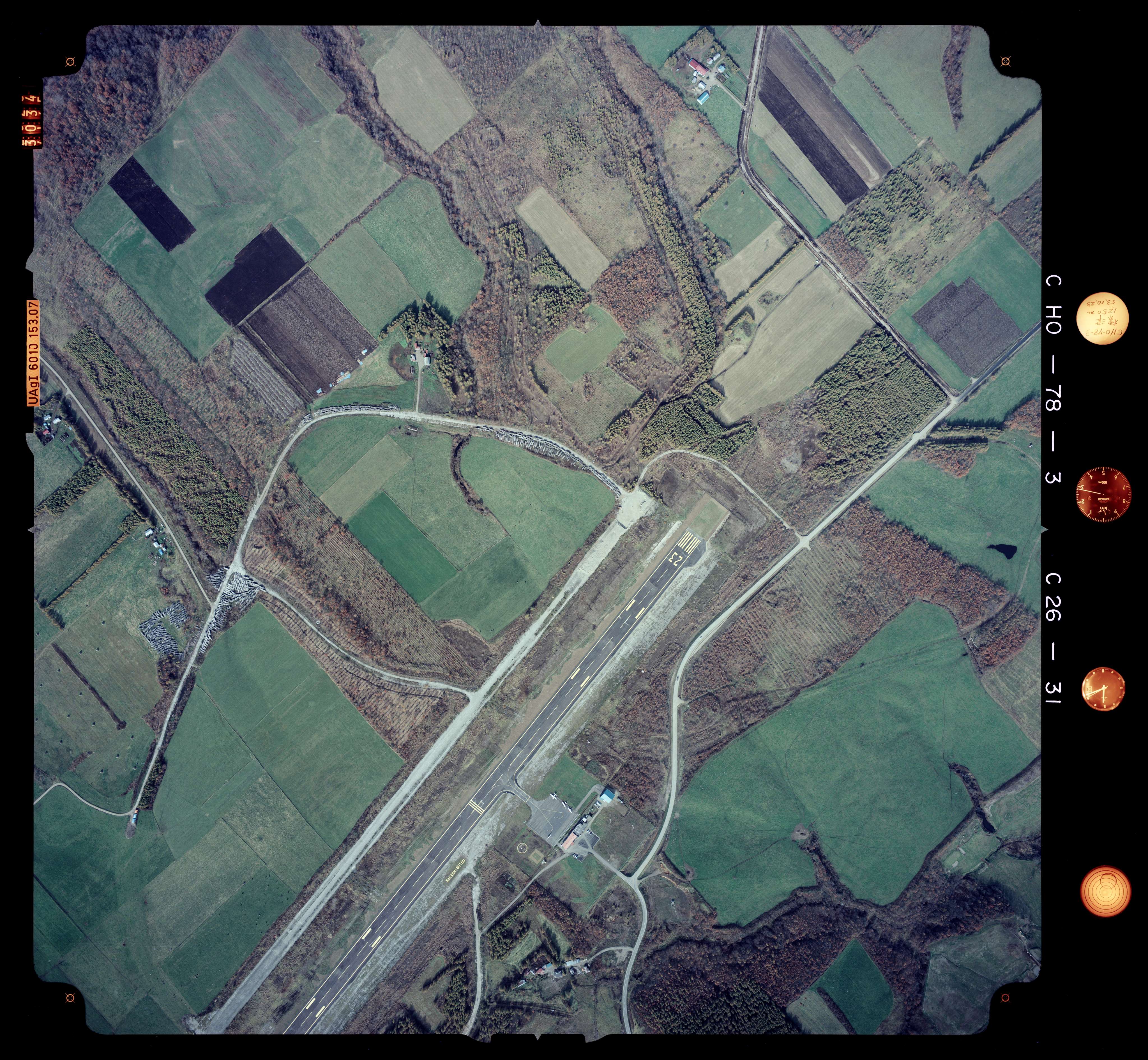
English: Photo by Geospatial Information Authority of Japan. Nakashibetsu Airport Runway(north), Hokkaido, Japan.
日本語: 国土交通省 地図・空中写真閲覧サービスCHO783-C26-31(1978/10/23)標津地域より。国土地理院により1978年10月23日に撮影された、北海道標津郡中標津町北中の中標津空港滑走路北側と原野の空中写真。 |
|||||
| Date | ||||||
| Source | http://mapps.gsi.go.jp/contentsImageDisplay.do?specificationId=935307 | |||||
| Author | Ministry of Land, Infrastructure, Transport and Tourism (Japan) | |||||
| Permission (Reusing this file) |
This file is licensed under the Creative Commons Attribution 4.0 International license. Attribution: 国土地理院 (GSI)
|

| Camera location | | View this and other nearby images on: OpenStreetMap |
|---|
Licensing
edit

|
The copyright holder of this file, the Ministry of Land, Infrastructure, Transport and Tourism of Japan, allows anyone to use it for any purpose, provided that the copyright holder is properly attributed. Redistribution, derivative work, commercial use, and all other use is permitted. |
Attribution:
Copyright © National Land Image Information (Color Aerial Photographs), Ministry of Land, Infrastructure, Transport and Tourism
|
 |
This image is copyrighted by the Ministry of Land, Infrastructure, Transport and Tourism of Japan. For terms of use, see the stipulation to use of National Land Information (in Japanese) and message from MLIT (in Japanese and English). When you display this image on an article, include the following phrase in the description: "Made based on National Land Image Information (Color Aerial Photographs), Ministry of Land, Infrastructure, Transport and Tourism".
|

|
This work is licensed under the Government of Japan Standard Terms of Use (Ver.2.0). The Terms of Use are compatible with the Creative Commons Attribution License 4.0 International. For the terms of use of this work, see this license page.
|
This file is licensed under the Creative Commons Attribution 4.0 International license.
Attribution: 国土地理院 (GSI)
- You are free:
- to share – to copy, distribute and transmit the work
- to remix – to adapt the work
- Under the following conditions:
- attribution – You must give appropriate credit, provide a link to the license, and indicate if changes were made. You may do so in any reasonable manner, but not in any way that suggests the licensor endorses you or your use.
This file, which was originally posted to
http://mapps.gsi.go.jp/contentsImageDisplay.do?specificationId=935307, was reviewed on 17 July 2018 by reviewer Leoboudv, who confirmed that it was available there under the stated license on that date.
|
File history
Click on a date/time to view the file as it appeared at that time.
| Date/Time | Thumbnail | Dimensions | User | Comment | |
|---|---|---|---|---|---|
| current | 03:30, 30 June 2018 | | 4,094 × 3,780 (1.85 MB) | Sasara (talk | contribs) | {{Information |description ={{en|1=Photo by Geospatial Information Authority of Japan. Nakashibetsu Airport Runway(north), Hokkaido, Japan.}} {{ja|1=国土交通省 地図・空中写真閲覧サービスCHO783-C26-31(1978/10/23)標津地域より。国土地理院により1978年10月23日に撮影された、北海道標津郡中標津町北中の中標津空港滑走路北側と原野の空中写真。}} |date =1978-10-23 |source =http://mapps.gsi.go.jp/contentsImageDisplay.do?specificationId=935307 |author =Ministry of Land, Infrastructure, Transport and Tourism (Japan) |permission ={{Template:AerialPhotogra... |
You cannot overwrite this file.
File usage on Commons
There are no pages that use this file.
File usage on other wikis
The following other wikis use this file:
- Usage on ja.wikipedia.org