File:Jacket's Field Long Barrow I.jpg

Size of this preview: 800 × 479 pixels. Other resolutions: 320 × 192 pixels | 640 × 383 pixels | 1,024 × 613 pixels | 1,280 × 766 pixels | 2,592 × 1,552 pixels.
Original file (2,592 × 1,552 pixels, file size: 1.69 MB, MIME type: image/jpeg)
Captions
Captions
Add a one-line explanation of what this file represents
Summary
edit
| Description |
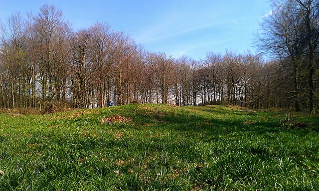
English: View of Jacket's Field Long Barrow in Kent, taken from the north-western end of the monument looking toward the south-eastern end. |
| Date | 13 April 2016 (according to Exif data) |
| Source | Own work by the original uploader |
| Author | Ethan Doyle White |
| Camera location | | View this and other nearby images on: OpenStreetMap |
|---|
Licensing
edit
Ethan Doyle White at English Wikipedia, the copyright holder of this work, hereby publishes it under the following license:
This file is licensed under the Creative Commons Attribution-Share Alike 3.0 Unported license.
Attribution: Ethan Doyle White at English Wikipedia
- You are free:
- to share – to copy, distribute and transmit the work
- to remix – to adapt the work
- Under the following conditions:
- attribution – You must give appropriate credit, provide a link to the license, and indicate if changes were made. You may do so in any reasonable manner, but not in any way that suggests the licensor endorses you or your use.
- share alike – If you remix, transform, or build upon the material, you must distribute your contributions under the same or compatible license as the original.
Original upload log
edit
The original description page was here. All following user names refer to en.wikipedia.
| Date/Time | Dimensions | User | Comment |
|---|---|---|---|
| 2016-04-13 19:47 | 2592×1552× (1776039 bytes) | Ethan Doyle White | {{Information |Description = {{en|1=View of Jacket's Field Long Barrow in Kent, taken from the north-western end of the monument looking toward the south-eastern end.}} {{listed building England|463155}} |Source = own work by original uploa... |
File history
Click on a date/time to view the file as it appeared at that time.
| Date/Time | Thumbnail | Dimensions | User | Comment | |
|---|---|---|---|---|---|
| current | 08:04, 20 April 2016 | | 2,592 × 1,552 (1.69 MB) | FastilyClone (talk | contribs) | Transferred from enwp |
You cannot overwrite this file.
File usage on Commons
The following 2 pages use this file:
File usage on other wikis
The following other wikis use this file:
- Usage on ar.wikipedia.org
- Usage on en.wikipedia.org
- Usage on sh.wikipedia.org
- Usage on www.wikidata.org