File:Jacques-Nicolas Bellin, Carte Réduite De L'Ocean Oriental ou Mer Des Indes (FL37817104 3153786).jpg

Size of this preview: 800 × 544 pixels. Other resolutions: 320 × 218 pixels | 640 × 435 pixels | 1,024 × 697 pixels | 1,280 × 871 pixels | 2,560 × 1,741 pixels | 20,930 × 14,237 pixels.
Original file (20,930 × 14,237 pixels, file size: 413.79 MB, MIME type: image/jpeg)
Captions
Captions
Add a one-line explanation of what this file represents
Summary
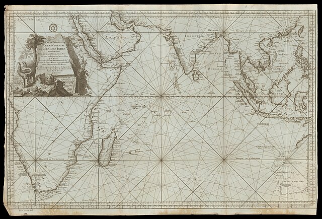
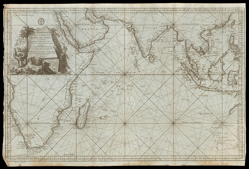
edit| Jacques-Nicolas Bellin: Carte Réduite De L'Ocean Oriental ou Mer Des Indes
( |
||||||||||||||||||||||||
|---|---|---|---|---|---|---|---|---|---|---|---|---|---|---|---|---|---|---|---|---|---|---|---|---|
| Artist |
|
|||||||||||||||||||||||
| Title |
Carte Réduite De L'Ocean Oriental ou Mer Des Indes |
|||||||||||||||||||||||
| Publisher |
Dépost des Cartes et Plans de la Marine |
|||||||||||||||||||||||
| Description |
Carte Réduite De L'Ocean Oriental ou Mer Des Indes. Pour Servir Aux Vaisseaux Du Roy . Dressée au Dépost des Cartes et Plans de la Marine Par ordre de M. De Machault. Par Bellin. |
|||||||||||||||||||||||
| Language | French | |||||||||||||||||||||||
| Publication date | 1767 | |||||||||||||||||||||||
| Medium | 1 map ; | |||||||||||||||||||||||
| Dimensions | height: 54 cm (21.2 in); width: 85 cm (33.4 in) | |||||||||||||||||||||||
| Collection |
|
|||||||||||||||||||||||
| Current location |
|
|||||||||||||||||||||||
| Place of publication | Paris | |||||||||||||||||||||||
| search Merhav catalog | Paris | |||||||||||||||||||||||
| Notes | Portolan map; Includes illustration of animals (an elephant). | |||||||||||||||||||||||
| IE PID | IE37817102 | |||||||||||||||||||||||
| Rosetta filename | FL37817104 | |||||||||||||||||||||||
| NNL item ID (P3959) | 990031537860205171 | |||||||||||||||||||||||
| search Merhav catalog | French, Jacques-Nicolas Bellin | |||||||||||||||||||||||
| search Merhav catalog | Dépost des Cartes et Plans de la Marine | |||||||||||||||||||||||
| Source/Photographer |
|
|||||||||||||||||||||||
| Other versions | ||||||||||||||||||||||||
| Jpg / Tif version |
|
|||||||||||||||||||||||

.jpg)

.jpg&action=edit§ion=1)
Licensing
edit.jpg&action=edit§ion=2)
The copyright situation of this work is theoretically uncertain, because in the country of origin copyright lasts 70 years after the death of the author, and the date of the author's death is unknown. However, the date of creation of the work was over 120 years ago, and it is thus a reasonable assumption that the copyright has expired (see here for the community discussion). Do not use this template if the date of death of the author is known.
| |
| This file has been identified as being free of known restrictions under copyright law, including all related and neighboring rights. | |
File history
Click on a date/time to view the file as it appeared at that time.
| Date/Time | Thumbnail | Dimensions | User | Comment | |
|---|---|---|---|---|---|
| current | 23:01, 2 September 2023 | | 20,930 × 14,237 (413.79 MB) | Geagea (talk | contribs) | pattypan 22.03 |
You cannot overwrite this file.
File usage on Commons
The following page uses this file:
.jpg&oldid=797942431)