File:January 27 west coast storm complex.jpg

Size of this preview: 800 × 480 pixels. Other resolutions: 320 × 192 pixels | 1,024 × 614 pixels | 1,280 × 768 pixels | 2,500 × 1,500 pixels.
Original file (2,500 × 1,500 pixels, file size: 727 KB, MIME type: image/jpeg)
Captions
Captions
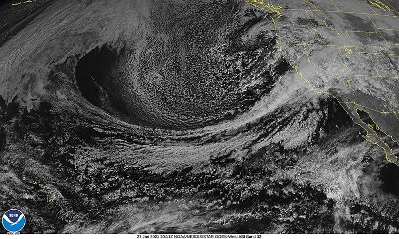
Satellite imagery of the Late January storm complex impacting the West Coast
Summary
edit
| Description |
English: Red visible GOES-17 satellite imagery of the late January storm complex impacting the west coast on January 27 |
| Date | |
| Source | https://www.star.nesdis.noaa.gov/GOES/conus.php?sat=G17 |
| Author | NOAA |
Licensing
edit
| This file is in the public domain in the United States because it was solely created by NASA. NASA copyright policy states that "NASA material is not protected by copyright unless noted". (See Template:PD-USGov, NASA copyright policy page or JPL Image Use Policy.) | ||
 |
Warnings:
|
File history
Click on a date/time to view the file as it appeared at that time.
| Date/Time | Thumbnail | Dimensions | User | Comment | |
|---|---|---|---|---|---|
| current | 20:32, 27 January 2021 | | 2,500 × 1,500 (727 KB) | Wikicanada1127 (talk | contribs) | Uploaded a work by NOAA from https://www.star.nesdis.noaa.gov/GOES/conus.php?sat=G17 with UploadWizard |
You cannot overwrite this file.
File usage on Commons
There are no pages that use this file.
File usage on other wikis
The following other wikis use this file:
- Usage on en.wikipedia.org