File:Japan Kansai Map.svg

Size of this PNG preview of this SVG file: 600 × 600 pixels. Other resolutions: 240 × 240 pixels | 480 × 480 pixels | 768 × 768 pixels | 1,024 × 1,024 pixels | 2,048 × 2,048 pixels | 3,003 × 3,003 pixels.
Original file (SVG file, nominally 3,003 × 3,003 pixels, file size: 2.77 MB)
Captions
Captions
Add a one-line explanation of what this file represents
Summary edit
| Description |
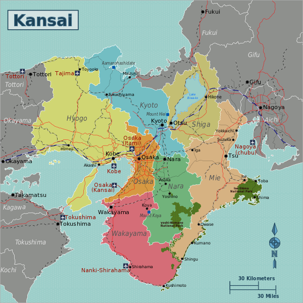
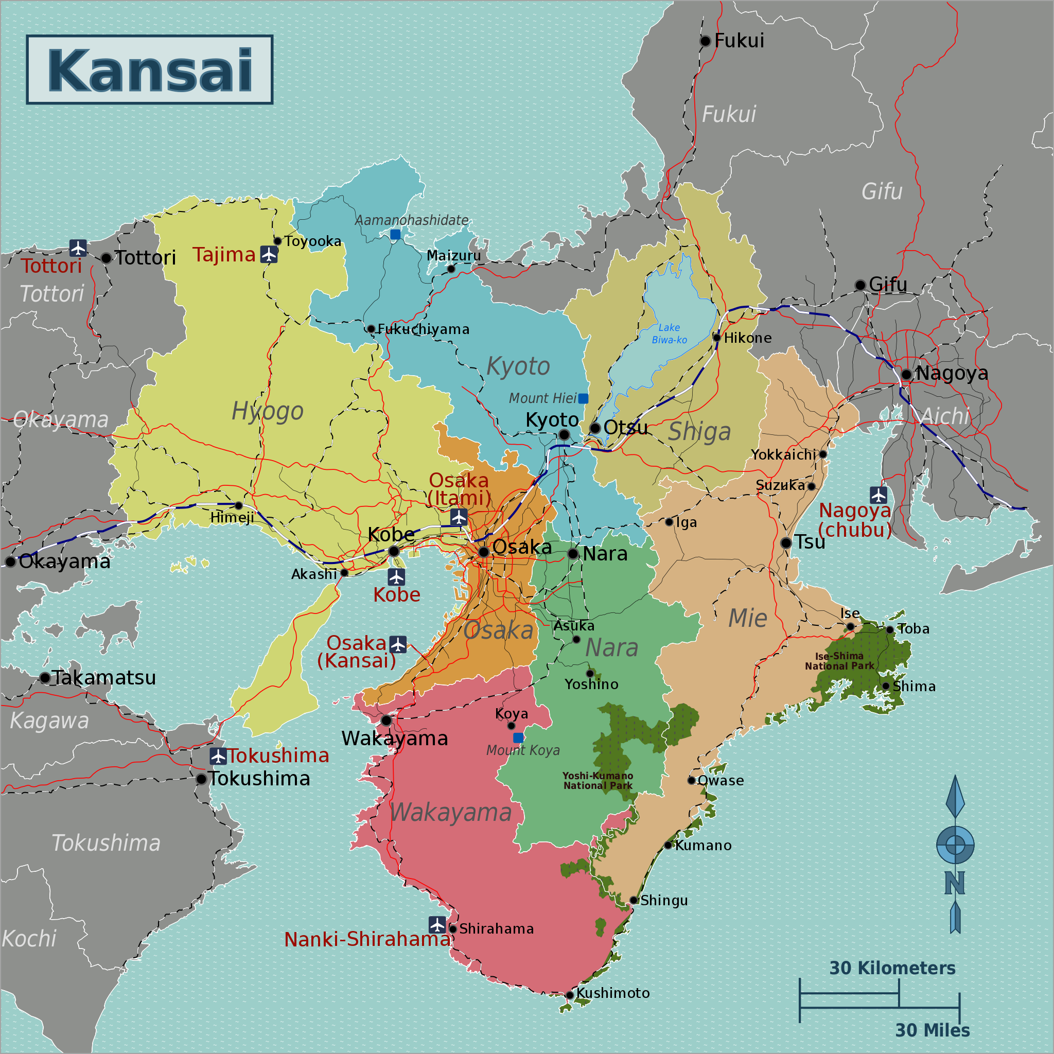
English: Map of the Kansai Region (JAPAN), Kansai, Japan. |
| Date | |
| Source | Own work |
| Author | T.Kambayashi |
This W3C-unspecified vector image was created with Inkscape .
Licensing edit
This file is licensed under the Creative Commons Attribution-Share Alike 3.0 Unported license.
- You are free:
- to share – to copy, distribute and transmit the work
- to remix – to adapt the work
- Under the following conditions:
- attribution – You must give appropriate credit, provide a link to the license, and indicate if changes were made. You may do so in any reasonable manner, but not in any way that suggests the licensor endorses you or your use.
- share alike – If you remix, transform, or build upon the material, you must distribute your contributions under the same or compatible license as the original.
Original upload log edit
| This file was imported from Wikivoyage WTS. |
The original description page was here. All following user names refer to wts.wikivoyage-old.
- 2011-02-13 18:32 (WT-shared) Kambayashi[dead link] 3000×3000 (2989540 bytes) {{Imagecredit|credit=|captureDate=|location=|source=|caption=|description=}} (Import from wikitravel.org/shared)
File history
Click on a date/time to view the file as it appeared at that time.
| Date/Time | Thumbnail | Dimensions | User | Comment | |
|---|---|---|---|---|---|
| current | 10:59, 6 November 2015 | | 3,003 × 3,003 (2.77 MB) | Hdamm (talk | contribs) | fixed flow text |
| 10:55, 6 November 2015 |  | 3,003 × 3,003 (2.77 MB) | Hdamm (talk | contribs) | converted flow text into text objects | |
| 00:18, 18 November 2012 |  | 3,000 × 3,000 (2.85 MB) | MGA73bot2 (talk | contribs) | {{BotMoveToCommons|wts.oldwikivoyage|year={{subst:CURRENTYEAR}}|month={{subst:CURRENTMONTHNAME}}|day={{subst:CURRENTDAY}}}} == {{int:filedesc}} == {{Information |description=Map of the Kansai Region (JAPAN). , Kansai * Map of: Japan¤ |date=20110214 |s... |
You cannot overwrite this file.
File usage on Commons
The following page uses this file:
File usage on other wikis
The following other wikis use this file:
- Usage on ca.wikipedia.org